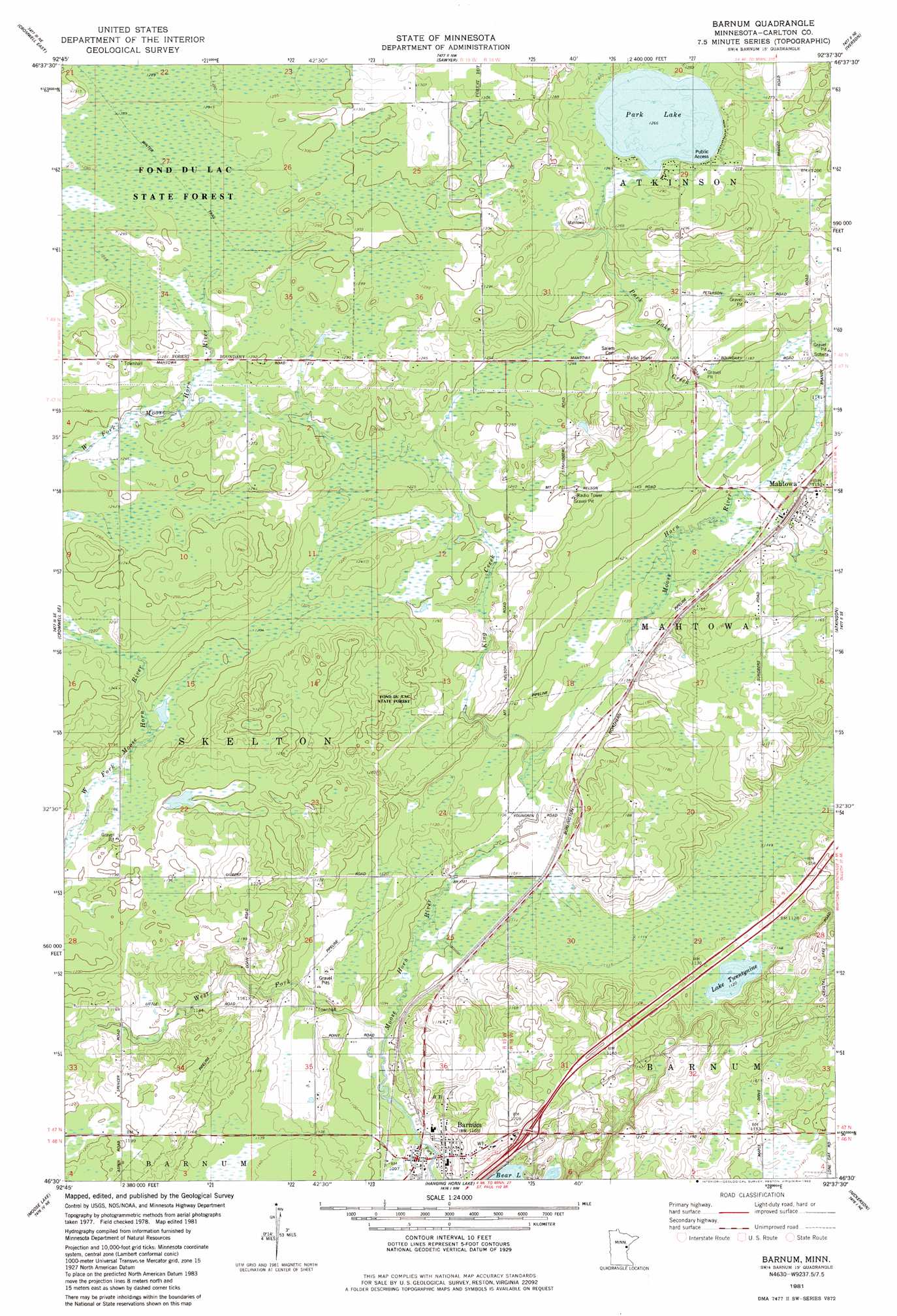
Barnum Topo Map Minnesota
To zoom in, hover over the map of Barnum
USGS Topo Quad 46092e6 - 1:24,000 scale
| Topo Map Name: | Barnum |
| USGS Topo Quad ID: | 46092e6 |
| Print Size: | ca. 21 1/4" wide x 27" high |
| Southeast Coordinates: | 46.5° N latitude / 92.625° W longitude |
| Map Center Coordinates: | 46.5625° N latitude / 92.6875° W longitude |
| U.S. State: | MN |
| Filename: | o46092e6.jpg |
| Download Map JPG Image: | Barnum topo map 1:24,000 scale |
| Map Type: | Topographic |
| Topo Series: | 7.5´ |
| Map Scale: | 1:24,000 |
| Source of Map Images: | United States Geological Survey (USGS) |
| Alternate Map Versions: |
Barnum MN 1981, updated 1982 Download PDF Buy paper map Barnum MN 2010 Download PDF Buy paper map Barnum MN 2013 Download PDF Buy paper map Barnum MN 2016 Download PDF Buy paper map |
1:24,000 Topo Quads surrounding Barnum
Prairie Lake |
Gowan |
Martin Lake |
Brookston |
Saginaw |
Cromwell West |
Cromwell East |
Sawyer |
Iverson |
Cloquet |
Heikkila Creek |
Cromwell Se |
Barnum |
Atkinson |
Wrenshall |
Kettle River |
Moose Lake |
Hanging Horn Lake |
Nickerson |
Holyoke |
Denham |
Willow River |
Bruno |
Kerrick |
Holyoke Sw |
> Back to 46092e1 at 1:100,000 scale
> Back to 46092a1 at 1:250,000 scale
> Back to U.S. Topo Maps home
Barnum topo map: Gazetteer
Barnum: Crossings
Interchange 220 elevation 354m 1161′Barnum: Dams
Ninefeldt Pool Dam elevation 364m 1194′Park Lake Dam elevation 389m 1276′
Barnum: Lakes
Lake Twentynine elevation 340m 1115′Park Lake elevation 384m 1259′
Barnum: Parks
Barnum City Park elevation 331m 1085′Barnum: Populated Places
Barnum elevation 337m 1105′Barnum Mobile Home Park elevation 338m 1108′
Mahtowa elevation 351m 1151′
Barnum: Post Offices
Barnum Post Office elevation 338m 1108′Mahtowa Post Office elevation 351m 1151′
Barnum: Reservoirs
Ninefeldt Pool elevation 364m 1194′Barnum: Streams
King Creek elevation 338m 1108′Park Lake Creek elevation 347m 1138′
West Fork Moose Horn River elevation 333m 1092′
Barnum digital topo map on disk
Buy this Barnum topo map showing relief, roads, GPS coordinates and other geographical features, as a high-resolution digital map file on DVD: