Brookston Nw Topo Map Minnesota
To zoom in, hover over the map of Brookston Nw
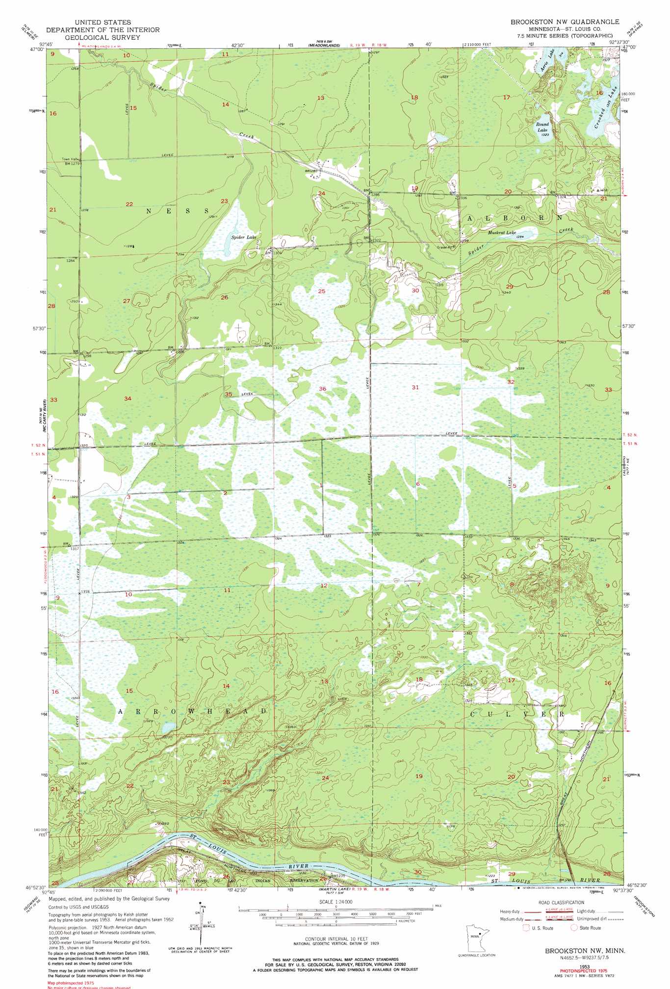
USGS Topo Quad 46092h6 - 1:24,000 scale
| Topo Map Name: | Brookston Nw |
| USGS Topo Quad ID: | 46092h6 |
| Print Size: | ca. 21 1/4" wide x 27" high |
| Southeast Coordinates: | 46.875° N latitude / 92.625° W longitude |
| Map Center Coordinates: | 46.9375° N latitude / 92.6875° W longitude |
| U.S. State: | MN |
| Filename: | o46092h6.jpg |
| Download Map JPG Image: | Brookston Nw topo map 1:24,000 scale |
| Map Type: | Topographic |
| Topo Series: | 7.5´ |
| Map Scale: | 1:24,000 |
| Source of Map Images: | United States Geological Survey (USGS) |
| Alternate Map Versions: |
Brookston NW MN 1953, updated 1955 Download PDF Buy paper map Brookston NW MN 1953, updated 1968 Download PDF Buy paper map Brookston NW MN 1953, updated 1984 Download PDF Buy paper map Brookston NW MN 1953, updated 1984 Download PDF Buy paper map Brookston NW MN 2010 Download PDF Buy paper map Brookston NW MN 2013 Download PDF Buy paper map Brookston NW MN 2016 Download PDF Buy paper map |
1:24,000 Topo Quads surrounding Brookston Nw
Upstead Lake |
Toivola |
Meadowlands Nw |
Kelsey |
Cotton |
Toivola Sw |
Elmer |
Meadowlands |
Payne |
Canyon |
Floodwood |
Mccarty River |
Brookston Nw |
Alborn |
Independence |
Prairie Lake |
Gowan |
Martin Lake |
Brookston |
Saginaw |
Cromwell West |
Cromwell East |
Sawyer |
Iverson |
Cloquet |
> Back to 46092e1 at 1:100,000 scale
> Back to 46092a1 at 1:250,000 scale
> Back to U.S. Topo Maps home
Brookston Nw topo map: Gazetteer
Brookston Nw: Lakes
Crooked Lake elevation 404m 1325′Muskrat Lake elevation 392m 1286′
Round Lake elevation 403m 1322′
Spider Lake elevation 389m 1276′
Brookston Nw: Post Offices
Congo Post Office (historical) elevation 379m 1243′Brookston Nw digital topo map on disk
Buy this Brookston Nw topo map showing relief, roads, GPS coordinates and other geographical features, as a high-resolution digital map file on DVD: