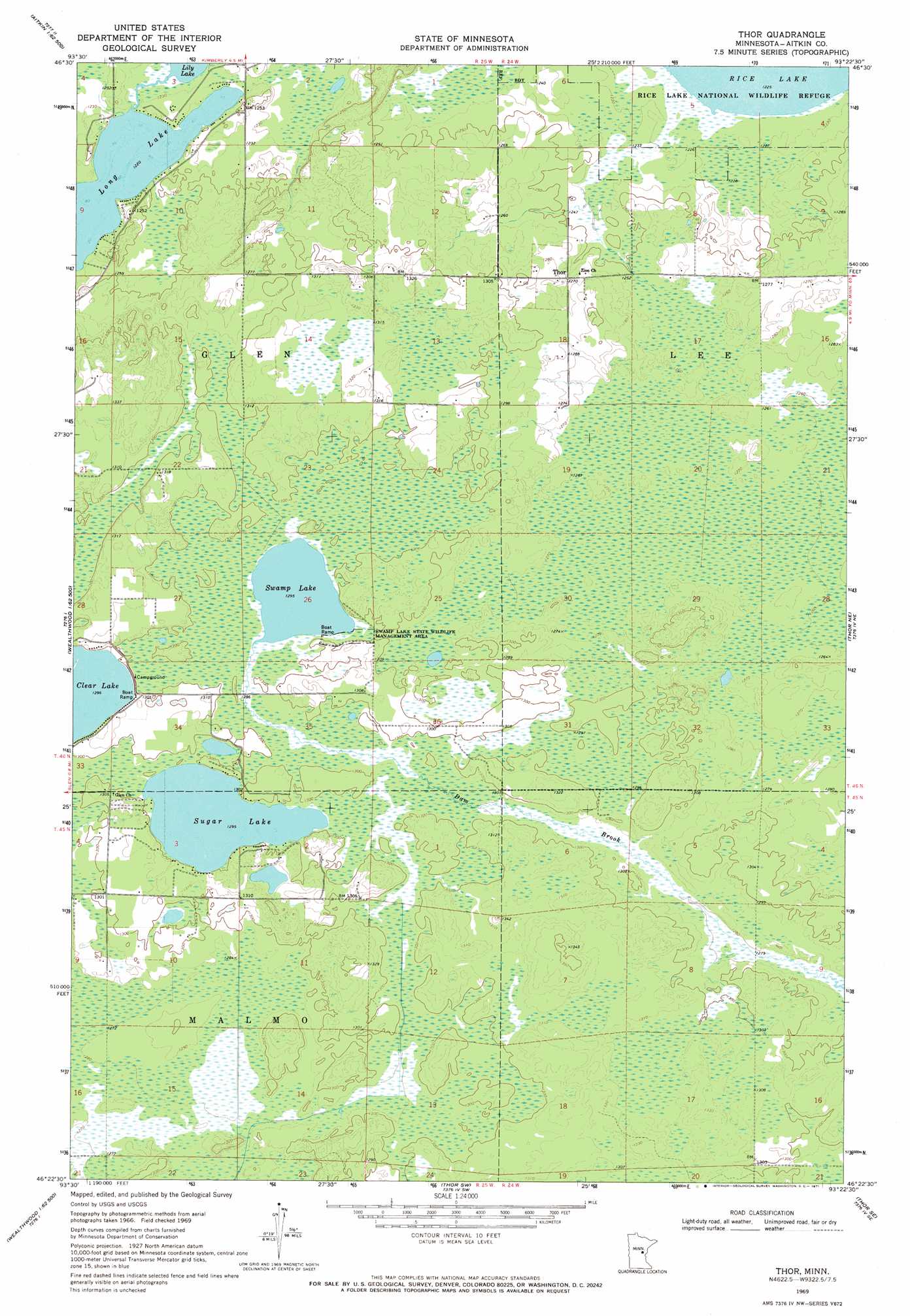
Thor Topo Map Minnesota
To zoom in, hover over the map of Thor
USGS Topo Quad 46093d4 - 1:24,000 scale
| Topo Map Name: | Thor |
| USGS Topo Quad ID: | 46093d4 |
| Print Size: | ca. 21 1/4" wide x 27" high |
| Southeast Coordinates: | 46.375° N latitude / 93.375° W longitude |
| Map Center Coordinates: | 46.4375° N latitude / 93.4375° W longitude |
| U.S. State: | MN |
| Filename: | o46093d4.jpg |
| Download Map JPG Image: | Thor topo map 1:24,000 scale |
| Map Type: | Topographic |
| Topo Series: | 7.5´ |
| Map Scale: | 1:24,000 |
| Source of Map Images: | United States Geological Survey (USGS) |
| Alternate Map Versions: |
Thor MN 1969, updated 1971 Download PDF Buy paper map Thor MN 1969, updated 1990 Download PDF Buy paper map Thor MN 2010 Download PDF Buy paper map Thor MN 2013 Download PDF Buy paper map Thor MN 2016 Download PDF Buy paper map |
1:24,000 Topo Quads surrounding Thor
Esquagamah Lake |
Waukenabo |
Palisade |
Minnewawa |
Tamarack |
Aitkin |
Hassman |
Kimberly |
Mcgregor |
Lawler |
Spirit Lake |
Glen |
Thor |
Thor Ne |
Split Rock Lake |
Wealthwood |
Malmo |
Thor Sw |
Thor Se |
Solana |
Onamia Nw |
Wahkon North |
Isle |
Mcgrath |
Kroschel Nw |
> Back to 46093a1 at 1:100,000 scale
> Back to 46092a1 at 1:250,000 scale
> Back to U.S. Topo Maps home
Thor topo map: Gazetteer
Thor: Dams
Jewett Wildlife Management Area Impoundment Dike 1 elevation 390m 1279′Jewett Wildlife Management Area Impoundment Dike 2 elevation 390m 1279′
Thor: Lakes
Long Lake elevation 372m 1220′Sugar Lake elevation 394m 1292′
Swamp Lake elevation 393m 1289′
Thor: Parks
Swamp Lake State Wildlife Management Area elevation 396m 1299′Thor: Populated Places
Thor elevation 387m 1269′Thor: Post Offices
Thor Post Office (historical) elevation 387m 1269′Thor: Reservoirs
Dam Brook elevation 390m 1279′Thor digital topo map on disk
Buy this Thor topo map showing relief, roads, GPS coordinates and other geographical features, as a high-resolution digital map file on DVD: