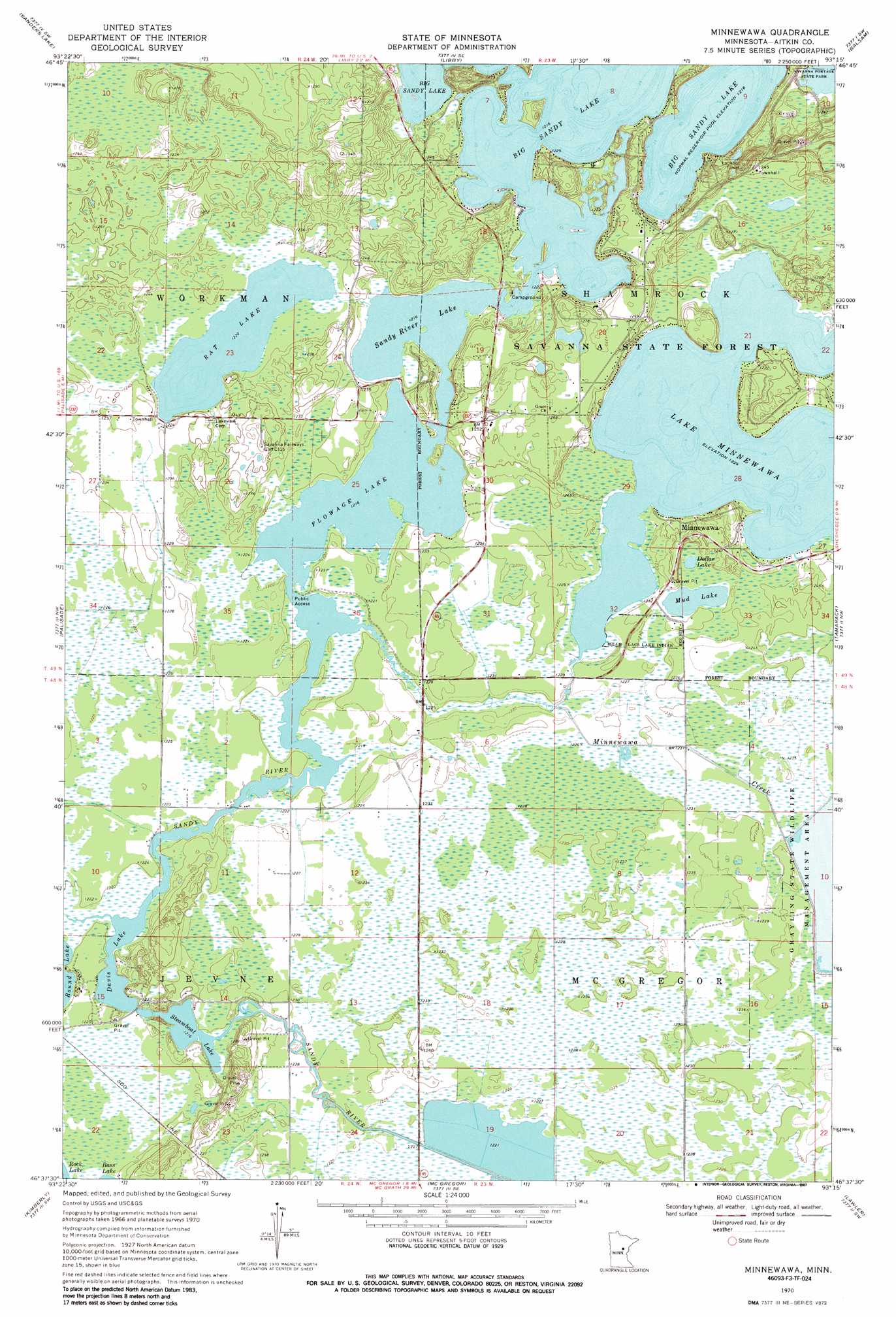
Minnewawa Topo Map Minnesota
To zoom in, hover over the map of Minnewawa
USGS Topo Quad 46093f3 - 1:24,000 scale
| Topo Map Name: | Minnewawa |
| USGS Topo Quad ID: | 46093f3 |
| Print Size: | ca. 21 1/4" wide x 27" high |
| Southeast Coordinates: | 46.625° N latitude / 93.25° W longitude |
| Map Center Coordinates: | 46.6875° N latitude / 93.3125° W longitude |
| U.S. State: | MN |
| Filename: | o46093f3.jpg |
| Download Map JPG Image: | Minnewawa topo map 1:24,000 scale |
| Map Type: | Topographic |
| Topo Series: | 7.5´ |
| Map Scale: | 1:24,000 |
| Source of Map Images: | United States Geological Survey (USGS) |
| Alternate Map Versions: |
Minnewawa MN 1970, updated 1972 Download PDF Buy paper map Minnewawa MN 1970, updated 1987 Download PDF Buy paper map Minnewawa MN 2010 Download PDF Buy paper map Minnewawa MN 2013 Download PDF Buy paper map Minnewawa MN 2016 Download PDF Buy paper map |
1:24,000 Topo Quads surrounding Minnewawa
Hill City |
Rabey |
Ball Bluff |
Vanduse Lake |
Island |
Bain |
Sanders Lake |
Libby |
Balsam |
Little Prairie Lake |
Waukenabo |
Palisade |
Minnewawa |
Tamarack |
Wright |
Hassman |
Kimberly |
Mcgregor |
Lawler |
Automba |
Glen |
Thor |
Thor Ne |
Split Rock Lake |
Ronald |
> Back to 46093e1 at 1:100,000 scale
> Back to 46092a1 at 1:250,000 scale
> Back to U.S. Topo Maps home
Minnewawa topo map: Gazetteer
Minnewawa: Lakes
Davis Lake elevation 371m 1217′Dollar Lake elevation 376m 1233′
Flowage Lake elevation 371m 1217′
Lake Minnewawa elevation 373m 1223′
Mud Lake elevation 374m 1227′
Rat Lake elevation 372m 1220′
Sandy River Lake elevation 371m 1217′
Steamboat Lake elevation 371m 1217′
Minnewawa: Parks
"Tell Him I Blame Him for the Children We Have Lost..." Aish-Ke-Vo-Go-Zhe Historical Marker elevation 372m 1220′Minnewawa: Populated Places
Minnewawa elevation 380m 1246′Minnewawa: Streams
Minnewawa Creek elevation 371m 1217′Minnewawa digital topo map on disk
Buy this Minnewawa topo map showing relief, roads, GPS coordinates and other geographical features, as a high-resolution digital map file on DVD: