Palisade Topo Map Minnesota
To zoom in, hover over the map of Palisade
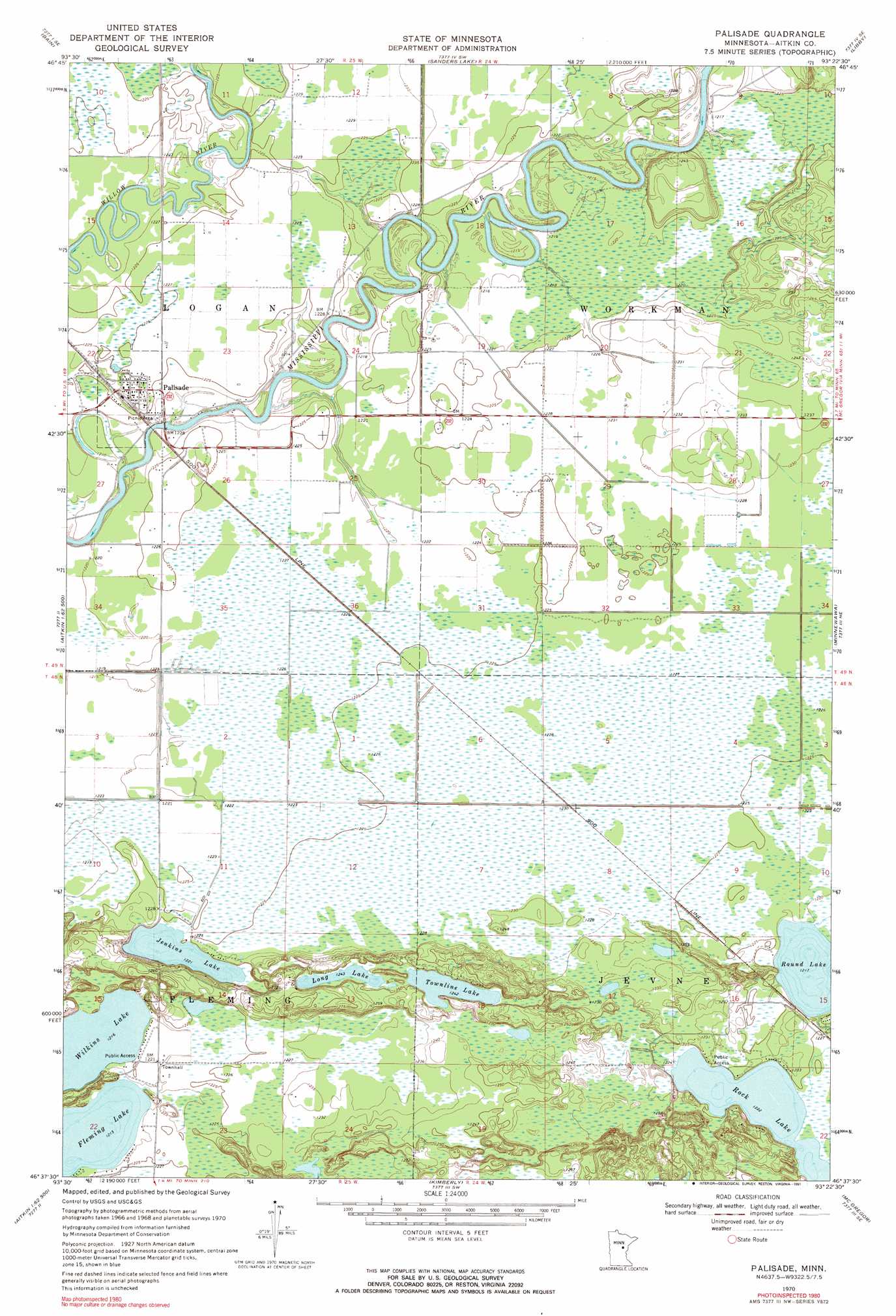
USGS Topo Quad 46093f4 - 1:24,000 scale
| Topo Map Name: | Palisade |
| USGS Topo Quad ID: | 46093f4 |
| Print Size: | ca. 21 1/4" wide x 27" high |
| Southeast Coordinates: | 46.625° N latitude / 93.375° W longitude |
| Map Center Coordinates: | 46.6875° N latitude / 93.4375° W longitude |
| U.S. State: | MN |
| Filename: | o46093f4.jpg |
| Download Map JPG Image: | Palisade topo map 1:24,000 scale |
| Map Type: | Topographic |
| Topo Series: | 7.5´ |
| Map Scale: | 1:24,000 |
| Source of Map Images: | United States Geological Survey (USGS) |
| Alternate Map Versions: |
Palisade MN 1970, updated 1972 Download PDF Buy paper map Palisade MN 1970, updated 1991 Download PDF Buy paper map Palisade MN 2010 Download PDF Buy paper map Palisade MN 2013 Download PDF Buy paper map Palisade MN 2016 Download PDF Buy paper map |
1:24,000 Topo Quads surrounding Palisade
Swatara |
Hill City |
Rabey |
Ball Bluff |
Vanduse Lake |
White Elk Lake |
Bain |
Sanders Lake |
Libby |
Balsam |
Esquagamah Lake |
Waukenabo |
Palisade |
Minnewawa |
Tamarack |
Aitkin |
Hassman |
Kimberly |
Mcgregor |
Lawler |
Spirit Lake |
Glen |
Thor |
Thor Ne |
Split Rock Lake |
> Back to 46093e1 at 1:100,000 scale
> Back to 46092a1 at 1:250,000 scale
> Back to U.S. Topo Maps home
Palisade topo map: Gazetteer
Palisade: Lakes
Fleming Lake elevation 371m 1217′Jenkins Lake elevation 372m 1220′
Long Lake elevation 379m 1243′
Rock Lake elevation 373m 1223′
Round Lake elevation 371m 1217′
Townline Lake elevation 379m 1243′
Wilkins Lake elevation 371m 1217′
Palisade: Parks
Roberts-Wickstrrom Wildlife Management Area elevation 374m 1227′Palisade: Populated Places
Palisade elevation 377m 1236′Palisade: Post Offices
Fleming Lake Post Office (historical) elevation 384m 1259′Palisade Post Office elevation 377m 1236′
Palisade digital topo map on disk
Buy this Palisade topo map showing relief, roads, GPS coordinates and other geographical features, as a high-resolution digital map file on DVD: