Ball Bluff Topo Map Minnesota
To zoom in, hover over the map of Ball Bluff
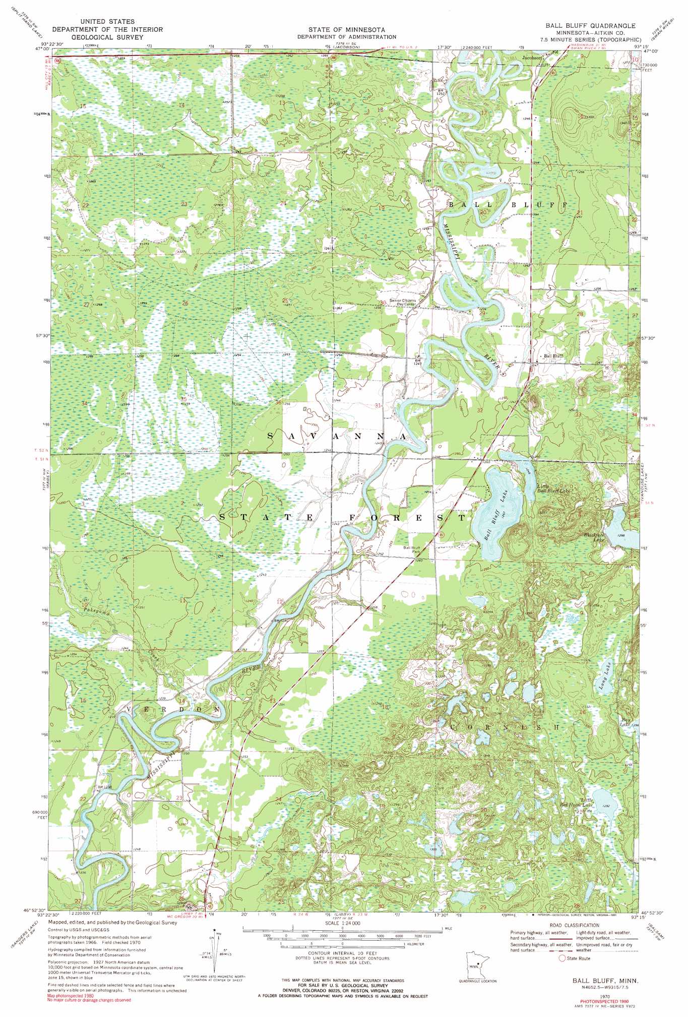
USGS Topo Quad 46093h3 - 1:24,000 scale
| Topo Map Name: | Ball Bluff |
| USGS Topo Quad ID: | 46093h3 |
| Print Size: | ca. 21 1/4" wide x 27" high |
| Southeast Coordinates: | 46.875° N latitude / 93.25° W longitude |
| Map Center Coordinates: | 46.9375° N latitude / 93.3125° W longitude |
| U.S. State: | MN |
| Filename: | o46093h3.jpg |
| Download Map JPG Image: | Ball Bluff topo map 1:24,000 scale |
| Map Type: | Topographic |
| Topo Series: | 7.5´ |
| Map Scale: | 1:24,000 |
| Source of Map Images: | United States Geological Survey (USGS) |
| Alternate Map Versions: |
Ball Bluff MN 1970, updated 1972 Download PDF Buy paper map Ball Bluff MN 2010 Download PDF Buy paper map Ball Bluff MN 2013 Download PDF Buy paper map Ball Bluff MN 2016 Download PDF Buy paper map |
1:24,000 Topo Quads surrounding Ball Bluff
Grand Rapids |
La Prairie |
Warba |
Goodland |
Floodwood Lake |
Mountain Ash Lake |
Split Hand Lake |
Jacobson |
Swan River |
Wawina |
Hill City |
Rabey |
Ball Bluff |
Vanduse Lake |
Island |
Bain |
Sanders Lake |
Libby |
Balsam |
Little Prairie Lake |
Waukenabo |
Palisade |
Minnewawa |
Tamarack |
Wright |
> Back to 46093e1 at 1:100,000 scale
> Back to 46092a1 at 1:250,000 scale
> Back to U.S. Topo Maps home
Ball Bluff topo map: Gazetteer
Ball Bluff: Lakes
Ball Bluff Lake elevation 380m 1246′Little Ball Bluff Lake elevation 380m 1246′
Little Red Horse Lake elevation 394m 1292′
Long Lake elevation 398m 1305′
Ball Bluff: Parks
Ball Bluff Park elevation 384m 1259′Ball Bluff: Populated Places
Ball Bluff elevation 381m 1250′Ball Bluff: Streams
Pokegama Creek elevation 371m 1217′Ball Bluff digital topo map on disk
Buy this Ball Bluff topo map showing relief, roads, GPS coordinates and other geographical features, as a high-resolution digital map file on DVD: