Staples Ne Topo Map Minnesota
To zoom in, hover over the map of Staples Ne
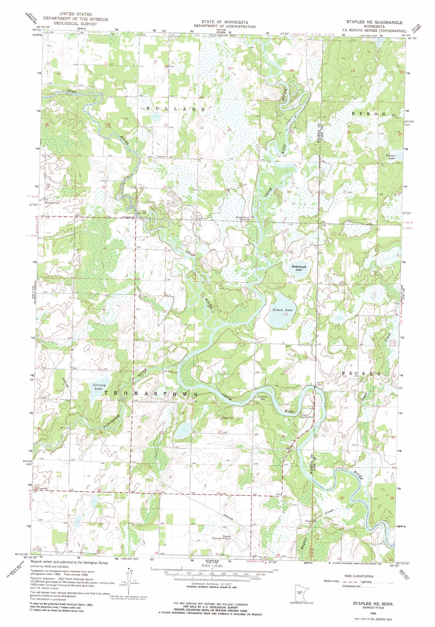
USGS Topo Quad 46094d7 - 1:24,000 scale
| Topo Map Name: | Staples Ne |
| USGS Topo Quad ID: | 46094d7 |
| Print Size: | ca. 21 1/4" wide x 27" high |
| Southeast Coordinates: | 46.375° N latitude / 94.75° W longitude |
| Map Center Coordinates: | 46.4375° N latitude / 94.8125° W longitude |
| U.S. State: | MN |
| Filename: | o46094d7.jpg |
| Download Map JPG Image: | Staples Ne topo map 1:24,000 scale |
| Map Type: | Topographic |
| Topo Series: | 7.5´ |
| Map Scale: | 1:24,000 |
| Source of Map Images: | United States Geological Survey (USGS) |
| Alternate Map Versions: |
Staples NE MN 1966, updated 1967 Download PDF Buy paper map Staples NE MN 1966, updated 1988 Download PDF Buy paper map Staples NE MN 2010 Download PDF Buy paper map Staples NE MN 2013 Download PDF Buy paper map Staples NE MN 2016 Download PDF Buy paper map |
1:24,000 Topo Quads surrounding Staples Ne
Sebeka |
Nimrod |
Burgen Lake |
Spider Lake |
Bungo Creek |
Blue Grass |
Nimrod Sw |
Oylen |
Leader |
Graff |
Verndale |
Aldrich North |
Staples Ne |
Motley Nw |
Casino |
Bertha |
Aldrich South |
Staples |
Motley |
Motley Se |
Eagle Bend |
Clarissa |
Browerville Ne |
Lincoln |
Cushing |
> Back to 46094a1 at 1:100,000 scale
> Back to 46094a1 at 1:250,000 scale
> Back to U.S. Topo Maps home
Staples Ne topo map: Gazetteer
Staples Ne: Airports
Staples Municipal Airport elevation 391m 1282′Staples Ne: Lakes
Lovejoy Lake elevation 388m 1272′Radabaugh Lake elevation 380m 1246′
Simon Lake elevation 380m 1246′
Staples Ne: Parks
McGivern Park elevation 379m 1243′Staples Ne: Streams
Hayden Creek elevation 378m 1240′Leaf River elevation 379m 1243′
Partridge River elevation 377m 1236′
Swan Creek elevation 378m 1240′
Staples Ne digital topo map on disk
Buy this Staples Ne topo map showing relief, roads, GPS coordinates and other geographical features, as a high-resolution digital map file on DVD: