Jenkins Topo Map Minnesota
To zoom in, hover over the map of Jenkins
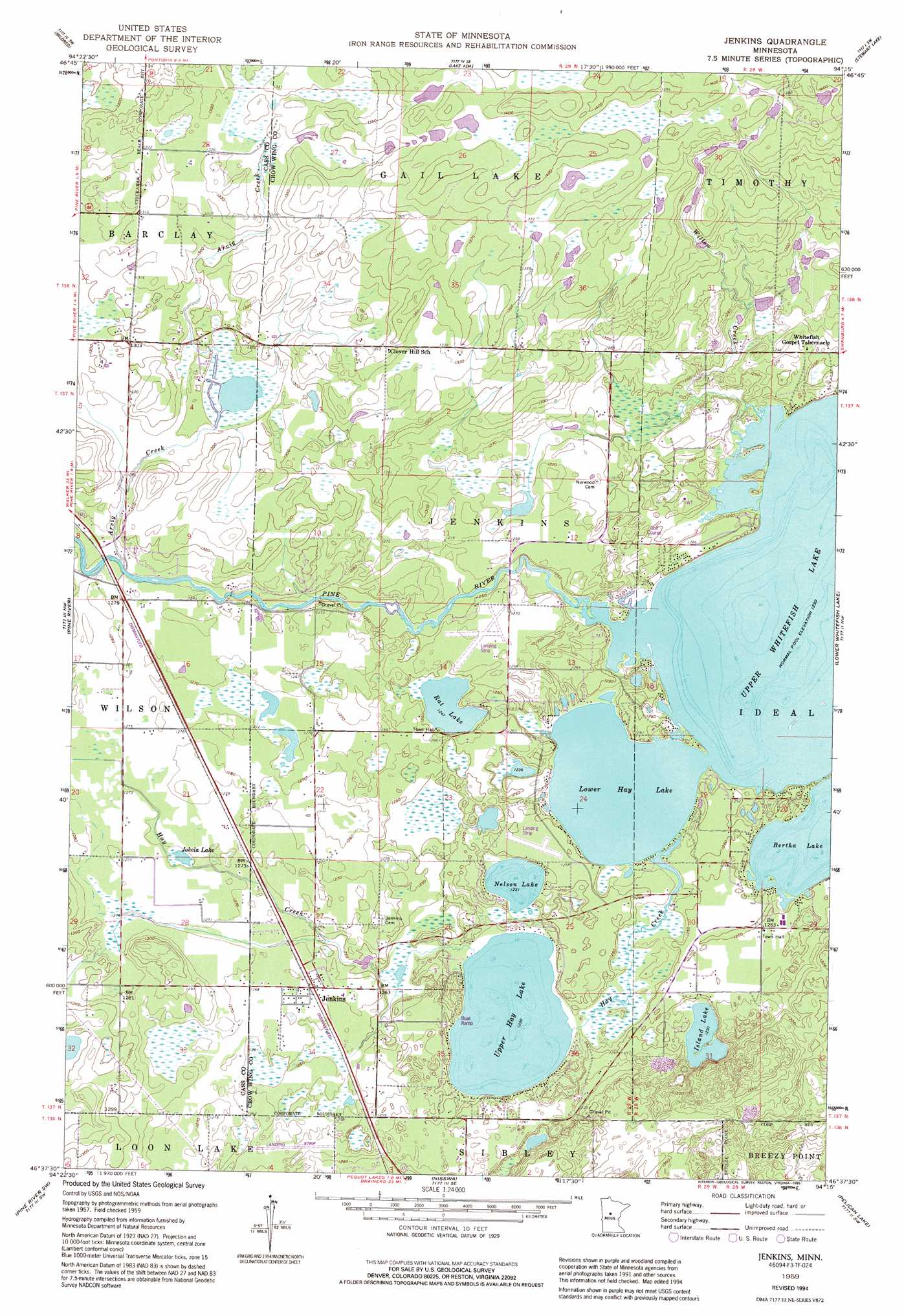
USGS Topo Quad 46094f3 - 1:24,000 scale
| Topo Map Name: | Jenkins |
| USGS Topo Quad ID: | 46094f3 |
| Print Size: | ca. 21 1/4" wide x 27" high |
| Southeast Coordinates: | 46.625° N latitude / 94.25° W longitude |
| Map Center Coordinates: | 46.6875° N latitude / 94.3125° W longitude |
| U.S. State: | MN |
| Filename: | o46094f3.jpg |
| Download Map JPG Image: | Jenkins topo map 1:24,000 scale |
| Map Type: | Topographic |
| Topo Series: | 7.5´ |
| Map Scale: | 1:24,000 |
| Source of Map Images: | United States Geological Survey (USGS) |
| Alternate Map Versions: |
Jenkins MN 1959, updated 1960 Download PDF Buy paper map Jenkins MN 1959, updated 1970 Download PDF Buy paper map Jenkins MN 1959, updated 1981 Download PDF Buy paper map Jenkins MN 1959, updated 1995 Download PDF Buy paper map Jenkins MN 2010 Download PDF Buy paper map Jenkins MN 2013 Download PDF Buy paper map Jenkins MN 2016 Download PDF Buy paper map |
1:24,000 Topo Quads surrounding Jenkins
Hackensack |
Webb Lake |
Woman Lake |
Longville |
Laura Lake |
Backus |
Mildred |
Lake Ada |
Stewart Lake |
Mitchell Lake |
Bungo Creek |
Pine River |
Jenkins |
Lower Whitefish Lake |
Cross Lake |
Graff |
Pine River Sw |
Nisswa |
Pelican Lake |
Trommald |
Casino |
Wilson Bay |
Gull Lake |
Merrifield |
Riverton |
> Back to 46094e1 at 1:100,000 scale
> Back to 46094a1 at 1:250,000 scale
> Back to U.S. Topo Maps home
Jenkins topo map: Gazetteer
Jenkins: Airports
Myers Field elevation 389m 1276′Ultraflyte Incorporated Airport elevation 388m 1272′
Jenkins: Lakes
Bertha Lake elevation 375m 1230′Island Lake elevation 375m 1230′
Jokela Lake elevation 385m 1263′
Lower Hay Lake elevation 375m 1230′
Nelson Lake elevation 375m 1230′
Rat Lake elevation 380m 1246′
Upper Hay Lake elevation 375m 1230′
Jenkins: Populated Places
Jenkins elevation 385m 1263′Jenkins: Post Offices
Jenkins Post Office elevation 385m 1263′Jenkins: Streams
Arvig Creek elevation 387m 1269′Hay Creek elevation 375m 1230′
Willow Creek elevation 375m 1230′
Jenkins digital topo map on disk
Buy this Jenkins topo map showing relief, roads, GPS coordinates and other geographical features, as a high-resolution digital map file on DVD: