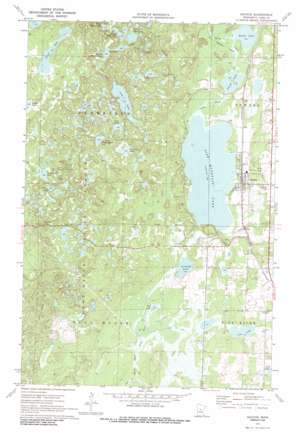
Backus Topo Map Minnesota
To zoom in, hover over the map of Backus
USGS Topo Quad 46094g5 - 1:24,000 scale
| Topo Map Name: | Backus |
| USGS Topo Quad ID: | 46094g5 |
| Print Size: | ca. 21 1/4" wide x 27" high |
| Southeast Coordinates: | 46.75° N latitude / 94.5° W longitude |
| Map Center Coordinates: | 46.8125° N latitude / 94.5625° W longitude |
| U.S. State: | MN |
| Filename: | o46094g5.jpg |
| Download Map JPG Image: | Backus topo map 1:24,000 scale |
| Map Type: | Topographic |
| Topo Series: | 7.5´ |
| Map Scale: | 1:24,000 |
| Source of Map Images: | United States Geological Survey (USGS) |
| Alternate Map Versions: |
Backus MN 1970, updated 1972 Download PDF Buy paper map Backus MN 2010 Download PDF Buy paper map Backus MN 2013 Download PDF Buy paper map Backus MN 2016 Download PDF Buy paper map |
1:24,000 Topo Quads surrounding Backus
> Back to 46094e1 at 1:100,000 scale
> Back to 46094a1 at 1:250,000 scale
> Back to U.S. Topo Maps home
Backus topo map: Gazetteer
Backus: Airports
Backus Municipal Airport elevation 412m 1351′Backus: Dams
Pine Mountain Lake Dam elevation 415m 1361′South Fork Pine River Dam elevation 400m 1312′
Backus: Lakes
Abel Lake elevation 405m 1328′Beuber Lake elevation 404m 1325′
Cow Lake elevation 403m 1322′
Cranberry Lake elevation 464m 1522′
Deer Lake elevation 445m 1459′
First Perch Lake elevation 449m 1473′
Goose Lake elevation 443m 1453′
Island Lake elevation 403m 1322′
Lee Lake elevation 458m 1502′
Long Lake elevation 435m 1427′
Ox Camp Lake elevation 439m 1440′
Perch Lake elevation 455m 1492′
Pine Mountain Lake elevation 403m 1322′
Scribner Lake elevation 405m 1328′
Second Perch Lake elevation 449m 1473′
Second Trestle Lake elevation 452m 1482′
Sleepy Island Lake elevation 455m 1492′
Third Perch Lake elevation 451m 1479′
Backus: Populated Places
Backus elevation 410m 1345′Backus: Post Offices
Backus Post Office elevation 409m 1341′Backus: Reservoirs
Pine Mountain Lake elevation 415m 1361′Backus: Streams
Cedar Creek elevation 400m 1312′Stony Creek elevation 403m 1322′
Backus: Trails
Deerfield Trail elevation 446m 1463′Backus digital topo map on disk
Buy this Backus topo map showing relief, roads, GPS coordinates and other geographical features, as a high-resolution digital map file on DVD:


