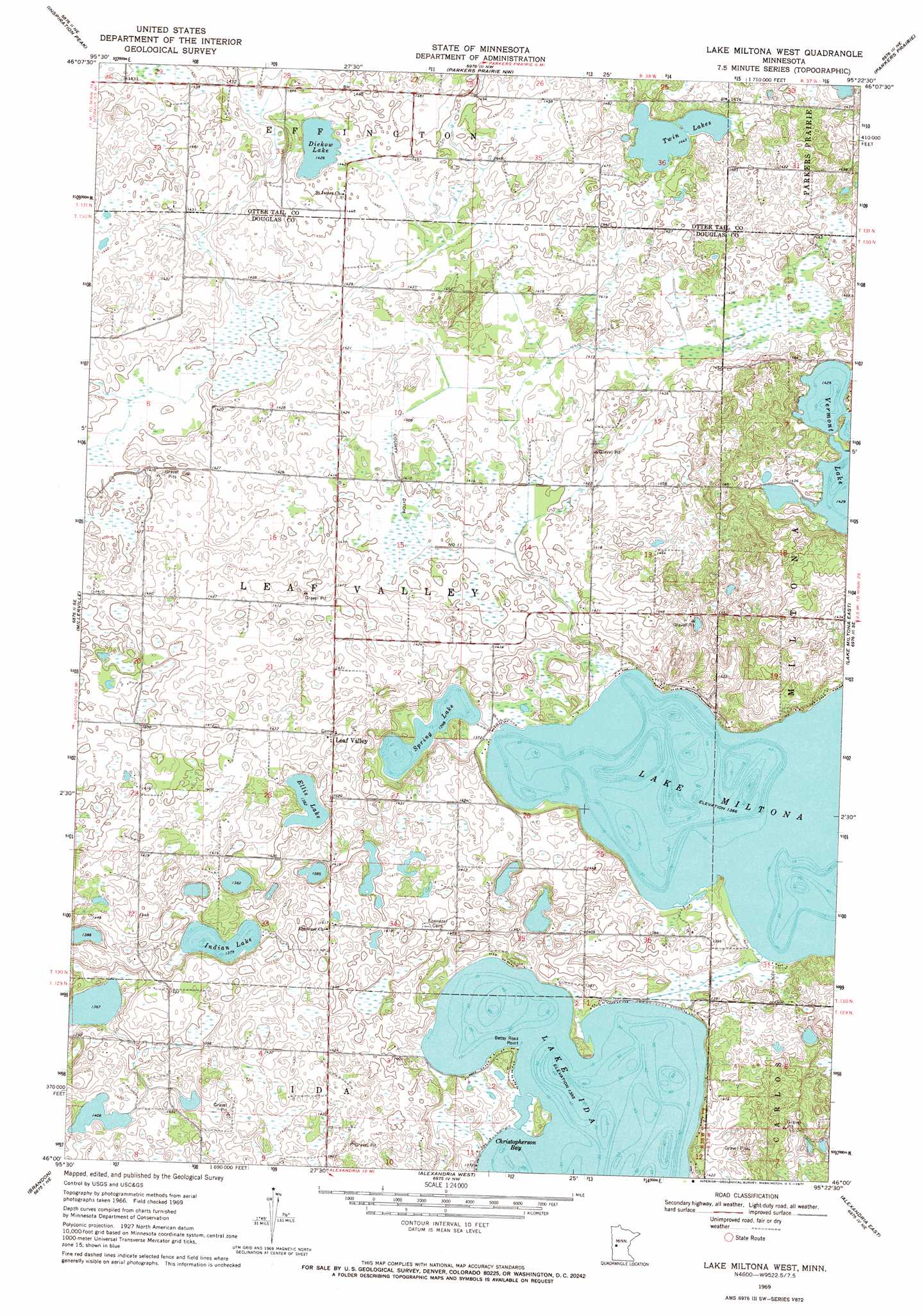
Lake Miltona West Topo Map Minnesota
To zoom in, hover over the map of Lake Miltona West
USGS Topo Quad 46095a4 - 1:24,000 scale
| Topo Map Name: | Lake Miltona West |
| USGS Topo Quad ID: | 46095a4 |
| Print Size: | ca. 21 1/4" wide x 27" high |
| Southeast Coordinates: | 46° N latitude / 95.375° W longitude |
| Map Center Coordinates: | 46.0625° N latitude / 95.4375° W longitude |
| U.S. State: | MN |
| Filename: | o46095a4.jpg |
| Download Map JPG Image: | Lake Miltona West topo map 1:24,000 scale |
| Map Type: | Topographic |
| Topo Series: | 7.5´ |
| Map Scale: | 1:24,000 |
| Source of Map Images: | United States Geological Survey (USGS) |
| Alternate Map Versions: |
Lake Miltona West MN 1969, updated 1971 Download PDF Buy paper map Lake Miltona West MN 2010 Download PDF Buy paper map Lake Miltona West MN 2013 Download PDF Buy paper map Lake Miltona West MN 2016 Download PDF Buy paper map |
1:24,000 Topo Quads surrounding Lake Miltona West
Battle Lake |
Vining |
Henning |
Henning Se |
Wrightstown |
Eagle Lake |
Inspiration Peak |
Parkers Prairie Nw |
Parkers Prairie |
Eagle Bend Nw |
Evansville |
Millerville |
Lake Miltona West |
Lake Miltona East |
Rose City |
Quam Lake |
Brandon |
Alexandria West |
Alexandria East |
Lake Osakis West |
Kensington |
Farwell |
Lake Mary |
Forada |
Osakis |
> Back to 46095a1 at 1:100,000 scale
> Back to 46094a1 at 1:250,000 scale
> Back to U.S. Topo Maps home
Lake Miltona West topo map: Gazetteer
Lake Miltona West: Bays
Christopherson Bay elevation 415m 1361′Lake Miltona West: Canals
County Ditch Number Eleven elevation 425m 1394′Lake Miltona West: Capes
Betsy Ross Point elevation 416m 1364′Lake Miltona West: Dams
Aaron Lake Dam elevation 430m 1410′Miltona Lake Dam elevation 418m 1371′
Lake Miltona West: Lakes
Diekow Lake elevation 434m 1423′Ellis Lake elevation 421m 1381′
Indian Lake elevation 418m 1371′
Private Lake (not official) elevation 415m 1361′
Spring Lake elevation 416m 1364′
Twin Lakes elevation 440m 1443′
Lake Miltona West: Populated Places
Leaf Valley elevation 436m 1430′Lake Miltona West: Post Offices
Leaf Valley Post Office (historical) elevation 436m 1430′Lake Miltona West: Reservoirs
Aaron Lake elevation 430m 1410′Miltona Lake elevation 418m 1371′
Lake Miltona West digital topo map on disk
Buy this Lake Miltona West topo map showing relief, roads, GPS coordinates and other geographical features, as a high-resolution digital map file on DVD: