Eagle Bend Topo Map Minnesota
To zoom in, hover over the map of Eagle Bend
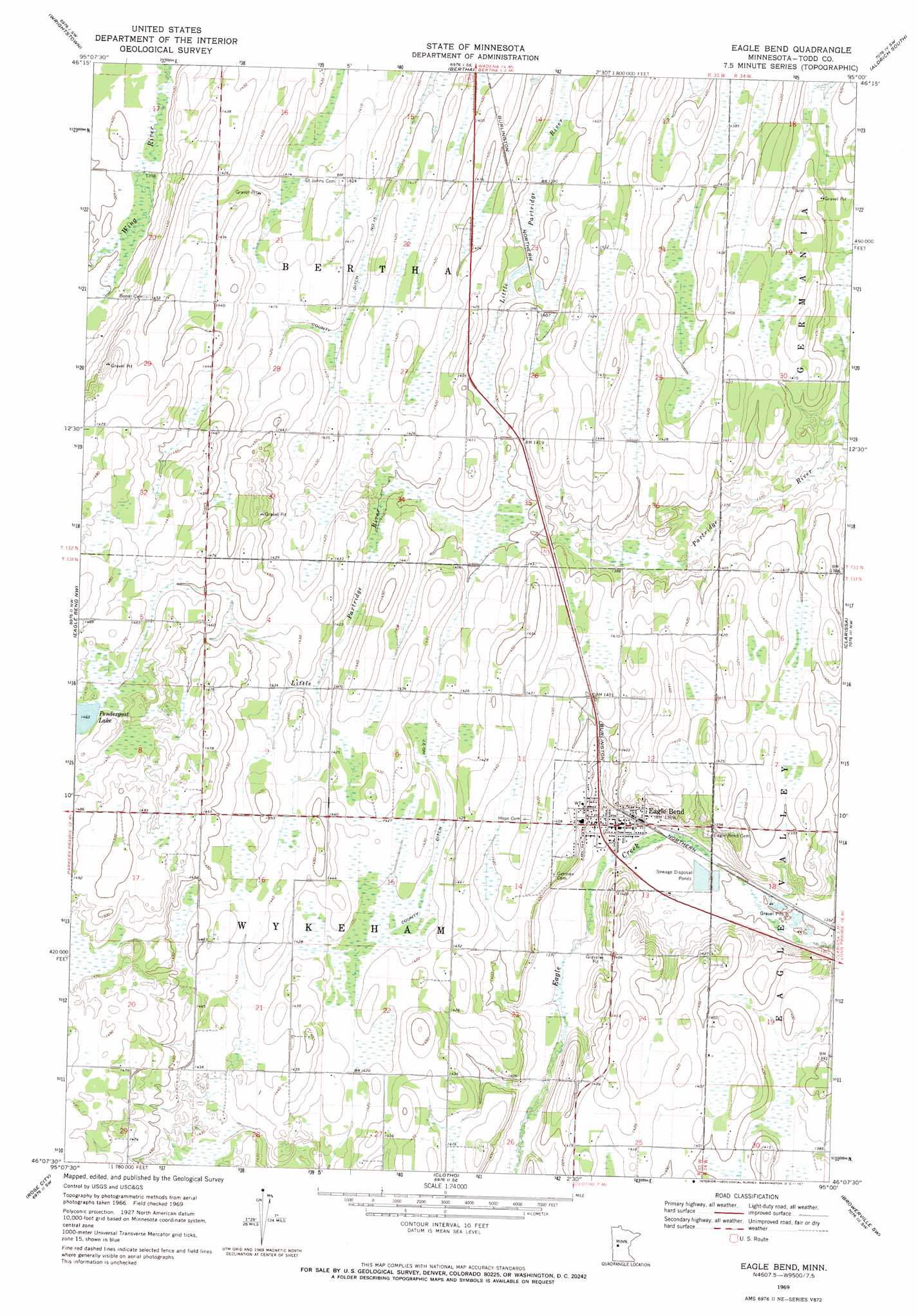
USGS Topo Quad 46095b1 - 1:24,000 scale
| Topo Map Name: | Eagle Bend |
| USGS Topo Quad ID: | 46095b1 |
| Print Size: | ca. 21 1/4" wide x 27" high |
| Southeast Coordinates: | 46.125° N latitude / 95° W longitude |
| Map Center Coordinates: | 46.1875° N latitude / 95.0625° W longitude |
| U.S. State: | MN |
| Filename: | o46095b1.jpg |
| Download Map JPG Image: | Eagle Bend topo map 1:24,000 scale |
| Map Type: | Topographic |
| Topo Series: | 7.5´ |
| Map Scale: | 1:24,000 |
| Source of Map Images: | United States Geological Survey (USGS) |
| Alternate Map Versions: |
Eagle Bend MN 1969, updated 1971 Download PDF Buy paper map Eagle Bend MN 2010 Download PDF Buy paper map Eagle Bend MN 2013 Download PDF Buy paper map Eagle Bend MN 2016 Download PDF Buy paper map |
1:24,000 Topo Quads surrounding Eagle Bend
Deer Creek |
Wadena |
Verndale |
Aldrich North |
Staples Ne |
Henning Se |
Wrightstown |
Bertha |
Aldrich South |
Staples |
Parkers Prairie |
Eagle Bend Nw |
Eagle Bend |
Clarissa |
Browerville Ne |
Lake Miltona East |
Rose City |
Clotho |
Browerville Sw |
Browerville |
Alexandria East |
Lake Osakis West |
Lake Osakis East |
Round Prairie |
Long Prairie |
> Back to 46095a1 at 1:100,000 scale
> Back to 46094a1 at 1:250,000 scale
> Back to U.S. Topo Maps home
Eagle Bend topo map: Gazetteer
Eagle Bend: Canals
County Ditch Number Twentyseven elevation 432m 1417′Eagle Bend: Populated Places
Eagle Bend elevation 417m 1368′Eagle Bend: Post Offices
Eagle Bend Post Office elevation 416m 1364′Eagle Bend digital topo map on disk
Buy this Eagle Bend topo map showing relief, roads, GPS coordinates and other geographical features, as a high-resolution digital map file on DVD: