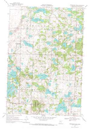
Inspiration Peak Topo Map Minnesota
To zoom in, hover over the map of Inspiration Peak
USGS Topo Quad 46095b5 - 1:24,000 scale
| Topo Map Name: | Inspiration Peak |
| USGS Topo Quad ID: | 46095b5 |
| Print Size: | ca. 21 1/4" wide x 27" high |
| Southeast Coordinates: | 46.125° N latitude / 95.5° W longitude |
| Map Center Coordinates: | 46.1875° N latitude / 95.5625° W longitude |
| U.S. State: | MN |
| Filename: | o46095b5.jpg |
| Download Map JPG Image: | Inspiration Peak topo map 1:24,000 scale |
| Map Type: | Topographic |
| Topo Series: | 7.5´ |
| Map Scale: | 1:24,000 |
| Source of Map Images: | United States Geological Survey (USGS) |
| Alternate Map Versions: |
Inspiration Peak MN 1969, updated 1971 Download PDF Buy paper map Inspiration Peak MN 2010 Download PDF Buy paper map Inspiration Peak MN 2013 Download PDF Buy paper map Inspiration Peak MN 2016 Download PDF Buy paper map |
1:24,000 Topo Quads surrounding Inspiration Peak
> Back to 46095a1 at 1:100,000 scale
> Back to 46094a1 at 1:250,000 scale
> Back to U.S. Topo Maps home
Inspiration Peak topo map: Gazetteer
Inspiration Peak: Lakes
Arken Lake elevation 443m 1453′Deusch Lake elevation 442m 1450′
Ellingson Lake elevation 409m 1341′
Lake Jessie elevation 440m 1443′
Long Lake elevation 415m 1361′
Millpond Lake elevation 421m 1381′
Sampson Lake elevation 415m 1361′
Siverson Lake elevation 415m 1361′
Stemmer Lake elevation 464m 1522′
Toms Lake elevation 448m 1469′
Trulse Lake elevation 425m 1394′
Inspiration Peak: Parks
Geology of Inspiration Peak Geological Marker elevation 498m 1633′Inspiration Peak Historical Marker elevation 498m 1633′
Inspiration Peak State Wayside Park elevation 475m 1558′
Inspiration State Wildlife Management Are elevation 450m 1476′
Inspiration Peak: Post Offices
Leaf Mountain Post Office (historical) elevation 449m 1473′Inspiration Peak: Summits
Inspiration Peak elevation 521m 1709′Inspiration Peak digital topo map on disk
Buy this Inspiration Peak topo map showing relief, roads, GPS coordinates and other geographical features, as a high-resolution digital map file on DVD:


