Bertha Topo Map Minnesota
To zoom in, hover over the map of Bertha
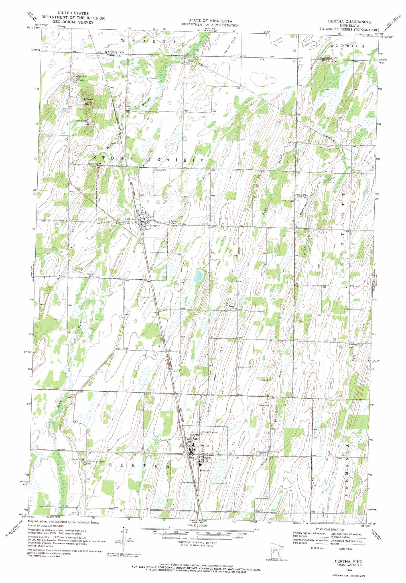
USGS Topo Quad 46095c1 - 1:24,000 scale
| Topo Map Name: | Bertha |
| USGS Topo Quad ID: | 46095c1 |
| Print Size: | ca. 21 1/4" wide x 27" high |
| Southeast Coordinates: | 46.25° N latitude / 95° W longitude |
| Map Center Coordinates: | 46.3125° N latitude / 95.0625° W longitude |
| U.S. State: | MN |
| Filename: | o46095c1.jpg |
| Download Map JPG Image: | Bertha topo map 1:24,000 scale |
| Map Type: | Topographic |
| Topo Series: | 7.5´ |
| Map Scale: | 1:24,000 |
| Source of Map Images: | United States Geological Survey (USGS) |
| Alternate Map Versions: |
Bertha MN 1969, updated 1971 Download PDF Buy paper map Bertha MN 2010 Download PDF Buy paper map Bertha MN 2013 Download PDF Buy paper map Bertha MN 2016 Download PDF Buy paper map |
1:24,000 Topo Quads surrounding Bertha
New York Mills East |
Sebeka Sw |
Blue Grass |
Nimrod Sw |
Oylen |
Deer Creek |
Wadena |
Verndale |
Aldrich North |
Staples Ne |
Henning Se |
Wrightstown |
Bertha |
Aldrich South |
Staples |
Parkers Prairie |
Eagle Bend Nw |
Eagle Bend |
Clarissa |
Browerville Ne |
Lake Miltona East |
Rose City |
Clotho |
Browerville Sw |
Browerville |
> Back to 46095a1 at 1:100,000 scale
> Back to 46094a1 at 1:250,000 scale
> Back to U.S. Topo Maps home
Bertha topo map: Gazetteer
Bertha: Canals
County Ditch Number Fifteen elevation 422m 1384′Bertha: Dams
Kramer Dam elevation 440m 1443′Bertha: Parks
Bertha Wayside Park elevation 428m 1404′Bertha: Populated Places
Bertha elevation 424m 1391′Hewitt elevation 418m 1371′
Bertha: Post Offices
Bertha Post Office elevation 427m 1400′Hewitt Post Office elevation 423m 1387′
Bertha: Reservoirs
Kramers Lake elevation 440m 1443′Bertha: Streams
Bear Creek elevation 407m 1335′Bertha: Summits
Mount Nebo elevation 461m 1512′Bertha digital topo map on disk
Buy this Bertha topo map showing relief, roads, GPS coordinates and other geographical features, as a high-resolution digital map file on DVD: