Deer Creek Topo Map Minnesota
To zoom in, hover over the map of Deer Creek
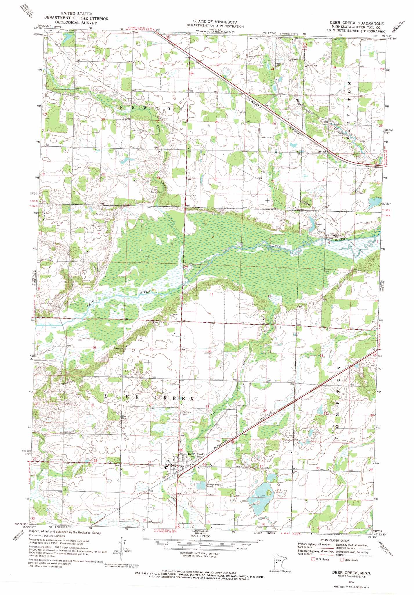
USGS Topo Quad 46095d3 - 1:24,000 scale
| Topo Map Name: | Deer Creek |
| USGS Topo Quad ID: | 46095d3 |
| Print Size: | ca. 21 1/4" wide x 27" high |
| Southeast Coordinates: | 46.375° N latitude / 95.25° W longitude |
| Map Center Coordinates: | 46.4375° N latitude / 95.3125° W longitude |
| U.S. State: | MN |
| Filename: | o46095d3.jpg |
| Download Map JPG Image: | Deer Creek topo map 1:24,000 scale |
| Map Type: | Topographic |
| Topo Series: | 7.5´ |
| Map Scale: | 1:24,000 |
| Source of Map Images: | United States Geological Survey (USGS) |
| Alternate Map Versions: |
Deer Creek MN 1969, updated 1971 Download PDF Buy paper map Deer Creek MN 2010 Download PDF Buy paper map Deer Creek MN 2013 Download PDF Buy paper map Deer Creek MN 2016 Download PDF Buy paper map |
1:24,000 Topo Quads surrounding Deer Creek
Little Pine Lake |
New York Mills Nw |
Butler |
Sebeka Nw |
Sebeka |
Perham |
New York Mills West |
New York Mills East |
Sebeka Sw |
Blue Grass |
Ottertail |
Heinola |
Deer Creek |
Wadena |
Verndale |
Vining |
Henning |
Henning Se |
Wrightstown |
Bertha |
Inspiration Peak |
Parkers Prairie Nw |
Parkers Prairie |
Eagle Bend Nw |
Eagle Bend |
> Back to 46095a1 at 1:100,000 scale
> Back to 46094a1 at 1:250,000 scale
> Back to U.S. Topo Maps home
Deer Creek topo map: Gazetteer
Deer Creek: Populated Places
Deer Creek elevation 425m 1394′Deer Creek Mobile Home Park elevation 425m 1394′
Topelius (historical) elevation 421m 1381′
Deer Creek: Post Offices
Deer Creek Post Office (historical) elevation 425m 1394′Dopelius Post Office (historical) elevation 421m 1381′
Deer Creek: Streams
Deer Creek elevation 403m 1322′Finn Creek elevation 400m 1312′
South Bluff Creek elevation 400m 1312′
Deer Creek digital topo map on disk
Buy this Deer Creek topo map showing relief, roads, GPS coordinates and other geographical features, as a high-resolution digital map file on DVD: