Menahga Topo Map Minnesota
To zoom in, hover over the map of Menahga
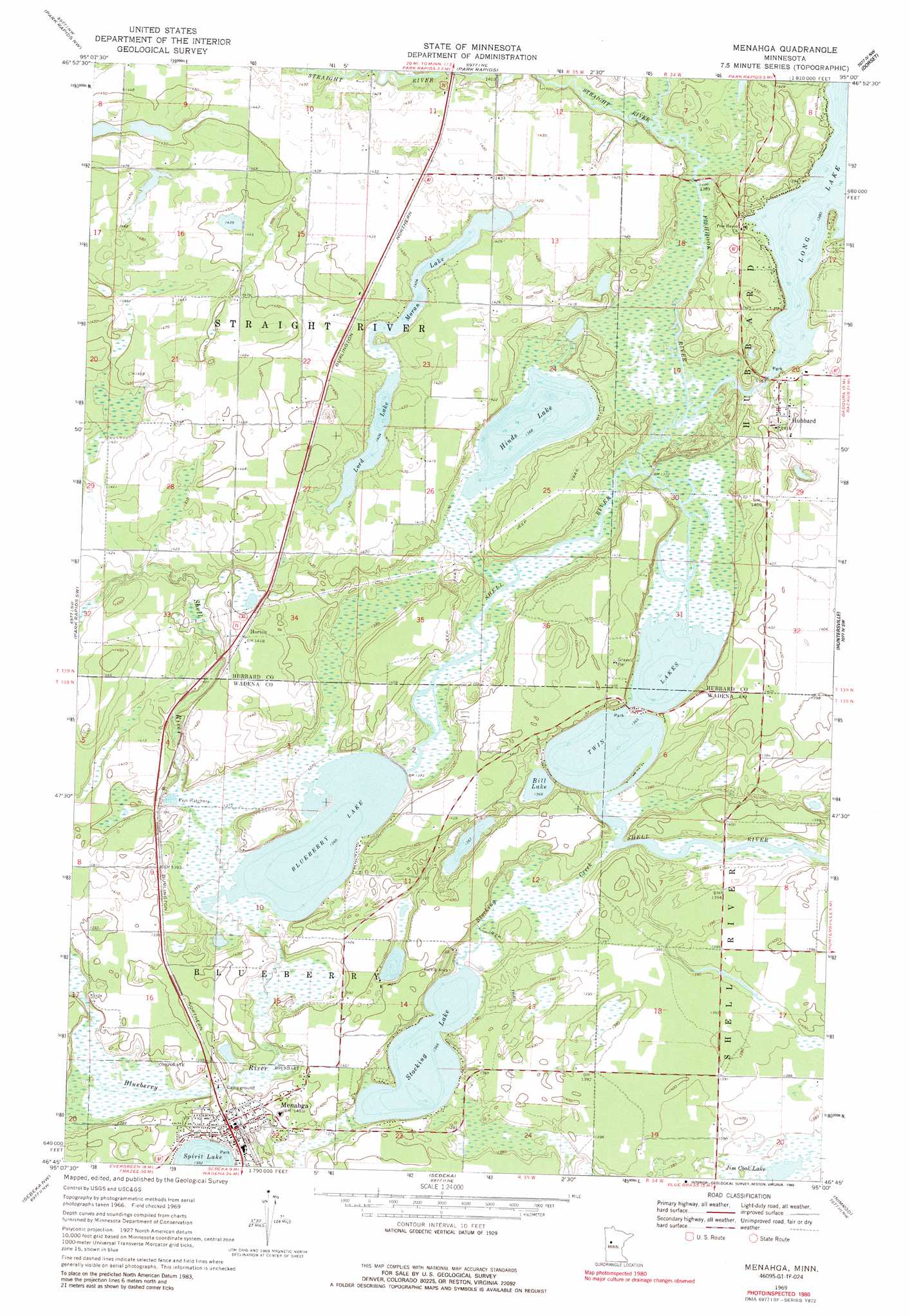
USGS Topo Quad 46095g1 - 1:24,000 scale
| Topo Map Name: | Menahga |
| USGS Topo Quad ID: | 46095g1 |
| Print Size: | ca. 21 1/4" wide x 27" high |
| Southeast Coordinates: | 46.75° N latitude / 95° W longitude |
| Map Center Coordinates: | 46.8125° N latitude / 95.0625° W longitude |
| U.S. State: | MN |
| Filename: | o46095g1.jpg |
| Download Map JPG Image: | Menahga topo map 1:24,000 scale |
| Map Type: | Topographic |
| Topo Series: | 7.5´ |
| Map Scale: | 1:24,000 |
| Source of Map Images: | United States Geological Survey (USGS) |
| Alternate Map Versions: |
Menahga MN 1969, updated 1971 Download PDF Buy paper map Menahga MN 1969, updated 1989 Download PDF Buy paper map Menahga MN 2010 Download PDF Buy paper map Menahga MN 2013 Download PDF Buy paper map Menahga MN 2016 Download PDF Buy paper map |
1:24,000 Topo Quads surrounding Menahga
Big Basswood Lake |
Two Inlets |
Skunk Lake |
Mantrap Lake |
East Crooked Lake |
Osage |
Park Rapids Nw |
Park Rapids |
Dorset |
Nevis |
Wolf Lake |
Park Rapids Sw |
Menahga |
Huntersville |
First Crow Wing Lake |
Butler |
Sebeka Nw |
Sebeka |
Nimrod |
Burgen Lake |
New York Mills East |
Sebeka Sw |
Blue Grass |
Nimrod Sw |
Oylen |
> Back to 46095e1 at 1:100,000 scale
> Back to 46094a1 at 1:250,000 scale
> Back to U.S. Topo Maps home
Menahga topo map: Gazetteer
Menahga: Airports
Falk Airport elevation 435m 1427′Menahga: Dams
Long Lake Dam elevation 421m 1381′Menahga: Lakes
Bill Lake elevation 415m 1361′Blueberry Lake elevation 416m 1364′
Hinds Lake elevation 417m 1368′
Long Lake elevation 421m 1381′
Lord Lake elevation 428m 1404′
Moran Lake elevation 428m 1404′
Stocking Lake elevation 417m 1368′
Twin Lakes elevation 415m 1361′
Menahga: Populated Places
Horton elevation 431m 1414′Hubbard elevation 431m 1414′
Menahga elevation 428m 1404′
Menahga: Post Offices
Ames Post Office (historical) elevation 436m 1430′Hubbard Post Office (historical) elevation 432m 1417′
Latona Post Office (historical) elevation 440m 1443′
Menahga: Reservoirs
Long Lake elevation 421m 1381′Menahga: Streams
Blueberry River elevation 416m 1364′Fishhook River elevation 416m 1364′
Stocking Creek elevation 416m 1364′
Straight River elevation 425m 1394′
Menahga digital topo map on disk
Buy this Menahga topo map showing relief, roads, GPS coordinates and other geographical features, as a high-resolution digital map file on DVD: