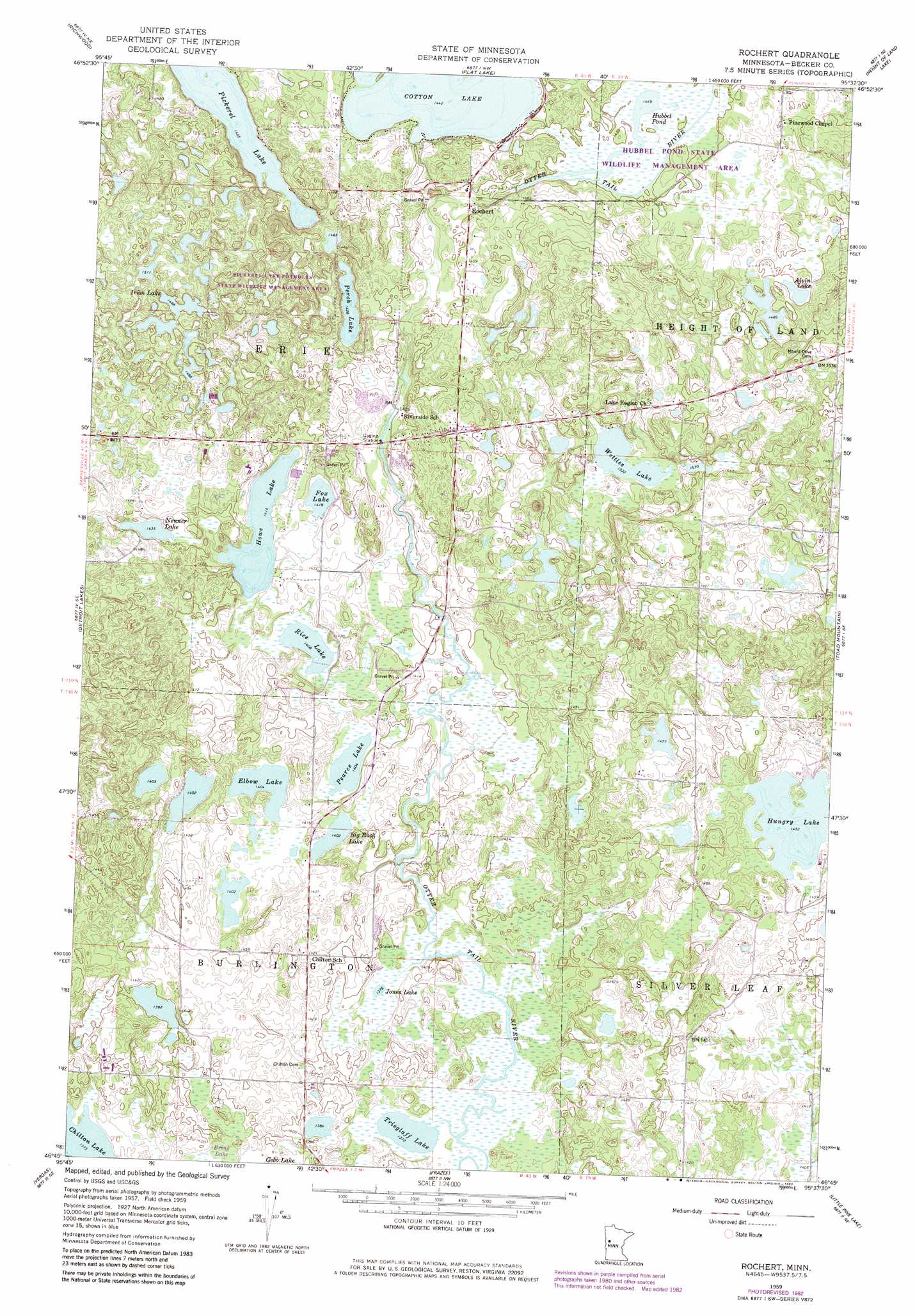
Rochert Topo Map Minnesota
To zoom in, hover over the map of Rochert
USGS Topo Quad 46095g6 - 1:24,000 scale
| Topo Map Name: | Rochert |
| USGS Topo Quad ID: | 46095g6 |
| Print Size: | ca. 21 1/4" wide x 27" high |
| Southeast Coordinates: | 46.75° N latitude / 95.625° W longitude |
| Map Center Coordinates: | 46.8125° N latitude / 95.6875° W longitude |
| U.S. State: | MN |
| Filename: | o46095g6.jpg |
| Download Map JPG Image: | Rochert topo map 1:24,000 scale |
| Map Type: | Topographic |
| Topo Series: | 7.5´ |
| Map Scale: | 1:24,000 |
| Source of Map Images: | United States Geological Survey (USGS) |
| Alternate Map Versions: |
Rochert MN 1959, updated 1960 Download PDF Buy paper map Rochert MN 1959, updated 1974 Download PDF Buy paper map Rochert MN 1959, updated 1982 Download PDF Buy paper map Rochert MN 2010 Download PDF Buy paper map Rochert MN 2013 Download PDF Buy paper map Rochert MN 2016 Download PDF Buy paper map |
1:24,000 Topo Quads surrounding Rochert
Ogema |
White Earth |
Strawberry Lake |
Many Point Lake |
Big Rush Lake |
Mount Rainier East |
Richwood |
Flat Lake |
Height Of Land Lake |
Ponsford |
Audubon |
Detroit Lakes |
Rochert |
Toad Mountain |
Evergreen |
Lake Franklin |
Vergas |
Frazee |
Little Pine Lake |
New York Mills Nw |
Lake Lida |
Star Lake |
Dent |
Perham |
New York Mills West |
> Back to 46095e1 at 1:100,000 scale
> Back to 46094a1 at 1:250,000 scale
> Back to U.S. Topo Maps home
Rochert topo map: Gazetteer
Rochert: Dams
Cotton Lake Diversion Dam elevation 440m 1443′Hubbel Pond Dam elevation 455m 1492′
Rochert: Lakes
Alvin Lake elevation 455m 1492′Big Rock Lake elevation 427m 1400′
Elbow Lake elevation 427m 1400′
Fox Lake elevation 431m 1414′
Howe Lake elevation 431m 1414′
Hubbel Pond elevation 440m 1443′
Hungry Lake elevation 443m 1453′
Irish Lake elevation 457m 1499′
Jones Lake elevation 418m 1371′
Neuner Lake elevation 437m 1433′
Pearce Lake elevation 427m 1400′
Perch Lake elevation 436m 1430′
Pickerel Lake elevation 438m 1437′
Rice Lake elevation 428m 1404′
Trieglaff Lake elevation 418m 1371′
Wettles Lake elevation 464m 1522′
Rochert: Parks
Hubbel Pond Game Refuge elevation 442m 1450′Rochert: Populated Places
Riverview Terrace Mobile Home Park elevation 439m 1440′Rochert elevation 439m 1440′
Rochert: Post Offices
Rochert Post Office (historical) elevation 440m 1443′Rochert digital topo map on disk
Buy this Rochert topo map showing relief, roads, GPS coordinates and other geographical features, as a high-resolution digital map file on DVD: