Mount Rainier East Topo Map Minnesota
To zoom in, hover over the map of Mount Rainier East
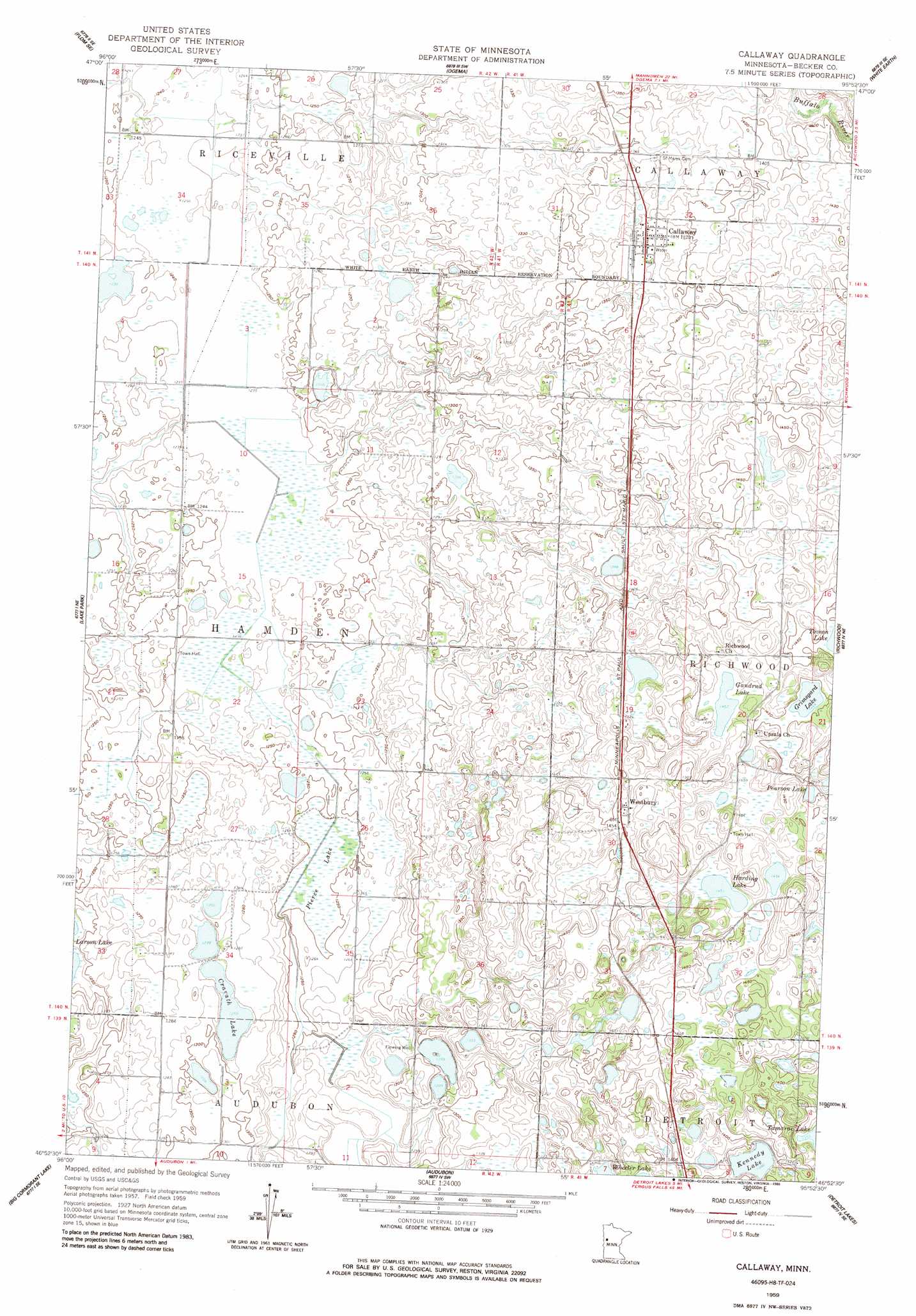
USGS Topo Quad 46095h8 - 1:24,000 scale
| Topo Map Name: | Mount Rainier East |
| USGS Topo Quad ID: | 46095h8 |
| Print Size: | ca. 21 1/4" wide x 27" high |
| Southeast Coordinates: | 46.875° N latitude / 95.875° W longitude |
| Map Center Coordinates: | 46.9375° N latitude / 95.9375° W longitude |
| U.S. State: | MN |
| Filename: | o46095h8.jpg |
| Download Map JPG Image: | Mount Rainier East topo map 1:24,000 scale |
| Map Type: | Topographic |
| Topo Series: | 7.5´ |
| Map Scale: | 1:24,000 |
| Source of Map Images: | United States Geological Survey (USGS) |
| Alternate Map Versions: |
Callaway MN 1959, updated 1960 Download PDF Buy paper map Callaway MN 2010 Download PDF Buy paper map Callaway MN 2013 Download PDF Buy paper map Callaway MN 2016 Download PDF Buy paper map |
1:24,000 Topo Quads surrounding Mount Rainier East
Flom |
Flom Ne |
Waubun |
Ogema Ne |
Snider Lake |
Tilde Lake |
Flom Se |
Ogema |
White Earth |
Strawberry Lake |
Dale |
Lake Park |
Mount Rainier East |
Richwood |
Flat Lake |
Lake Park Sw |
Big Cormorant Lake |
Audubon |
Detroit Lakes |
Rochert |
Rollag |
Cormorant |
Lake Franklin |
Vergas |
Frazee |
> Back to 46095e1 at 1:100,000 scale
> Back to 46094a1 at 1:250,000 scale
> Back to U.S. Topo Maps home
Mount Rainier East topo map: Gazetteer
Mount Rainier East: Dams
Barrett Lake Dam elevation 443m 1453′Ted Kath Dam elevation 387m 1269′
Ted Kath Dam elevation 396m 1299′
Mount Rainier East: Lakes
Cravath Lake elevation 390m 1279′Gandrud Lake elevation 443m 1453′
Grimsgard Lake elevation 440m 1443′
Harding Lake elevation 443m 1453′
Kennedy Lake elevation 421m 1381′
Pearson Lake elevation 441m 1446′
Mount Rainier East: Populated Places
Callaway elevation 423m 1387′Westbury elevation 446m 1463′
Mount Rainier East: Post Offices
Callaway Post Office (historical) elevation 422m 1384′Westbury Post Office (historical) elevation 446m 1463′
Mount Rainier East: Swamps
Pierce Lake elevation 380m 1246′Mount Rainier East digital topo map on disk
Buy this Mount Rainier East topo map showing relief, roads, GPS coordinates and other geographical features, as a high-resolution digital map file on DVD: