South Of Wahpeton Topo Map Minnesota
To zoom in, hover over the map of South Of Wahpeton
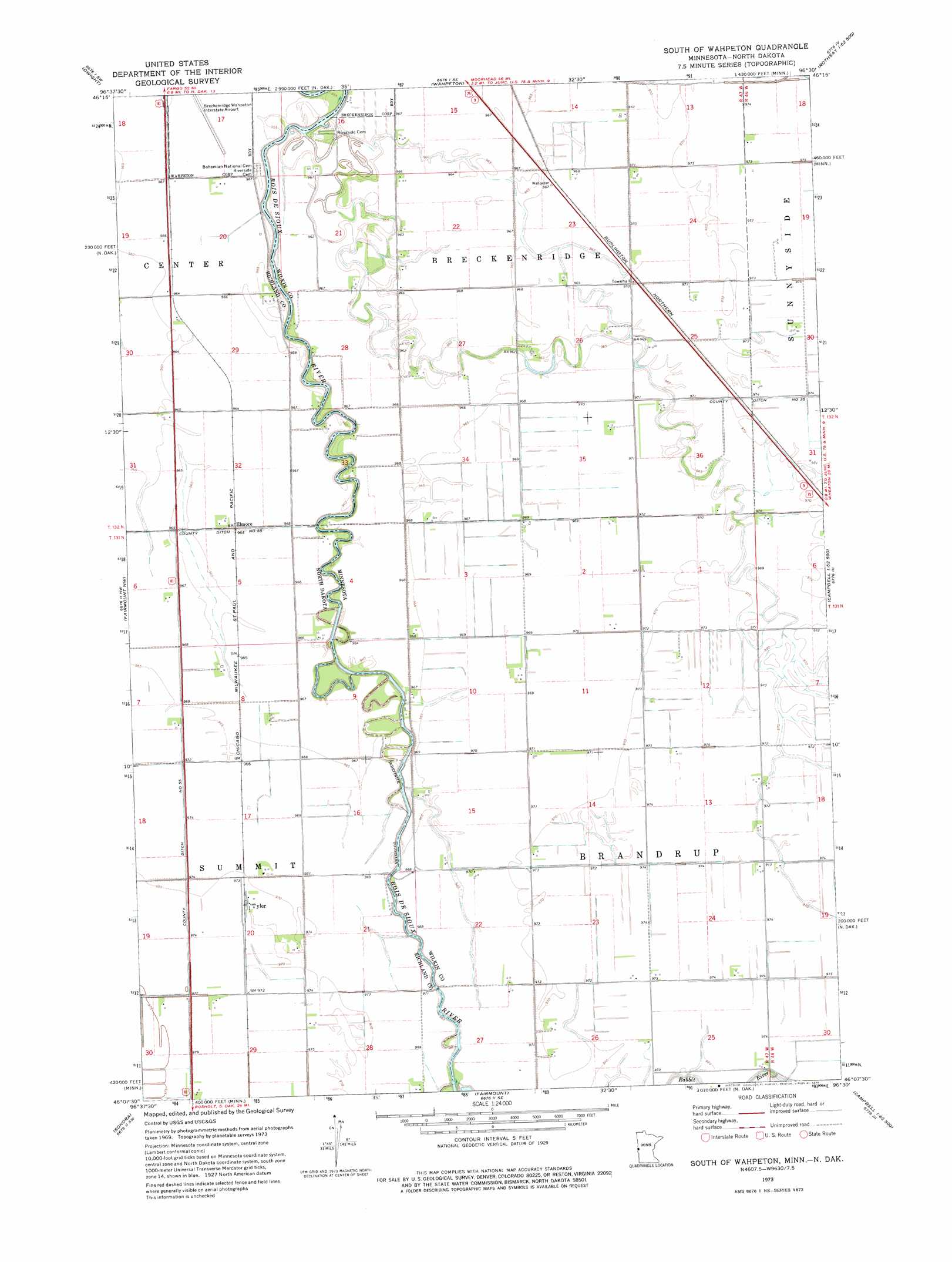
USGS Topo Quad 46096b5 - 1:24,000 scale
| Topo Map Name: | South Of Wahpeton |
| USGS Topo Quad ID: | 46096b5 |
| Print Size: | ca. 21 1/4" wide x 27" high |
| Southeast Coordinates: | 46.125° N latitude / 96.5° W longitude |
| Map Center Coordinates: | 46.1875° N latitude / 96.5625° W longitude |
| U.S. States: | MN, ND |
| Filename: | o46096b5.jpg |
| Download Map JPG Image: | South Of Wahpeton topo map 1:24,000 scale |
| Map Type: | Topographic |
| Topo Series: | 7.5´ |
| Map Scale: | 1:24,000 |
| Source of Map Images: | United States Geological Survey (USGS) |
| Alternate Map Versions: |
South of Wahpeton MN 1973, updated 1975 Download PDF Buy paper map South of Wahpeton MN 2011 Download PDF Buy paper map South of Wahpeton MN 2013 Download PDF Buy paper map South of Wahpeton MN 2016 Download PDF Buy paper map |
1:24,000 Topo Quads surrounding South Of Wahpeton
Galchutt |
Abercrombie |
Wahpeton Ne |
Rothsay Nw |
Rothsay |
Mooreton East |
Dwight |
Wahpeton |
Everdell |
Foxhome |
Great Bend |
Fairmount Nw |
South Of Wahpeton |
Doran |
Campbell Ne |
Hankinson Se |
Sonora |
Fairmount |
Campbell |
Tintah |
New Effington Ne |
La Mars |
Boisberg |
Wheaton Nw |
Charlesville |
> Back to 46096a1 at 1:100,000 scale
> Back to 46096a1 at 1:250,000 scale
> Back to U.S. Topo Maps home
South Of Wahpeton topo map: Gazetteer
South Of Wahpeton: Airports
Breckenridge-Wahpeton Interstate Airport elevation 294m 964′South Of Wahpeton: Canals
County Ditch Number 55 elevation 296m 971′South Of Wahpeton: Populated Places
Elmore elevation 293m 961′Tyler elevation 296m 971′
South Of Wahpeton digital topo map on disk
Buy this South Of Wahpeton topo map showing relief, roads, GPS coordinates and other geographical features, as a high-resolution digital map file on DVD:
Eastern North Dakota & Eastern South Dakota
Buy digital topo maps: Eastern North Dakota & Eastern South Dakota