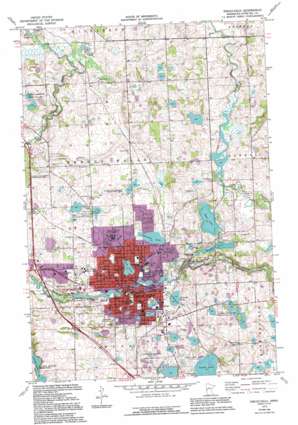
Fergus Falls Topo Map Minnesota
To zoom in, hover over the map of Fergus Falls
USGS Topo Quad 46096c1 - 1:24,000 scale
| Topo Map Name: | Fergus Falls |
| USGS Topo Quad ID: | 46096c1 |
| Print Size: | ca. 21 1/4" wide x 27" high |
| Southeast Coordinates: | 46.25° N latitude / 96° W longitude |
| Map Center Coordinates: | 46.3125° N latitude / 96.0625° W longitude |
| U.S. State: | MN |
| Filename: | o46096c1.jpg |
| Download Map JPG Image: | Fergus Falls topo map 1:24,000 scale |
| Map Type: | Topographic |
| Topo Series: | 7.5´ |
| Map Scale: | 1:24,000 |
| Source of Map Images: | United States Geological Survey (USGS) |
| Alternate Map Versions: |
Fergus Falls MN 1973, updated 1975 Download PDF Buy paper map Fergus Falls MN 1973, updated 1995 Download PDF Buy paper map Fergus Falls MN 2010 Download PDF Buy paper map Fergus Falls MN 2013 Download PDF Buy paper map Fergus Falls MN 2016 Download PDF Buy paper map |
1:24,000 Topo Quads surrounding Fergus Falls
> Back to 46096a1 at 1:100,000 scale
> Back to 46096a1 at 1:250,000 scale
> Back to U.S. Topo Maps home
Fergus Falls topo map: Gazetteer
Fergus Falls: Crossings
Interchange 54 elevation 360m 1181′Interchange 55 elevation 362m 1187′
Interchange 57 elevation 380m 1246′
Fergus Falls: Dams
Central-Wright Dam elevation 358m 1174′Pisgah Dam elevation 353m 1158′
Fergus Falls: Lakes
Grotto Lake elevation 372m 1220′Hoot Lake elevation 383m 1256′
Lake Alice elevation 369m 1210′
Lake Charles elevation 370m 1213′
Onemile Lake elevation 361m 1184′
Opperman Lake elevation 370m 1213′
Pebble Lake elevation 363m 1190′
Wright Lake elevation 383m 1256′
Fergus Falls: Parks
Adams Park elevation 374m 1227′Broken Down Dam Park elevation 368m 1207′
Channing Recreational Area elevation 368m 1207′
City Hall Park elevation 357m 1171′
Delagoon Park elevation 366m 1200′
Fergus Falls State Wildlife Management Area elevation 373m 1223′
George B Wright Park elevation 360m 1181′
Godel Park elevation 385m 1263′
Kennedy Park elevation 351m 1151′
Lake Alice Park elevation 375m 1230′
N P Park elevation 361m 1184′
North Broadway Park elevation 369m 1210′
Northeast Park elevation 389m 1276′
Old Smokey Ski Hill Park elevation 358m 1174′
Riverside Park elevation 354m 1161′
Riverside Waterfowl Sanctuary elevation 360m 1181′
Robert Hannah Recreational Area elevation 353m 1158′
Roosevelt Park elevation 372m 1220′
T H Johnson Athletic Park elevation 359m 1177′
Van Dyk Park elevation 369m 1210′
Veterans Memorial Park elevation 360m 1181′
Whitford Recreational Area elevation 371m 1217′
Fergus Falls: Populated Places
Fergus Falls elevation 360m 1181′Green Acres Mobile Park elevation 374m 1227′
Lakeview Estates elevation 390m 1279′
River Bluff Estates elevation 364m 1194′
Fergus Falls: Post Offices
Fergus Falls Post Office (historical) elevation 360m 1181′Mill Park Post Office (historical) elevation 394m 1292′
Fergus Falls: Reservoirs
Otter Tail River Reservoir elevation 353m 1158′Otter Tail River Reservoir elevation 358m 1174′
Fergus Falls digital topo map on disk
Buy this Fergus Falls topo map showing relief, roads, GPS coordinates and other geographical features, as a high-resolution digital map file on DVD:
Eastern North Dakota & Eastern South Dakota
Buy digital topo maps: Eastern North Dakota & Eastern South Dakota


