Foxhome Topo Map Minnesota
To zoom in, hover over the map of Foxhome
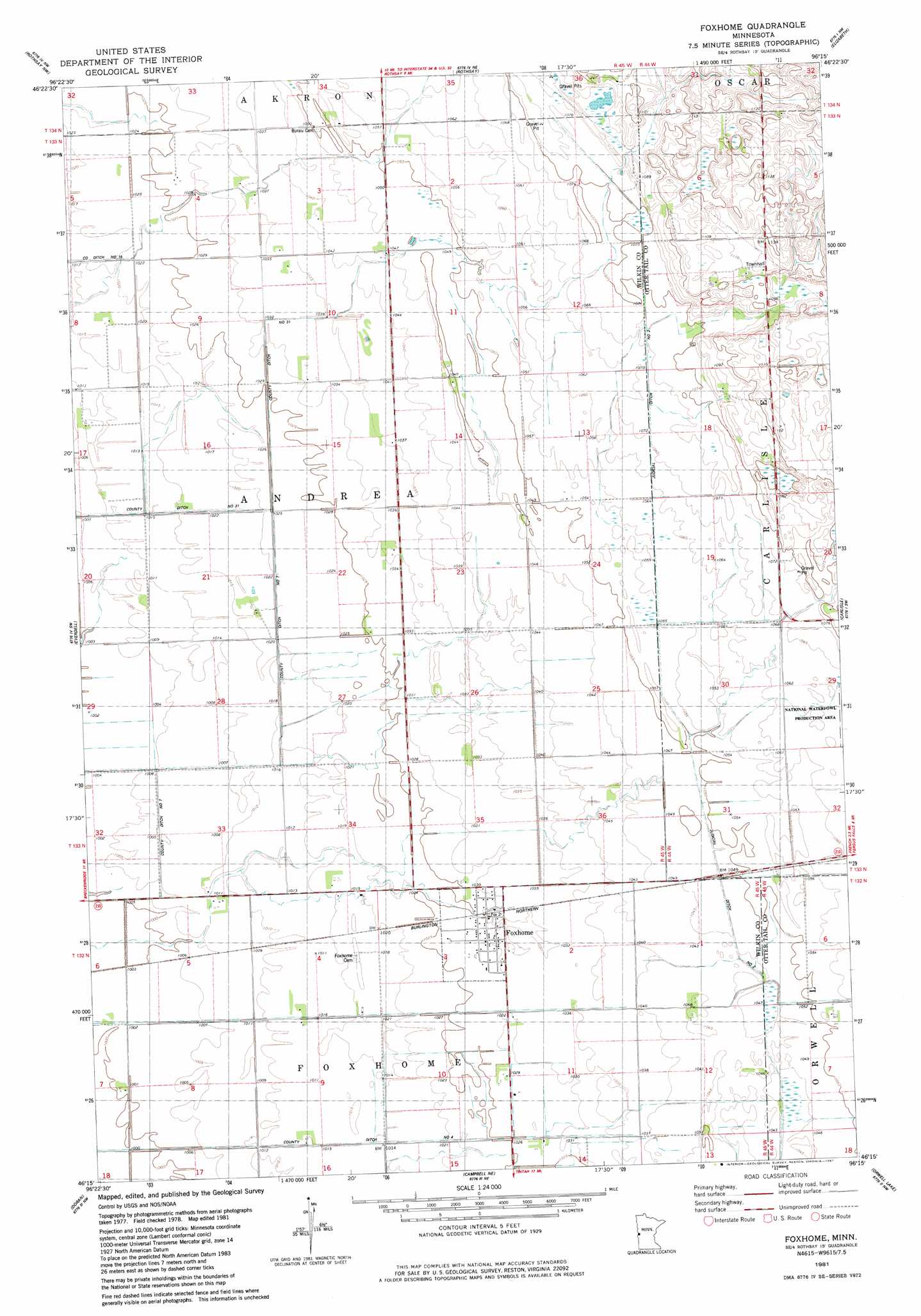
USGS Topo Quad 46096c3 - 1:24,000 scale
| Topo Map Name: | Foxhome |
| USGS Topo Quad ID: | 46096c3 |
| Print Size: | ca. 21 1/4" wide x 27" high |
| Southeast Coordinates: | 46.25° N latitude / 96.25° W longitude |
| Map Center Coordinates: | 46.3125° N latitude / 96.3125° W longitude |
| U.S. State: | MN |
| Filename: | o46096c3.jpg |
| Download Map JPG Image: | Foxhome topo map 1:24,000 scale |
| Map Type: | Topographic |
| Topo Series: | 7.5´ |
| Map Scale: | 1:24,000 |
| Source of Map Images: | United States Geological Survey (USGS) |
| Alternate Map Versions: |
Foxhome MN 1981, updated 1981 Download PDF Buy paper map Foxhome MN 2010 Download PDF Buy paper map Foxhome MN 2013 Download PDF Buy paper map Foxhome MN 2016 Download PDF Buy paper map |
1:24,000 Topo Quads surrounding Foxhome
Wolverton Se |
Barnesville Sw |
Lawndale |
Lake Olaf |
Pelican Rapids |
Wahpeton Ne |
Rothsay Nw |
Rothsay |
Elizabeth |
Erhard |
Wahpeton |
Everdell |
Foxhome |
Carlisle |
Fergus Falls |
South Of Wahpeton |
Doran |
Campbell Ne |
Orwell Lake |
Dayton Hollow Dam |
Fairmount |
Campbell |
Tintah |
Stony Lake |
Wendell |
> Back to 46096a1 at 1:100,000 scale
> Back to 46096a1 at 1:250,000 scale
> Back to U.S. Topo Maps home
Foxhome topo map: Gazetteer
Foxhome: Airports
Knapp Airport elevation 311m 1020′Foxhome: Canals
County Ditch Number Four elevation 308m 1010′County Ditch Number Seven elevation 310m 1017′
Judicial Ditch Number Two elevation 322m 1056′
Foxhome: Populated Places
Foxhome elevation 314m 1030′Foxhome: Post Offices
Burau Post Office (historical) elevation 320m 1049′Foxhome Post Office elevation 314m 1030′
Foxhome digital topo map on disk
Buy this Foxhome topo map showing relief, roads, GPS coordinates and other geographical features, as a high-resolution digital map file on DVD:
Eastern North Dakota & Eastern South Dakota
Buy digital topo maps: Eastern North Dakota & Eastern South Dakota