Dwight Topo Map North Dakota
To zoom in, hover over the map of Dwight
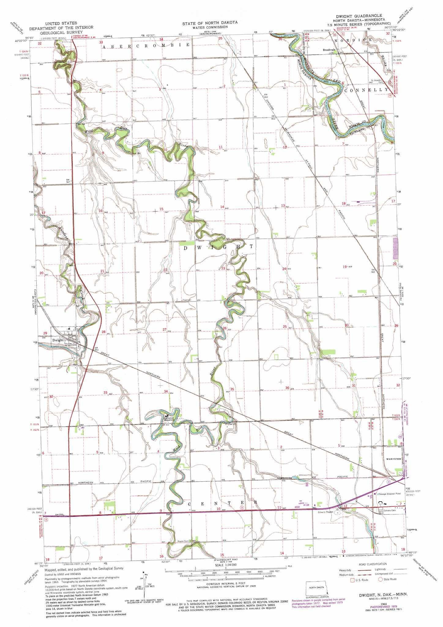
USGS Topo Quad 46096c6 - 1:24,000 scale
| Topo Map Name: | Dwight |
| USGS Topo Quad ID: | 46096c6 |
| Print Size: | ca. 21 1/4" wide x 27" high |
| Southeast Coordinates: | 46.25° N latitude / 96.625° W longitude |
| Map Center Coordinates: | 46.3125° N latitude / 96.6875° W longitude |
| U.S. States: | ND, MN |
| Filename: | O46096C6.jpg |
| Download Map JPG Image: | Dwight topo map 1:24,000 scale |
| Map Type: | Topographic |
| Topo Series: | 7.5´ |
| Map Scale: | 1:24,000 |
| Source of Map Images: | United States Geological Survey (USGS) |
| Alternate Map Versions: |
Dwight ND 1964, updated 1966 Download PDF Buy paper map Dwight ND 1964, updated 1976 Download PDF Buy paper map Dwight ND 1964, updated 1979 Download PDF Buy paper map Dwight ND 2011 Download PDF Buy paper map Dwight ND 2014 Download PDF Buy paper map |
1:24,000 Topo Quads surrounding Dwight
Walcott |
Christine |
Wolverton |
Wolverton Se |
Barnesville Sw |
Mooreton Nw |
Galchutt |
Abercrombie |
Wahpeton Ne |
Rothsay Nw |
Mooreton West |
Mooreton East |
Dwight |
Wahpeton |
Everdell |
Mantador |
Great Bend |
Fairmount Nw |
South Of Wahpeton |
Doran |
Hankinson |
Hankinson Se |
Sonora |
Fairmount |
Campbell |
> Back to 46096a1 at 1:100,000 scale
> Back to 46096a1 at 1:250,000 scale
> Back to U.S. Topo Maps home
Dwight topo map: Gazetteer
Dwight: Dams
Hanson Dam elevation 291m 954′Dwight: Populated Places
Brushvale elevation 290m 951′Dwight elevation 290m 951′
Dwight: Post Offices
Brushvale Post Office (historical) elevation 290m 951′Dwight digital topo map on disk
Buy this Dwight topo map showing relief, roads, GPS coordinates and other geographical features, as a high-resolution digital map file on DVD:
Eastern North Dakota & Eastern South Dakota
Buy digital topo maps: Eastern North Dakota & Eastern South Dakota