Rothsay Nw Topo Map Minnesota
To zoom in, hover over the map of Rothsay Nw
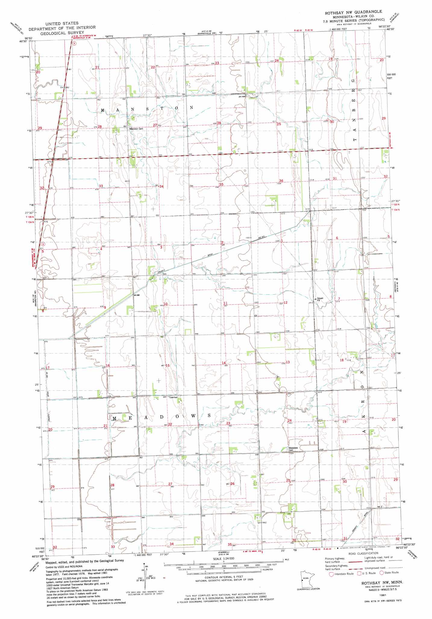
USGS Topo Quad 46096d4 - 1:24,000 scale
| Topo Map Name: | Rothsay Nw |
| USGS Topo Quad ID: | 46096d4 |
| Print Size: | ca. 21 1/4" wide x 27" high |
| Southeast Coordinates: | 46.375° N latitude / 96.375° W longitude |
| Map Center Coordinates: | 46.4375° N latitude / 96.4375° W longitude |
| U.S. State: | MN |
| Filename: | o46096d4.jpg |
| Download Map JPG Image: | Rothsay Nw topo map 1:24,000 scale |
| Map Type: | Topographic |
| Topo Series: | 7.5´ |
| Map Scale: | 1:24,000 |
| Source of Map Images: | United States Geological Survey (USGS) |
| Alternate Map Versions: |
Rothsay NW MN 1981, updated 1981 Download PDF Buy paper map Rothsay NW MN 2010 Download PDF Buy paper map Rothsay NW MN 2013 Download PDF Buy paper map Rothsay NW MN 2016 Download PDF Buy paper map |
1:24,000 Topo Quads surrounding Rothsay Nw
Comstock |
Baker |
Barnesville |
Big Slough |
Rollag |
Wolverton |
Wolverton Se |
Barnesville Sw |
Lawndale |
Lake Olaf |
Abercrombie |
Wahpeton Ne |
Rothsay Nw |
Rothsay |
Elizabeth |
Dwight |
Wahpeton |
Everdell |
Foxhome |
Carlisle |
Fairmount Nw |
South Of Wahpeton |
Doran |
Campbell Ne |
Orwell Lake |
> Back to 46096a1 at 1:100,000 scale
> Back to 46096a1 at 1:250,000 scale
> Back to U.S. Topo Maps home
No gazetteer data is available for the Rothsay Nw topo map sheet.
Rothsay Nw digital topo map on disk
Buy this Rothsay Nw topo map showing relief, roads, GPS coordinates and other geographical features, as a high-resolution digital map file on DVD:
Eastern North Dakota & Eastern South Dakota
Buy digital topo maps: Eastern North Dakota & Eastern South Dakota