Lawndale Topo Map Minnesota
To zoom in, hover over the map of Lawndale
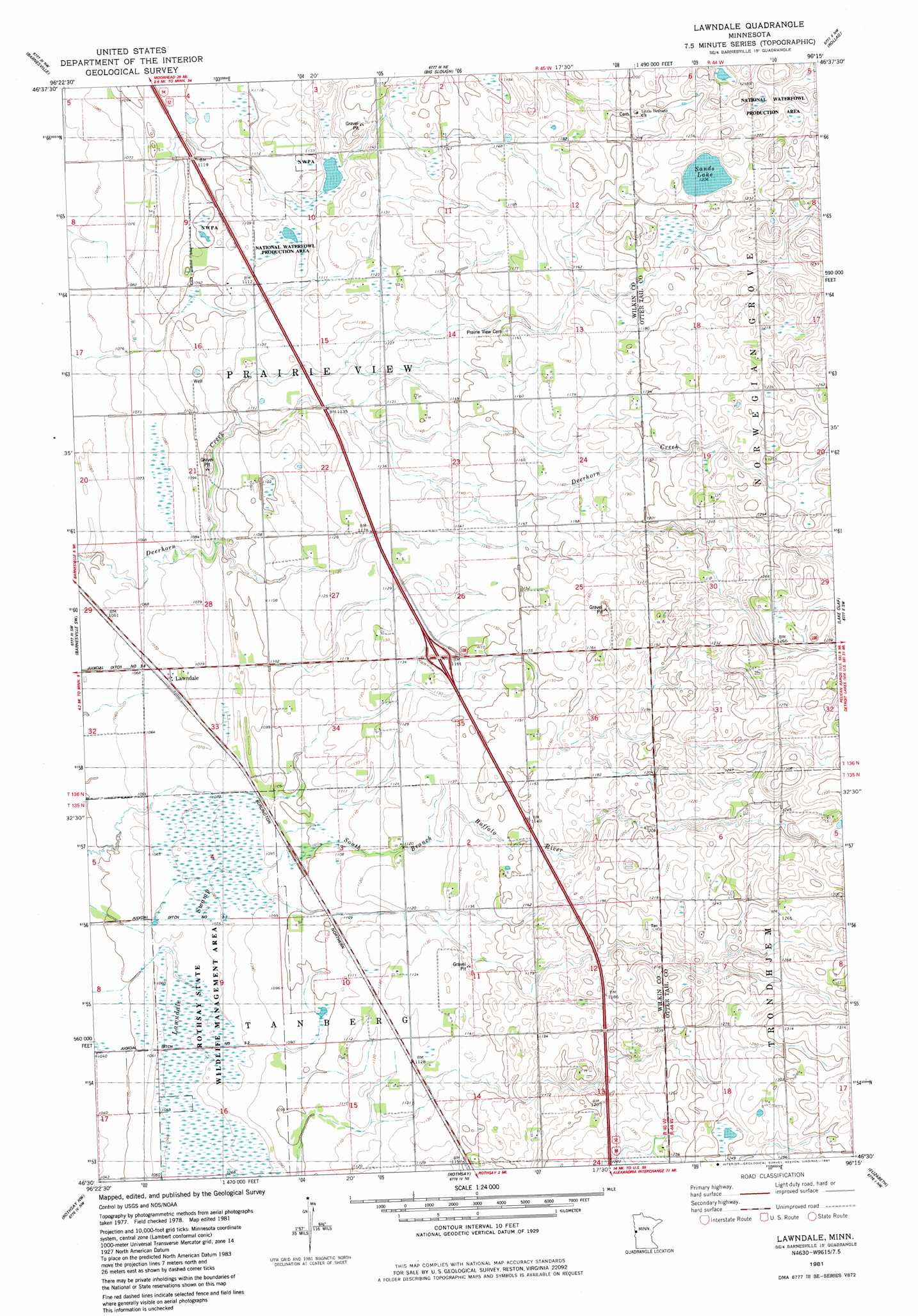
USGS Topo Quad 46096e3 - 1:24,000 scale
| Topo Map Name: | Lawndale |
| USGS Topo Quad ID: | 46096e3 |
| Print Size: | ca. 21 1/4" wide x 27" high |
| Southeast Coordinates: | 46.5° N latitude / 96.25° W longitude |
| Map Center Coordinates: | 46.5625° N latitude / 96.3125° W longitude |
| U.S. State: | MN |
| Filename: | o46096e3.jpg |
| Download Map JPG Image: | Lawndale topo map 1:24,000 scale |
| Map Type: | Topographic |
| Topo Series: | 7.5´ |
| Map Scale: | 1:24,000 |
| Source of Map Images: | United States Geological Survey (USGS) |
| Alternate Map Versions: |
Lawndale MN 1981, updated 1981 Download PDF Buy paper map Lawndale MN 2010 Download PDF Buy paper map Lawndale MN 2013 Download PDF Buy paper map Lawndale MN 2016 Download PDF Buy paper map |
1:24,000 Topo Quads surrounding Lawndale
Glyndon South |
Downer |
Hawley Se |
Lake Park Sw |
Big Cormorant Lake |
Baker |
Barnesville |
Big Slough |
Rollag |
Cormorant |
Wolverton Se |
Barnesville Sw |
Lawndale |
Lake Olaf |
Pelican Rapids |
Wahpeton Ne |
Rothsay Nw |
Rothsay |
Elizabeth |
Erhard |
Wahpeton |
Everdell |
Foxhome |
Carlisle |
Fergus Falls |
> Back to 46096e1 at 1:100,000 scale
> Back to 46096a1 at 1:250,000 scale
> Back to U.S. Topo Maps home
Lawndale topo map: Gazetteer
Lawndale: Crossings
Interchange 32 elevation 349m 1145′Lawndale: Lakes
Sands Lake elevation 368m 1207′Lawndale: Parks
Rothsay State Wildlife Management Area elevation 326m 1069′Lawndale: Populated Places
Lawndale elevation 326m 1069′Lawndale: Post Offices
Lawndale Post Office (historical) elevation 326m 1069′Lawndale: Swamps
Lawndale Swamp elevation 333m 1092′Lawndale digital topo map on disk
Buy this Lawndale topo map showing relief, roads, GPS coordinates and other geographical features, as a high-resolution digital map file on DVD:
Eastern North Dakota & Eastern South Dakota
Buy digital topo maps: Eastern North Dakota & Eastern South Dakota