Glyndon South Topo Map Minnesota
To zoom in, hover over the map of Glyndon South
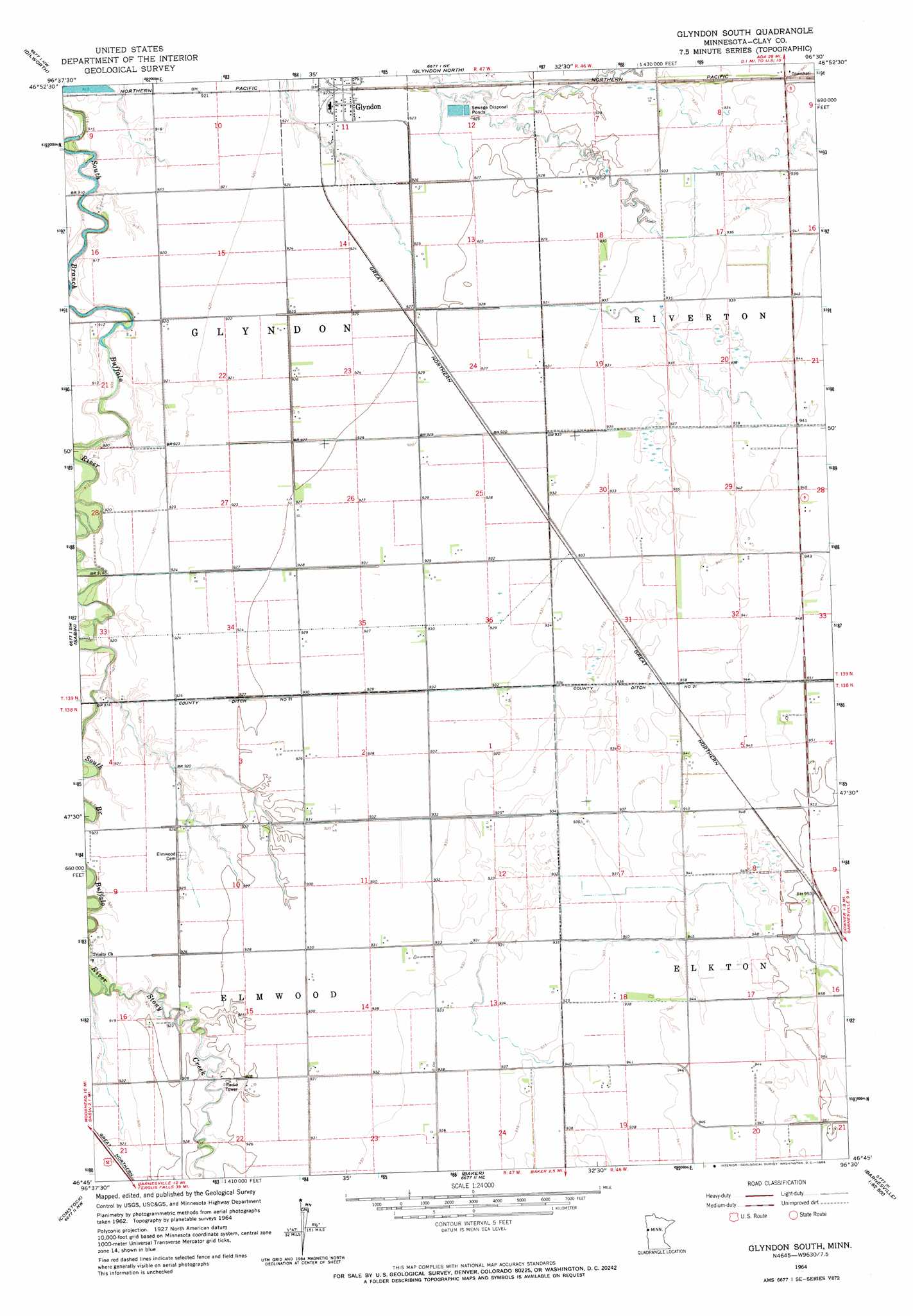
USGS Topo Quad 46096g5 - 1:24,000 scale
| Topo Map Name: | Glyndon South |
| USGS Topo Quad ID: | 46096g5 |
| Print Size: | ca. 21 1/4" wide x 27" high |
| Southeast Coordinates: | 46.75° N latitude / 96.5° W longitude |
| Map Center Coordinates: | 46.8125° N latitude / 96.5625° W longitude |
| U.S. State: | MN |
| Filename: | o46096g5.jpg |
| Download Map JPG Image: | Glyndon South topo map 1:24,000 scale |
| Map Type: | Topographic |
| Topo Series: | 7.5´ |
| Map Scale: | 1:24,000 |
| Source of Map Images: | United States Geological Survey (USGS) |
| Alternate Map Versions: |
Glyndon South MN 1964, updated 1966 Download PDF Buy paper map Glyndon South MN 2010 Download PDF Buy paper map Glyndon South MN 2013 Download PDF Buy paper map Glyndon South MN 2016 Download PDF Buy paper map |
1:24,000 Topo Quads surrounding Glyndon South
Georgetown |
Felton Sw |
Felton |
Ulen Sw |
Ulen |
Fargo North |
Dilworth |
Glyndon North |
Hawley Nw |
Hawley |
Fargo South |
Sabin |
Glyndon South |
Downer |
Hawley Se |
Hickson |
Comstock |
Baker |
Barnesville |
Big Slough |
Christine |
Wolverton |
Wolverton Se |
Barnesville Sw |
Lawndale |
> Back to 46096e1 at 1:100,000 scale
> Back to 46096a1 at 1:250,000 scale
> Back to U.S. Topo Maps home
Glyndon South topo map: Gazetteer
Glyndon South: Canals
County Ditch Number Twelve elevation 283m 928′County Ditch Number Twentyone elevation 284m 931′
Glyndon City Hall elevation 281m 921′
Glyndon South: Crossings
Interchange 15 elevation 288m 944′Glyndon South: Streams
Stony Creek elevation 277m 908′Glyndon South digital topo map on disk
Buy this Glyndon South topo map showing relief, roads, GPS coordinates and other geographical features, as a high-resolution digital map file on DVD:
Eastern North Dakota & Eastern South Dakota
Buy digital topo maps: Eastern North Dakota & Eastern South Dakota