Hawley Nw Topo Map Minnesota
To zoom in, hover over the map of Hawley Nw
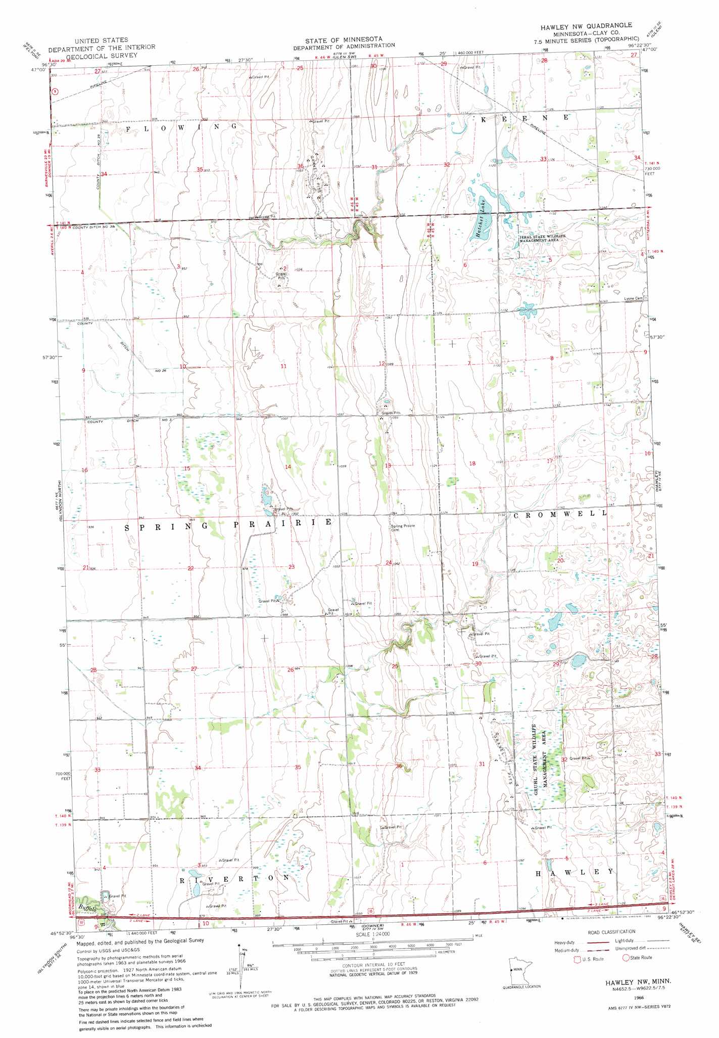
USGS Topo Quad 46096h4 - 1:24,000 scale
| Topo Map Name: | Hawley Nw |
| USGS Topo Quad ID: | 46096h4 |
| Print Size: | ca. 21 1/4" wide x 27" high |
| Southeast Coordinates: | 46.875° N latitude / 96.375° W longitude |
| Map Center Coordinates: | 46.9375° N latitude / 96.4375° W longitude |
| U.S. State: | MN |
| Filename: | o46096h4.jpg |
| Download Map JPG Image: | Hawley Nw topo map 1:24,000 scale |
| Map Type: | Topographic |
| Topo Series: | 7.5´ |
| Map Scale: | 1:24,000 |
| Source of Map Images: | United States Geological Survey (USGS) |
| Alternate Map Versions: |
Hawley NW MN 1966, updated 1967 Download PDF Buy paper map Hawley NW MN 1966, updated 1982 Download PDF Buy paper map Hawley NW MN 2010 Download PDF Buy paper map Hawley NW MN 2013 Download PDF Buy paper map Hawley NW MN 2016 Download PDF Buy paper map |
1:24,000 Topo Quads surrounding Hawley Nw
Felton Nw |
Borup |
Ulen Nw |
Syre |
Flom |
Felton Sw |
Felton |
Ulen Sw |
Ulen |
Tilde Lake |
Dilworth |
Glyndon North |
Hawley Nw |
Hawley |
Dale |
Sabin |
Glyndon South |
Downer |
Hawley Se |
Lake Park Sw |
Comstock |
Baker |
Barnesville |
Big Slough |
Rollag |
> Back to 46096e1 at 1:100,000 scale
> Back to 46096a1 at 1:250,000 scale
> Back to U.S. Topo Maps home
Hawley Nw topo map: Gazetteer
Hawley Nw: Canals
County Ditch Number Thirty Eight elevation 284m 931′Hawley Nw: Lakes
Hatchet Lake elevation 339m 1112′Hawley Nw: Parks
Gruhl State Wildlife Management Area elevation 339m 1112′Jeral State Wildlife Management Area elevation 342m 1122′
Hawley Nw digital topo map on disk
Buy this Hawley Nw topo map showing relief, roads, GPS coordinates and other geographical features, as a high-resolution digital map file on DVD:
Eastern North Dakota & Eastern South Dakota
Buy digital topo maps: Eastern North Dakota & Eastern South Dakota