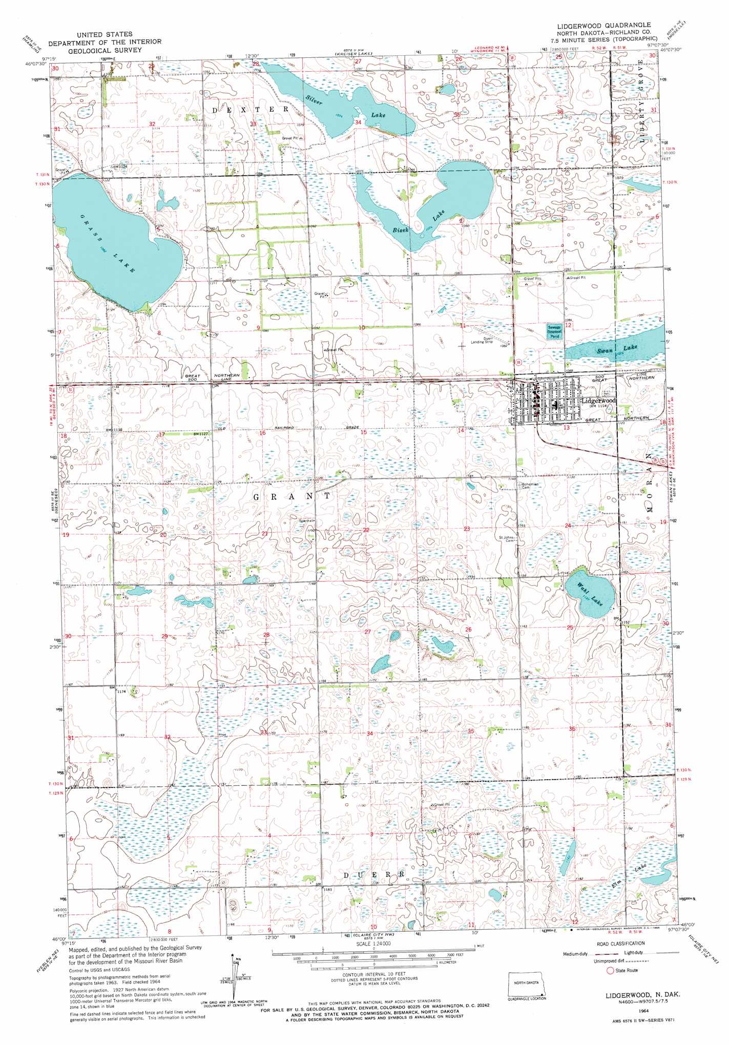
Lidgerwood Topo Map North Dakota
To zoom in, hover over the map of Lidgerwood
USGS Topo Quad 46097a2 - 1:24,000 scale
| Topo Map Name: | Lidgerwood |
| USGS Topo Quad ID: | 46097a2 |
| Print Size: | ca. 21 1/4" wide x 27" high |
| Southeast Coordinates: | 46° N latitude / 97.125° W longitude |
| Map Center Coordinates: | 46.0625° N latitude / 97.1875° W longitude |
| U.S. State: | ND |
| Filename: | O46097A2.jpg |
| Download Map JPG Image: | Lidgerwood topo map 1:24,000 scale |
| Map Type: | Topographic |
| Topo Series: | 7.5´ |
| Map Scale: | 1:24,000 |
| Source of Map Images: | United States Geological Survey (USGS) |
| Alternate Map Versions: |
Lidgerwood ND 1964, updated 1965 Download PDF Buy paper map Lidgerwood ND 2011 Download PDF Buy paper map Lidgerwood ND 2014 Download PDF Buy paper map |
1:24,000 Topo Quads surrounding Lidgerwood
Milnor |
De Lamere |
Wyndmere |
Wyndmere Se |
Mooreton West |
Cayuga Nw |
Hamlin |
Kreiser Lake |
Moselle |
Mantador |
Cayuga |
Geneseo |
Lidgerwood |
Swan Lake |
Hankinson |
Marlow |
Veblen Ne |
Claire City Nw |
Claire City Ne |
New Effington Nw |
Hillhead |
Veblen |
Claire City Sw |
Claire City |
New Effington |
> Back to 46097a1 at 1:100,000 scale
> Back to 46096a1 at 1:250,000 scale
> Back to U.S. Topo Maps home
Lidgerwood topo map: Gazetteer
Lidgerwood: Lakes
Bisek Lake elevation 328m 1076′Elm Lake elevation 355m 1164′
Elm Lake (historical) elevation 339m 1112′
Grass Lake elevation 330m 1082′
Silver Lake elevation 328m 1076′
Wahl Lake elevation 344m 1128′
Lidgerwood: Populated Places
Lidgerwood elevation 339m 1112′Lidgerwood digital topo map on disk
Buy this Lidgerwood topo map showing relief, roads, GPS coordinates and other geographical features, as a high-resolution digital map file on DVD:
Eastern North Dakota & Eastern South Dakota
Buy digital topo maps: Eastern North Dakota & Eastern South Dakota