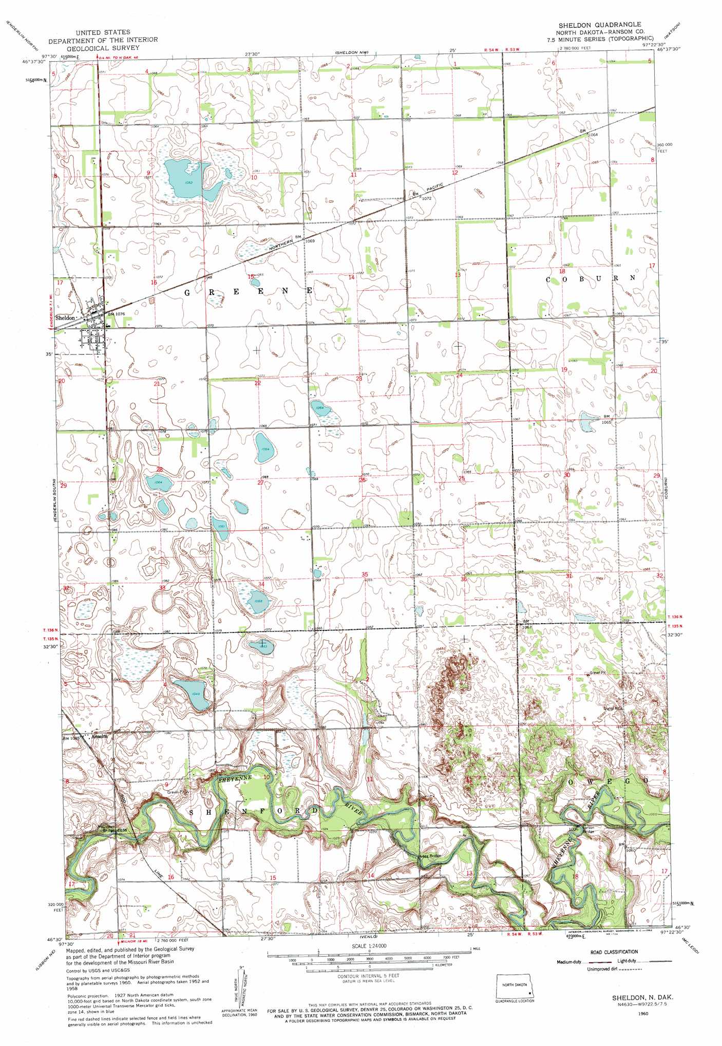
Sheldon Topo Map North Dakota
To zoom in, hover over the map of Sheldon
USGS Topo Quad 46097e4 - 1:24,000 scale
| Topo Map Name: | Sheldon |
| USGS Topo Quad ID: | 46097e4 |
| Print Size: | ca. 21 1/4" wide x 27" high |
| Southeast Coordinates: | 46.5° N latitude / 97.375° W longitude |
| Map Center Coordinates: | 46.5625° N latitude / 97.4375° W longitude |
| U.S. State: | ND |
| Filename: | O46097E4.jpg |
| Download Map JPG Image: | Sheldon topo map 1:24,000 scale |
| Map Type: | Topographic |
| Topo Series: | 7.5´ |
| Map Scale: | 1:24,000 |
| Source of Map Images: | United States Geological Survey (USGS) |
| Alternate Map Versions: |
Sheldon ND 1960, updated 1962 Download PDF Buy paper map Sheldon ND 1998, updated 2000 Download PDF Buy paper map Sheldon ND 2011 Download PDF Buy paper map Sheldon ND 2014 Download PDF Buy paper map |
| FStopo: | US Forest Service topo Sheldon is available: Download FStopo PDF Download FStopo TIF |
1:24,000 Topo Quads surrounding Sheldon
Tower City Sw |
Alice |
Embden |
Chaffee |
Durbin |
Lucca |
Enderlin North |
Sheldon Nw |
Sheldon Ne |
Leonard |
Buttzville |
Enderlin South |
Sheldon |
Coburn |
Power |
Lisbon |
Lisbon Ne |
Venlo |
Mcleod |
Wyndmere Nw |
Lisbon Sw |
Lisbon Se |
Milnor |
De Lamere |
Wyndmere |
> Back to 46097e1 at 1:100,000 scale
> Back to 46096a1 at 1:250,000 scale
> Back to U.S. Topo Maps home
Sheldon topo map: Gazetteer
Sheldon: Bridges
Larson Bridge elevation 311m 1020′Legg Bridge elevation 307m 1007′
McCusker Bridge elevation 313m 1026′
Sheldon: Populated Places
Anselm elevation 336m 1102′Sheldon elevation 332m 1089′
Sheldon digital topo map on disk
Buy this Sheldon topo map showing relief, roads, GPS coordinates and other geographical features, as a high-resolution digital map file on DVD:
Eastern North Dakota & Eastern South Dakota
Buy digital topo maps: Eastern North Dakota & Eastern South Dakota