Valley City East Topo Map North Dakota
To zoom in, hover over the map of Valley City East
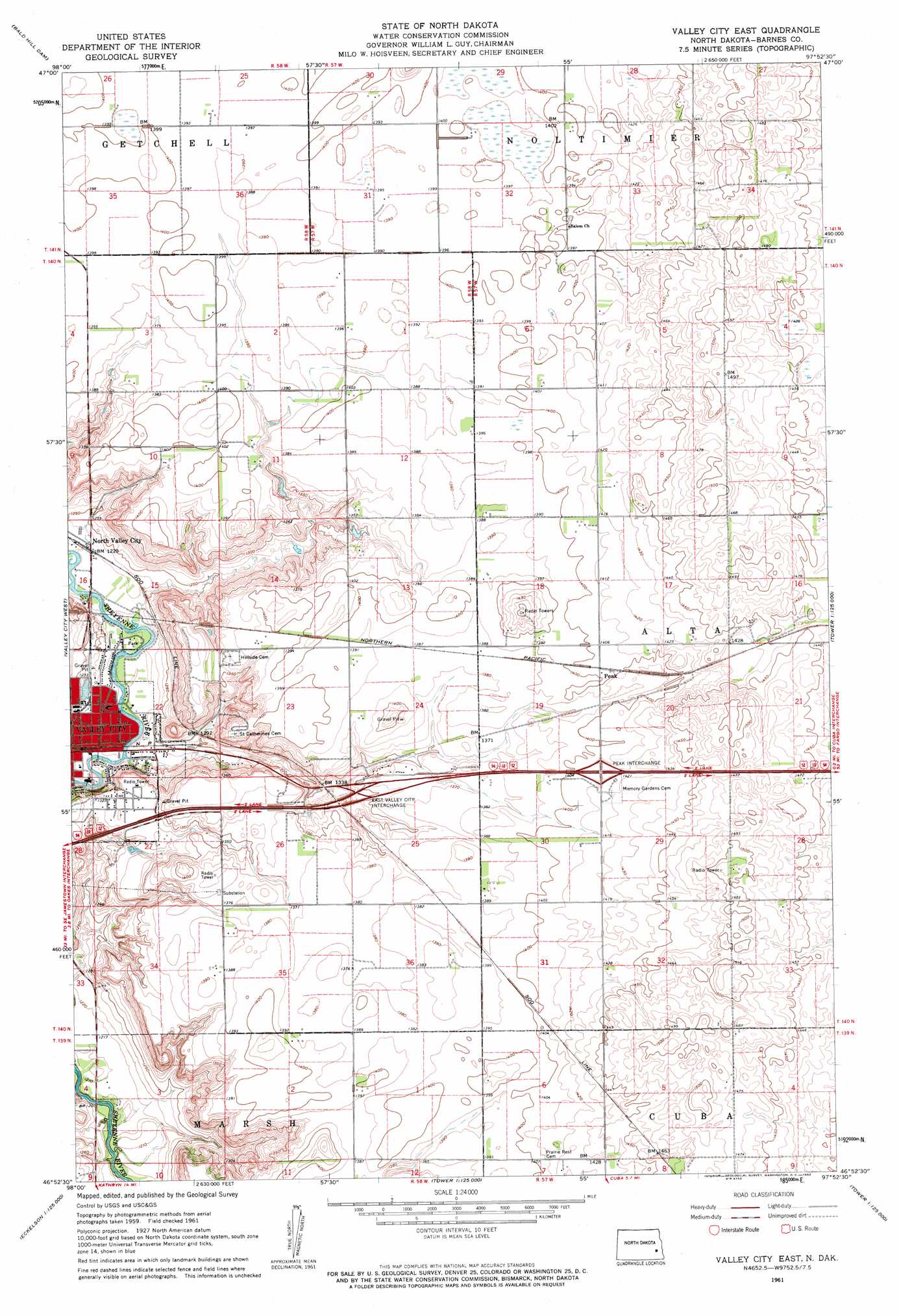
USGS Topo Quad 46097h8 - 1:24,000 scale
| Topo Map Name: | Valley City East |
| USGS Topo Quad ID: | 46097h8 |
| Print Size: | ca. 21 1/4" wide x 27" high |
| Southeast Coordinates: | 46.875° N latitude / 97.875° W longitude |
| Map Center Coordinates: | 46.9375° N latitude / 97.9375° W longitude |
| U.S. State: | ND |
| Filename: | O46097H8.jpg |
| Download Map JPG Image: | Valley City East topo map 1:24,000 scale |
| Map Type: | Topographic |
| Topo Series: | 7.5´ |
| Map Scale: | 1:24,000 |
| Source of Map Images: | United States Geological Survey (USGS) |
| Alternate Map Versions: |
Valley City East ND 1961, updated 1962 Download PDF Buy paper map Valley City East ND 2011 Download PDF Buy paper map Valley City East ND 2014 Download PDF Buy paper map |
1:24,000 Topo Quads surrounding Valley City East
Dazey |
Dazey Ne |
Sibley |
Pillsbury |
Colgate |
Rogers |
Baldhill Dam |
Pillsbury Sw |
Pillsbury Se |
Page Sw |
Sanborn |
Valley City West |
Valley City East |
Oriska |
Tower City |
Moon Lake |
Sanborn Se |
Fingal Sw |
Fingal |
Tower City Sw |
Litchville |
Hastings |
Kathryn |
Nome |
Lucca |
> Back to 46097e1 at 1:100,000 scale
> Back to 46096a1 at 1:250,000 scale
> Back to U.S. Topo Maps home
Valley City East topo map: Gazetteer
Valley City East: Crossings
East Valley City Interchange elevation 412m 1351′Peak Interchange elevation 433m 1420′
Valley City East: Populated Places
North Valley City elevation 378m 1240′Peak elevation 427m 1400′
Valley City East digital topo map on disk
Buy this Valley City East topo map showing relief, roads, GPS coordinates and other geographical features, as a high-resolution digital map file on DVD:
Eastern North Dakota & Eastern South Dakota
Buy digital topo maps: Eastern North Dakota & Eastern South Dakota