Fullerton Se Topo Map North Dakota
To zoom in, hover over the map of Fullerton Se
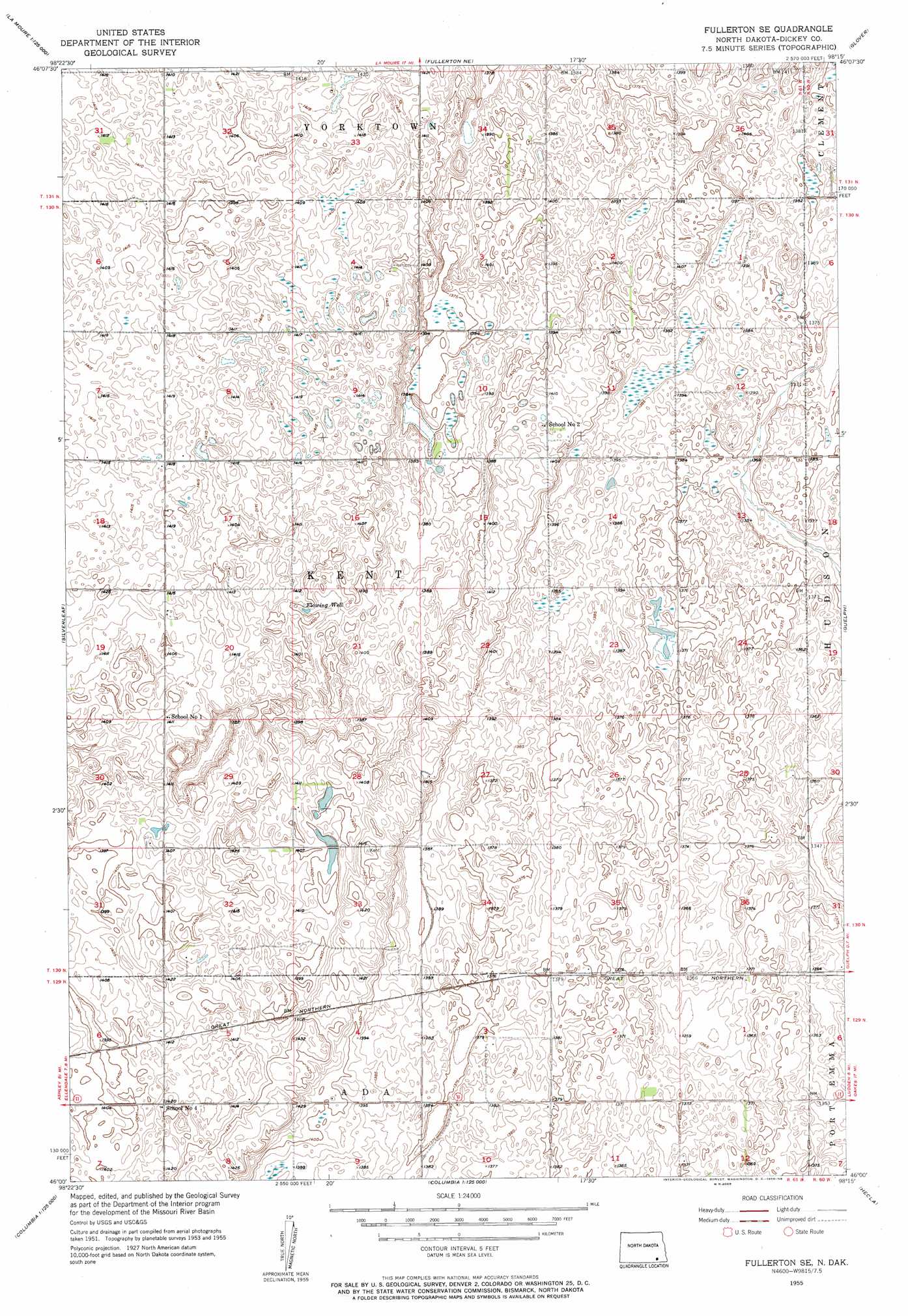
USGS Topo Quad 46098a3 - 1:24,000 scale
| Topo Map Name: | Fullerton Se |
| USGS Topo Quad ID: | 46098a3 |
| Print Size: | ca. 21 1/4" wide x 27" high |
| Southeast Coordinates: | 46° N latitude / 98.25° W longitude |
| Map Center Coordinates: | 46.0625° N latitude / 98.3125° W longitude |
| U.S. State: | ND |
| Filename: | O46098A3.jpg |
| Download Map JPG Image: | Fullerton Se topo map 1:24,000 scale |
| Map Type: | Topographic |
| Topo Series: | 7.5´ |
| Map Scale: | 1:24,000 |
| Source of Map Images: | United States Geological Survey (USGS) |
| Alternate Map Versions: |
Fullerton SE ND 1955, updated 1956 Download PDF Buy paper map Fullerton SE ND 2011 Download PDF Buy paper map Fullerton SE ND 2014 Download PDF Buy paper map |
1:24,000 Topo Quads surrounding Fullerton Se
Edgeley Se |
La Moure Sw |
La Moure |
Independence |
Verona |
Monango |
Fullerton |
Fullerton Ne |
Glover |
Oakes |
Ellendale North |
Silverleaf |
Fullerton Se |
Guelph |
Oakes Se |
Ellendale South |
Savo Nw |
Savo Ne |
Hecla |
Hecla Ne |
Frederick |
Savo Sw |
Savo Se |
Houghton |
Hecla Se |
> Back to 46098a1 at 1:100,000 scale
> Back to 46098a1 at 1:250,000 scale
> Back to U.S. Topo Maps home
Fullerton Se topo map: Gazetteer
Fullerton Se: Populated Places
Hudson (historical) elevation 419m 1374′Fullerton Se digital topo map on disk
Buy this Fullerton Se topo map showing relief, roads, GPS coordinates and other geographical features, as a high-resolution digital map file on DVD:
Eastern North Dakota & Eastern South Dakota
Buy digital topo maps: Eastern North Dakota & Eastern South Dakota