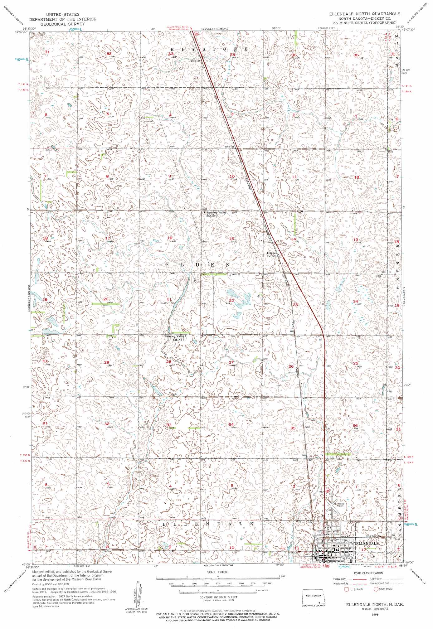
Ellendale North Topo Map North Dakota
To zoom in, hover over the map of Ellendale North
USGS Topo Quad 46098a5 - 1:24,000 scale
| Topo Map Name: | Ellendale North |
| USGS Topo Quad ID: | 46098a5 |
| Print Size: | ca. 21 1/4" wide x 27" high |
| Southeast Coordinates: | 46° N latitude / 98.5° W longitude |
| Map Center Coordinates: | 46.0625° N latitude / 98.5625° W longitude |
| U.S. State: | ND |
| Filename: | O46098A5.jpg |
| Download Map JPG Image: | Ellendale North topo map 1:24,000 scale |
| Map Type: | Topographic |
| Topo Series: | 7.5´ |
| Map Scale: | 1:24,000 |
| Source of Map Images: | United States Geological Survey (USGS) |
| Alternate Map Versions: |
Ellendale North ND 1956, updated 1957 Download PDF Buy paper map Ellendale North ND 2011 Download PDF Buy paper map Ellendale North ND 2014 Download PDF Buy paper map |
1:24,000 Topo Quads surrounding Ellendale North
Kulm-Edgeley Dam |
Edgeley |
Edgeley Se |
La Moure Sw |
La Moure |
Merricourt |
Monango Nw |
Monango |
Fullerton |
Fullerton Ne |
Merricourt Se |
Monango Sw |
Ellendale North |
Silverleaf |
Fullerton Se |
Forbes |
Frederick Nw |
Ellendale South |
Savo Nw |
Savo Ne |
Forbes Se |
Frederick Sw |
Frederick |
Savo Sw |
Savo Se |
> Back to 46098a1 at 1:100,000 scale
> Back to 46098a1 at 1:250,000 scale
> Back to U.S. Topo Maps home
Ellendale North topo map: Gazetteer
Ellendale North: Airports
Ellendale Municipal Airport elevation 444m 1456′Ellendale North: Populated Places
Duane elevation 451m 1479′Ellendale elevation 443m 1453′
Ellendale North digital topo map on disk
Buy this Ellendale North topo map showing relief, roads, GPS coordinates and other geographical features, as a high-resolution digital map file on DVD:
Eastern North Dakota & Eastern South Dakota
Buy digital topo maps: Eastern North Dakota & Eastern South Dakota