Kulm-Edgeley Dam Topo Map North Dakota
To zoom in, hover over the map of Kulm-Edgeley Dam
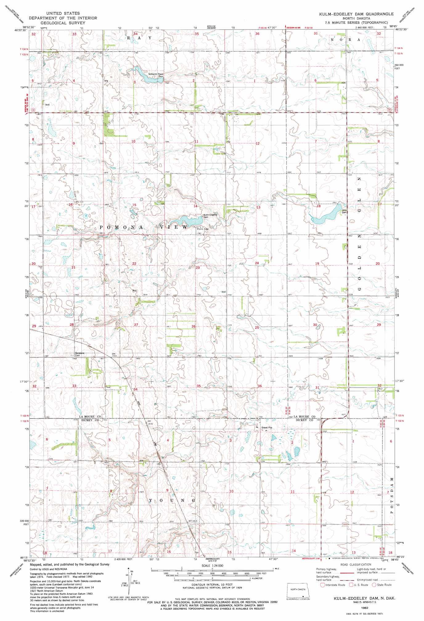
USGS Topo Quad 46098c7 - 1:24,000 scale
| Topo Map Name: | Kulm-Edgeley Dam |
| USGS Topo Quad ID: | 46098c7 |
| Print Size: | ca. 21 1/4" wide x 27" high |
| Southeast Coordinates: | 46.25° N latitude / 98.75° W longitude |
| Map Center Coordinates: | 46.3125° N latitude / 98.8125° W longitude |
| U.S. State: | ND |
| Filename: | O46098C7.jpg |
| Download Map JPG Image: | Kulm-Edgeley Dam topo map 1:24,000 scale |
| Map Type: | Topographic |
| Topo Series: | 7.5´ |
| Map Scale: | 1:24,000 |
| Source of Map Images: | United States Geological Survey (USGS) |
| Alternate Map Versions: |
Kulm-Edgeley Dam ND 1982, updated 1983 Download PDF Buy paper map Kulm-Edgeley Dam ND 2011 Download PDF Buy paper map Kulm-Edgeley Dam ND 2014 Download PDF Buy paper map |
1:24,000 Topo Quads surrounding Kulm-Edgeley Dam
Alfred |
Jud |
Jud Se |
Nortonville |
Adrian |
Fredonia Ne |
Schlecht-Weixel Dam |
Deisem |
Edgeley Junction |
Medberry |
Fredonia |
Kulm |
Kulm-Edgeley Dam |
Edgeley |
Edgeley Se |
Writing Rock South |
Merricourt Nw |
Merricourt |
Monango Nw |
Monango |
Coldwater Lake |
Merricourt Sw |
Merricourt Se |
Monango Sw |
Ellendale North |
> Back to 46098a1 at 1:100,000 scale
> Back to 46098a1 at 1:250,000 scale
> Back to U.S. Topo Maps home
Kulm-Edgeley Dam topo map: Gazetteer
Kulm-Edgeley Dam: Dams
Jolin Dam elevation 504m 1653′Kulm-Edgeley Dam elevation 511m 1676′
Schlecht-Thom Dam elevation 532m 1745′
Kulm-Edgeley Dam digital topo map on disk
Buy this Kulm-Edgeley Dam topo map showing relief, roads, GPS coordinates and other geographical features, as a high-resolution digital map file on DVD:
Eastern North Dakota & Eastern South Dakota
Buy digital topo maps: Eastern North Dakota & Eastern South Dakota