Sanborn Se Topo Map North Dakota
To zoom in, hover over the map of Sanborn Se
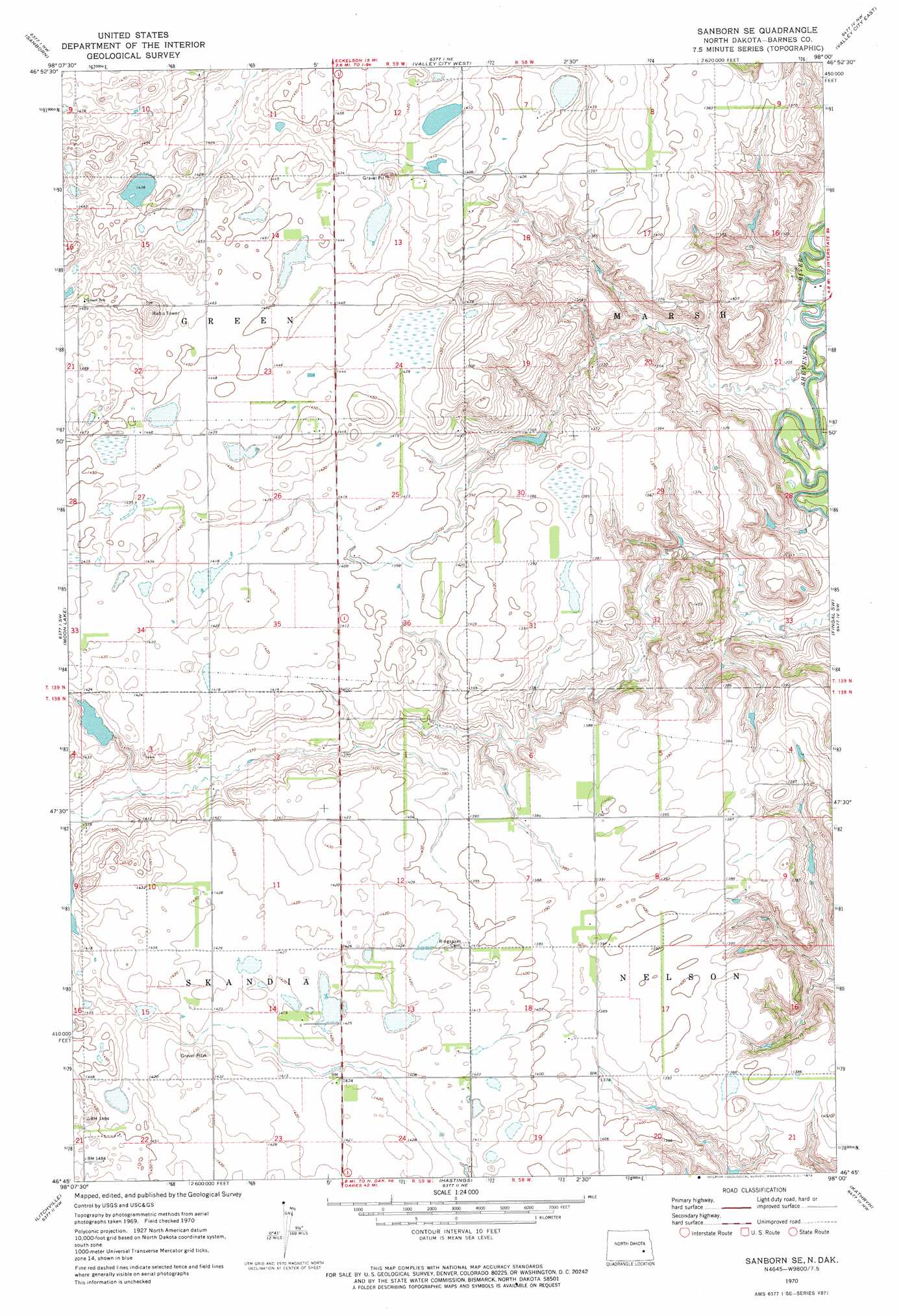
USGS Topo Quad 46098g1 - 1:24,000 scale
| Topo Map Name: | Sanborn Se |
| USGS Topo Quad ID: | 46098g1 |
| Print Size: | ca. 21 1/4" wide x 27" high |
| Southeast Coordinates: | 46.75° N latitude / 98° W longitude |
| Map Center Coordinates: | 46.8125° N latitude / 98.0625° W longitude |
| U.S. State: | ND |
| Filename: | O46098G1.jpg |
| Download Map JPG Image: | Sanborn Se topo map 1:24,000 scale |
| Map Type: | Topographic |
| Topo Series: | 7.5´ |
| Map Scale: | 1:24,000 |
| Source of Map Images: | United States Geological Survey (USGS) |
| Alternate Map Versions: |
Sanborn SE ND 1970, updated 1973 Download PDF Buy paper map Sanborn SE ND 2011 Download PDF Buy paper map Sanborn SE ND 2014 Download PDF Buy paper map |
1:24,000 Topo Quads surrounding Sanborn Se
Leal |
Rogers |
Baldhill Dam |
Pillsbury Sw |
Pillsbury Se |
Eckelson |
Sanborn |
Valley City West |
Valley City East |
Oriska |
Eckelson Se |
Moon Lake |
Sanborn Se |
Fingal Sw |
Fingal |
Marion Ne |
Litchville |
Hastings |
Kathryn |
Nome |
Marion |
Litchville Sw |
Litchville Se |
Fort Ransom |
Nome Se |
> Back to 46098e1 at 1:100,000 scale
> Back to 46098a1 at 1:250,000 scale
> Back to U.S. Topo Maps home
Sanborn Se topo map: Gazetteer
Sanborn Se: Dams
Berckerley Dam elevation 431m 1414′Hansen Dam elevation 418m 1371′
Sanborn Se digital topo map on disk
Buy this Sanborn Se topo map showing relief, roads, GPS coordinates and other geographical features, as a high-resolution digital map file on DVD:
Eastern North Dakota & Eastern South Dakota
Buy digital topo maps: Eastern North Dakota & Eastern South Dakota