Jamestown Topo Map North Dakota
To zoom in, hover over the map of Jamestown
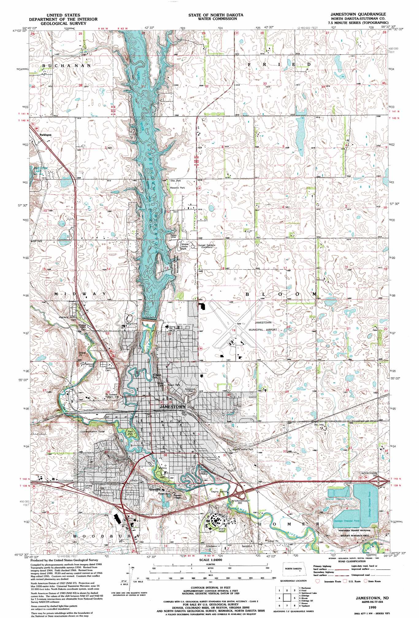
USGS Topo Quad 46098h6 - 1:24,000 scale
| Topo Map Name: | Jamestown |
| USGS Topo Quad ID: | 46098h6 |
| Print Size: | ca. 21 1/4" wide x 27" high |
| Southeast Coordinates: | 46.875° N latitude / 98.625° W longitude |
| Map Center Coordinates: | 46.9375° N latitude / 98.6875° W longitude |
| U.S. State: | ND |
| Filename: | O46098H6.jpg |
| Download Map JPG Image: | Jamestown topo map 1:24,000 scale |
| Map Type: | Topographic |
| Topo Series: | 7.5´ |
| Map Scale: | 1:24,000 |
| Source of Map Images: | United States Geological Survey (USGS) |
| Alternate Map Versions: |
Jamestown ND 1951, updated 1951 Download PDF Buy paper map Jamestown ND 1966, updated 1967 Download PDF Buy paper map Jamestown ND 1966, updated 1978 Download PDF Buy paper map Jamestown ND 1990, updated 1995 Download PDF Buy paper map Jamestown ND 2011 Download PDF Buy paper map Jamestown ND 2014 Download PDF Buy paper map |
1:24,000 Topo Quads surrounding Jamestown
Pingree |
Jim Lake |
Courtenay Nw |
Courtenay |
Wimbledon |
Pingree Sw |
Buchanan |
Fried |
Spiritwood Lake |
Clementsville |
Eldridge Nw |
Eldridge |
Jamestown |
Bloom |
Spiritwood |
Eldridge Sw |
Eldridge Se |
Homer |
Ypsilanti |
Eckelson Sw |
Jud Nw |
Millarton |
Montpelier Nw |
Montpelier |
Marion Nw |
> Back to 46098e1 at 1:100,000 scale
> Back to 46098a1 at 1:250,000 scale
> Back to U.S. Topo Maps home
Jamestown topo map: Gazetteer
Jamestown: Airports
Jamestown Municipal Airport elevation 455m 1492′Jamestown: Dams
Jamestown Dam elevation 429m 1407′Jamestown Ice House Dam elevation 426m 1397′
Jamestown: Parks
Elks Park elevation 458m 1502′Feton Park elevation 444m 1456′
Fort Seward Historic Site elevation 443m 1453′
Klaus Park elevation 424m 1391′
Masonic Park elevation 458m 1502′
McElroy Park elevation 424m 1391′
Nickeus Park elevation 426m 1397′
Stutsman County Recreation Area elevation 453m 1486′
Jamestown: Populated Places
Frontier Village elevation 450m 1476′Jamestown elevation 429m 1407′
Jamestown: Reservoirs
Jamestown Reservoir elevation 437m 1433′Jamestown: Streams
Pipestem Creek elevation 424m 1391′Jamestown digital topo map on disk
Buy this Jamestown topo map showing relief, roads, GPS coordinates and other geographical features, as a high-resolution digital map file on DVD:
Eastern North Dakota & Eastern South Dakota
Buy digital topo maps: Eastern North Dakota & Eastern South Dakota