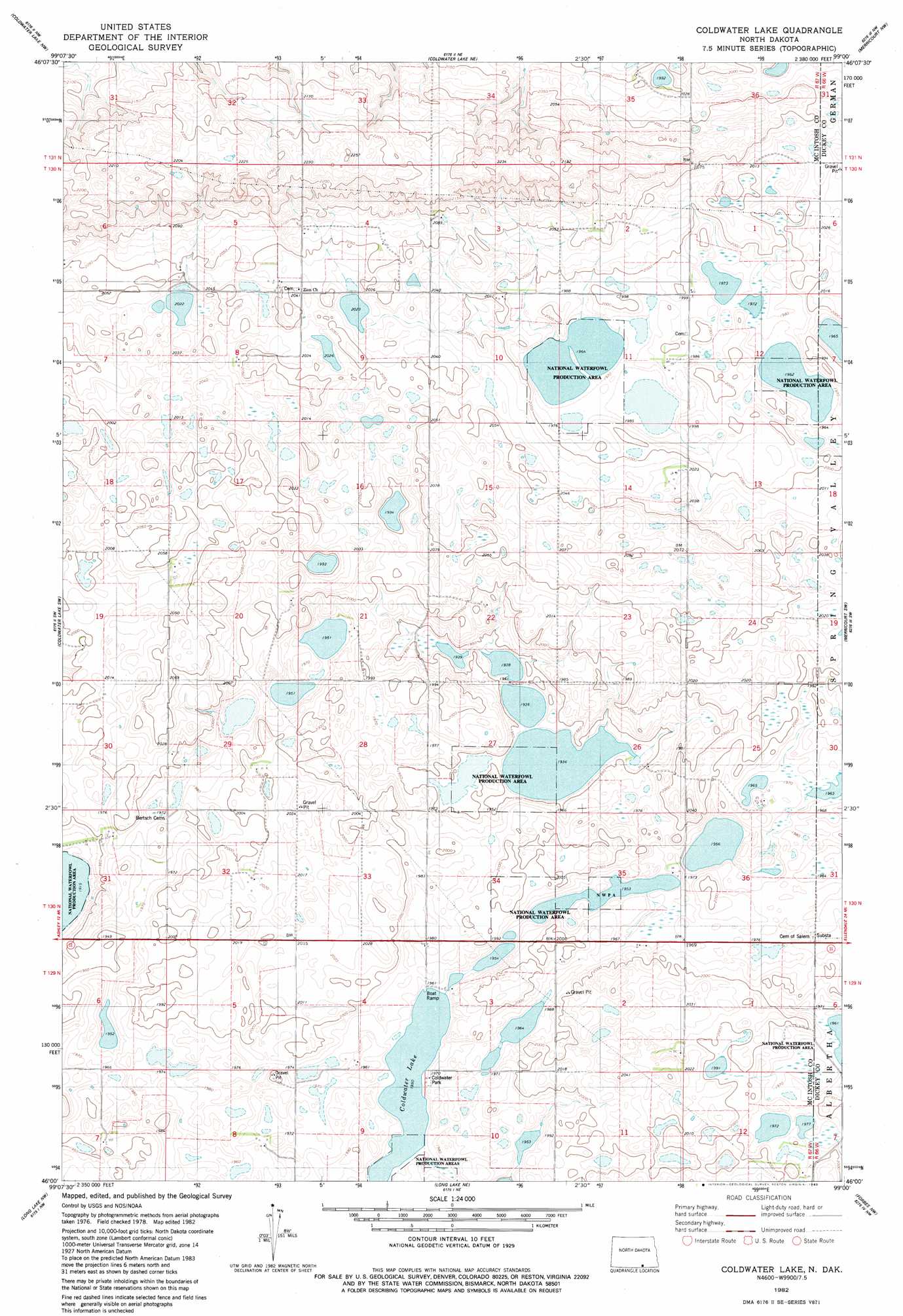
Coldwater Lake Topo Map North Dakota
To zoom in, hover over the map of Coldwater Lake
USGS Topo Quad 46099a1 - 1:24,000 scale
| Topo Map Name: | Coldwater Lake |
| USGS Topo Quad ID: | 46099a1 |
| Print Size: | ca. 21 1/4" wide x 27" high |
| Southeast Coordinates: | 46° N latitude / 99° W longitude |
| Map Center Coordinates: | 46.0625° N latitude / 99.0625° W longitude |
| U.S. State: | ND |
| Filename: | O46099A1.jpg |
| Download Map JPG Image: | Coldwater Lake topo map 1:24,000 scale |
| Map Type: | Topographic |
| Topo Series: | 7.5´ |
| Map Scale: | 1:24,000 |
| Source of Map Images: | United States Geological Survey (USGS) |
| Alternate Map Versions: |
Coldwater Lake ND 1982, updated 1983 Download PDF Buy paper map Coldwater Lake ND 2011 Download PDF Buy paper map Coldwater Lake ND 2014 Download PDF Buy paper map |
1:24,000 Topo Quads surrounding Coldwater Lake
Lehr |
Guyson |
Fredonia |
Kulm |
Kulm-Edgeley Dam |
Ashley Ne |
Ashley 4 Nw |
Writing Rock South |
Merricourt Nw |
Merricourt |
Ashley East |
Ashley 4 Sw |
Coldwater Lake |
Merricourt Sw |
Merricourt Se |
Schumacher Lake Ne |
Long Lake Nw |
Long Lake Ne |
Forbes Nw |
Forbes |
Schumacher Lake |
Long Lake |
Long Lake Se |
Forbes Sw |
Forbes Se |
> Back to 46099a1 at 1:100,000 scale
> Back to 46098a1 at 1:250,000 scale
> Back to U.S. Topo Maps home
Coldwater Lake topo map: Gazetteer
Coldwater Lake: Lakes
Coldwater Lake elevation 595m 1952′Coldwater Lake: Parks
Coldwater Park elevation 604m 1981′Coldwater Lake: Plains
Coteau du Missouri elevation 610m 2001′Coldwater Lake digital topo map on disk
Buy this Coldwater Lake topo map showing relief, roads, GPS coordinates and other geographical features, as a high-resolution digital map file on DVD:
Eastern North Dakota & Eastern South Dakota
Buy digital topo maps: Eastern North Dakota & Eastern South Dakota