Ashley 4 Nw Topo Map North Dakota
To zoom in, hover over the map of Ashley 4 Nw
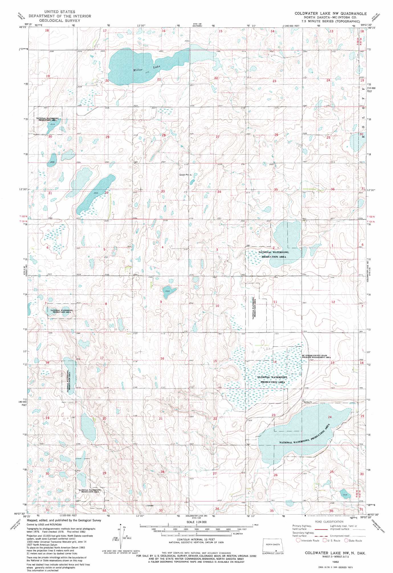
USGS Topo Quad 46099b2 - 1:24,000 scale
| Topo Map Name: | Ashley 4 Nw |
| USGS Topo Quad ID: | 46099b2 |
| Print Size: | ca. 21 1/4" wide x 27" high |
| Southeast Coordinates: | 46.125° N latitude / 99.125° W longitude |
| Map Center Coordinates: | 46.1875° N latitude / 99.1875° W longitude |
| U.S. State: | ND |
| Filename: | O46099B2.jpg |
| Download Map JPG Image: | Ashley 4 Nw topo map 1:24,000 scale |
| Map Type: | Topographic |
| Topo Series: | 7.5´ |
| Map Scale: | 1:24,000 |
| Source of Map Images: | United States Geological Survey (USGS) |
| Alternate Map Versions: |
Coldwater Lake NW ND 1982, updated 1982 Download PDF Buy paper map Coldwater Lake NW ND 2011 Download PDF Buy paper map Coldwater Lake NW ND 2014 Download PDF Buy paper map |
1:24,000 Topo Quads surrounding Ashley 4 Nw
Lehr Nw |
Lehr Ne |
Fredonia Nw |
Fredonia Ne |
Schlecht-Weixel Dam |
Lehr Sw |
Lehr |
Guyson |
Fredonia |
Kulm |
Danzig |
Ashley Ne |
Ashley 4 Nw |
Writing Rock South |
Merricourt Nw |
Ashley West |
Ashley East |
Ashley 4 Sw |
Coldwater Lake |
Merricourt Sw |
Wolff Lake |
Schumacher Lake Ne |
Long Lake Nw |
Long Lake Ne |
Forbes Nw |
> Back to 46099a1 at 1:100,000 scale
> Back to 46098a1 at 1:250,000 scale
> Back to U.S. Topo Maps home
Ashley 4 Nw topo map: Gazetteer
Ashley 4 Nw: Lakes
Miller Lake elevation 602m 1975′Ashley 4 Nw: Parks
McIntosh County State Wildlife Management Area elevation 584m 1916′Ashley 4 Nw digital topo map on disk
Buy this Ashley 4 Nw topo map showing relief, roads, GPS coordinates and other geographical features, as a high-resolution digital map file on DVD:
Eastern North Dakota & Eastern South Dakota
Buy digital topo maps: Eastern North Dakota & Eastern South Dakota