Weisser Dam West Topo Map North Dakota
To zoom in, hover over the map of Weisser Dam West
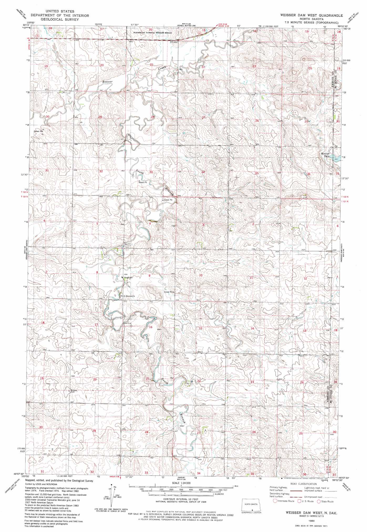
USGS Topo Quad 46099b8 - 1:24,000 scale
| Topo Map Name: | Weisser Dam West |
| USGS Topo Quad ID: | 46099b8 |
| Print Size: | ca. 21 1/4" wide x 27" high |
| Southeast Coordinates: | 46.125° N latitude / 99.875° W longitude |
| Map Center Coordinates: | 46.1875° N latitude / 99.9375° W longitude |
| U.S. State: | ND |
| Filename: | O46099B8.jpg |
| Download Map JPG Image: | Weisser Dam West topo map 1:24,000 scale |
| Map Type: | Topographic |
| Topo Series: | 7.5´ |
| Map Scale: | 1:24,000 |
| Source of Map Images: | United States Geological Survey (USGS) |
| Alternate Map Versions: |
Weisser Dam West ND 1980, updated 1980 Download PDF Buy paper map Weisser Dam West ND 2011 Download PDF Buy paper map Weisser Dam West ND 2014 Download PDF Buy paper map |
1:24,000 Topo Quads surrounding Weisser Dam West
Appert Lake |
Linton Ne |
Schell Buttes Nw |
Mckenna Lake South |
Burnstad |
Linton |
Rohrich Dam |
Schell Buttes Sw |
Schell Buttes |
Wishek Sw |
Strasburg |
Senger Lake North |
Weisser Dam West |
Weisser Dam East |
May Lake Nw |
Westfield |
Senger Lake South |
Hague |
Hague Se |
May Lake Sw |
Herreid Nw |
Herreid Ne |
Zeeland Nw |
Zeeland |
Greenway |
> Back to 46099a1 at 1:100,000 scale
> Back to 46098a1 at 1:250,000 scale
> Back to U.S. Topo Maps home
Weisser Dam West topo map: Gazetteer
Weisser Dam West: Dams
Flickertail Dam elevation 568m 1863′Weisser Dam elevation 589m 1932′
Weisser Dam West: Reservoirs
Flickertail Lake elevation 568m 1863′Weisser Dam elevation 589m 1932′
Weisser Dam West: Streams
South Branch Beaver Creek elevation 567m 1860′Weisser Dam West digital topo map on disk
Buy this Weisser Dam West topo map showing relief, roads, GPS coordinates and other geographical features, as a high-resolution digital map file on DVD:
Eastern North Dakota & Eastern South Dakota
Buy digital topo maps: Eastern North Dakota & Eastern South Dakota