Hazelton Sw Topo Map North Dakota
To zoom in, hover over the map of Hazelton Sw
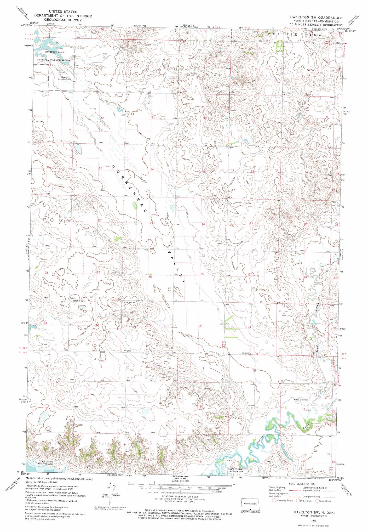
USGS Topo Quad 46100c4 - 1:24,000 scale
| Topo Map Name: | Hazelton Sw |
| USGS Topo Quad ID: | 46100c4 |
| Print Size: | ca. 21 1/4" wide x 27" high |
| Southeast Coordinates: | 46.25° N latitude / 100.375° W longitude |
| Map Center Coordinates: | 46.3125° N latitude / 100.4375° W longitude |
| U.S. State: | ND |
| Filename: | O46100C4.jpg |
| Download Map JPG Image: | Hazelton Sw topo map 1:24,000 scale |
| Map Type: | Topographic |
| Topo Series: | 7.5´ |
| Map Scale: | 1:24,000 |
| Source of Map Images: | United States Geological Survey (USGS) |
| Alternate Map Versions: |
Hazelton SW ND 1971, updated 1973 Download PDF Buy paper map Hazelton SW ND 2011 Download PDF Buy paper map Hazelton SW ND 2014 Download PDF Buy paper map |
1:24,000 Topo Quads surrounding Hazelton Sw
Huff |
Fort Rice |
Moffit Sw |
Moffit Se |
Dana |
Cannon Ball Nw |
Cannon Ball |
Hazelton Nw |
Hazelton |
Appert Lake |
Cannon Ball Sw |
Cannon Ball Se |
Hazelton Sw |
Temvik |
Linton |
Fort Yates Nw |
Fort Yates Ne |
Grassna Nw |
Grassna Ne |
Strasburg |
Fort Yates |
Fort Yates Se |
Kiefer Buttes |
Grassna |
Westfield |
> Back to 46100a1 at 1:100,000 scale
> Back to 46100a1 at 1:250,000 scale
> Back to U.S. Topo Maps home
Hazelton Sw topo map: Gazetteer
Hazelton Sw: Airports
Frank Lawler Private Airport elevation 505m 1656′Hazelton Sw: Dams
Reinhold Klaudt Dam elevation 513m 1683′Hazelton Sw: Parks
Sunburst Lake National Wildlife Refuge elevation 508m 1666′Hazelton Sw: Streams
Sand Creek elevation 499m 1637′Hazelton Sw: Valleys
Horsehead Valley elevation 497m 1630′Hazelton Sw digital topo map on disk
Buy this Hazelton Sw topo map showing relief, roads, GPS coordinates and other geographical features, as a high-resolution digital map file on DVD:
Eastern North Dakota & Eastern South Dakota
Buy digital topo maps: Eastern North Dakota & Eastern South Dakota