Huff Topo Map North Dakota
To zoom in, hover over the map of Huff
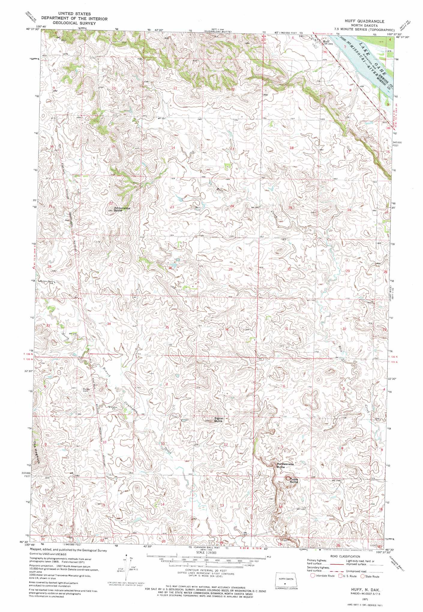
USGS Topo Quad 46100e6 - 1:24,000 scale
| Topo Map Name: | Huff |
| USGS Topo Quad ID: | 46100e6 |
| Print Size: | ca. 21 1/4" wide x 27" high |
| Southeast Coordinates: | 46.5° N latitude / 100.625° W longitude |
| Map Center Coordinates: | 46.5625° N latitude / 100.6875° W longitude |
| U.S. State: | ND |
| Filename: | O46100E6.jpg |
| Download Map JPG Image: | Huff topo map 1:24,000 scale |
| Map Type: | Topographic |
| Topo Series: | 7.5´ |
| Map Scale: | 1:24,000 |
| Source of Map Images: | United States Geological Survey (USGS) |
| Alternate Map Versions: |
Huff ND 1971, updated 1973 Download PDF Buy paper map Huff ND 2011 Download PDF Buy paper map Huff ND 2014 Download PDF Buy paper map |
1:24,000 Topo Quads surrounding Huff
Mandan |
Bismarck |
Menoken Sw |
Menoken |
Mckenzie |
Lynwood |
Schmidt |
Sugarloaf Butte |
Huff Ne |
Moffit Nw |
Saint Anthony |
The Hogback |
Huff |
Fort Rice |
Moffit Sw |
Breien |
Solen |
Cannon Ball Nw |
Cannon Ball |
Hazelton Nw |
Solen Sw |
Half Timber Butte |
Cannon Ball Sw |
Cannon Ball Se |
Hazelton Sw |
> Back to 46100e1 at 1:100,000 scale
> Back to 46100a1 at 1:250,000 scale
> Back to U.S. Topo Maps home
Huff topo map: Gazetteer
Huff: Populated Places
Huff elevation 505m 1656′Huff: Summits
Ambulance Butte elevation 697m 2286′Rattlesnake Butte elevation 595m 1952′
Signal Butte elevation 636m 2086′
Table Butte elevation 601m 1971′
Huff digital topo map on disk
Buy this Huff topo map showing relief, roads, GPS coordinates and other geographical features, as a high-resolution digital map file on DVD:
Eastern North Dakota & Eastern South Dakota
Buy digital topo maps: Eastern North Dakota & Eastern South Dakota