Lynwood Topo Map North Dakota
To zoom in, hover over the map of Lynwood
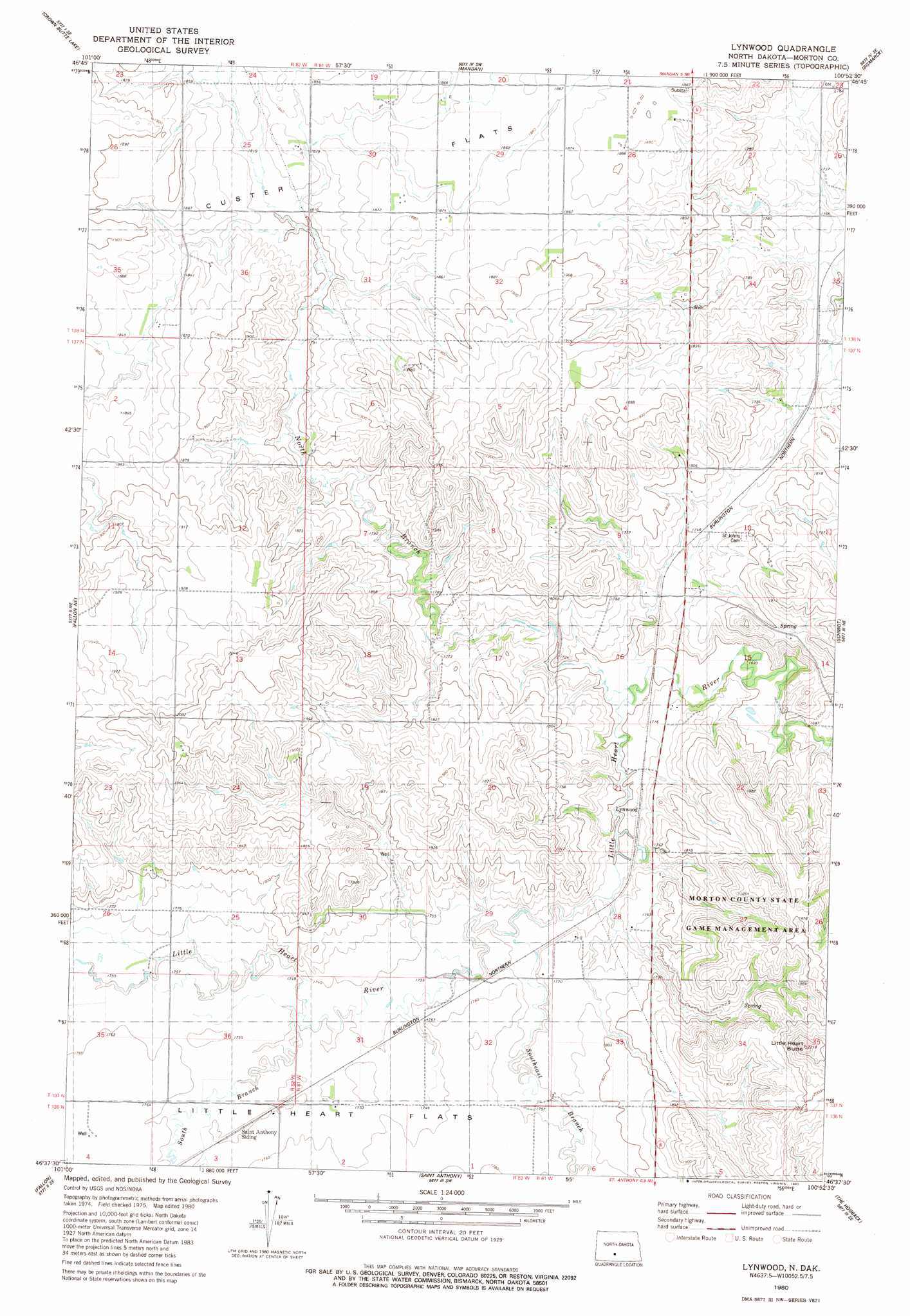
USGS Topo Quad 46100f8 - 1:24,000 scale
| Topo Map Name: | Lynwood |
| USGS Topo Quad ID: | 46100f8 |
| Print Size: | ca. 21 1/4" wide x 27" high |
| Southeast Coordinates: | 46.625° N latitude / 100.875° W longitude |
| Map Center Coordinates: | 46.6875° N latitude / 100.9375° W longitude |
| U.S. State: | ND |
| Filename: | O46100F8.jpg |
| Download Map JPG Image: | Lynwood topo map 1:24,000 scale |
| Map Type: | Topographic |
| Topo Series: | 7.5´ |
| Map Scale: | 1:24,000 |
| Source of Map Images: | United States Geological Survey (USGS) |
| Alternate Map Versions: |
Lynwood ND 1980, updated 1980 Download PDF Buy paper map Lynwood ND 2011 Download PDF Buy paper map Lynwood ND 2014 Download PDF Buy paper map |
1:24,000 Topo Quads surrounding Lynwood
Crown Butte Nw |
Crown Butte |
Harmon |
Burnt Butte |
Keever Butte |
Sweet Briar |
Crown Butte Lake |
Mandan |
Bismarck |
Menoken Sw |
Fish Creek Lane |
Fallon Ne |
Lynwood |
Schmidt |
Sugarloaf Butte |
Nygren Dam |
Fallon |
Saint Anthony |
The Hogback |
Huff |
Flasher |
Burgess |
Breien |
Solen |
Cannon Ball Nw |
> Back to 46100e1 at 1:100,000 scale
> Back to 46100a1 at 1:250,000 scale
> Back to U.S. Topo Maps home
Lynwood topo map: Gazetteer
Lynwood: Parks
Morton County State Game Management Area elevation 569m 1866′Lynwood: Populated Places
Lynwood elevation 529m 1735′Lynwood: Streams
North Branch Little Heart River elevation 526m 1725′South Branch Little Heart River elevation 525m 1722′
Southeast Branch Little Heart River elevation 587m 1925′
Lynwood digital topo map on disk
Buy this Lynwood topo map showing relief, roads, GPS coordinates and other geographical features, as a high-resolution digital map file on DVD:
Eastern North Dakota & Eastern South Dakota
Buy digital topo maps: Eastern North Dakota & Eastern South Dakota