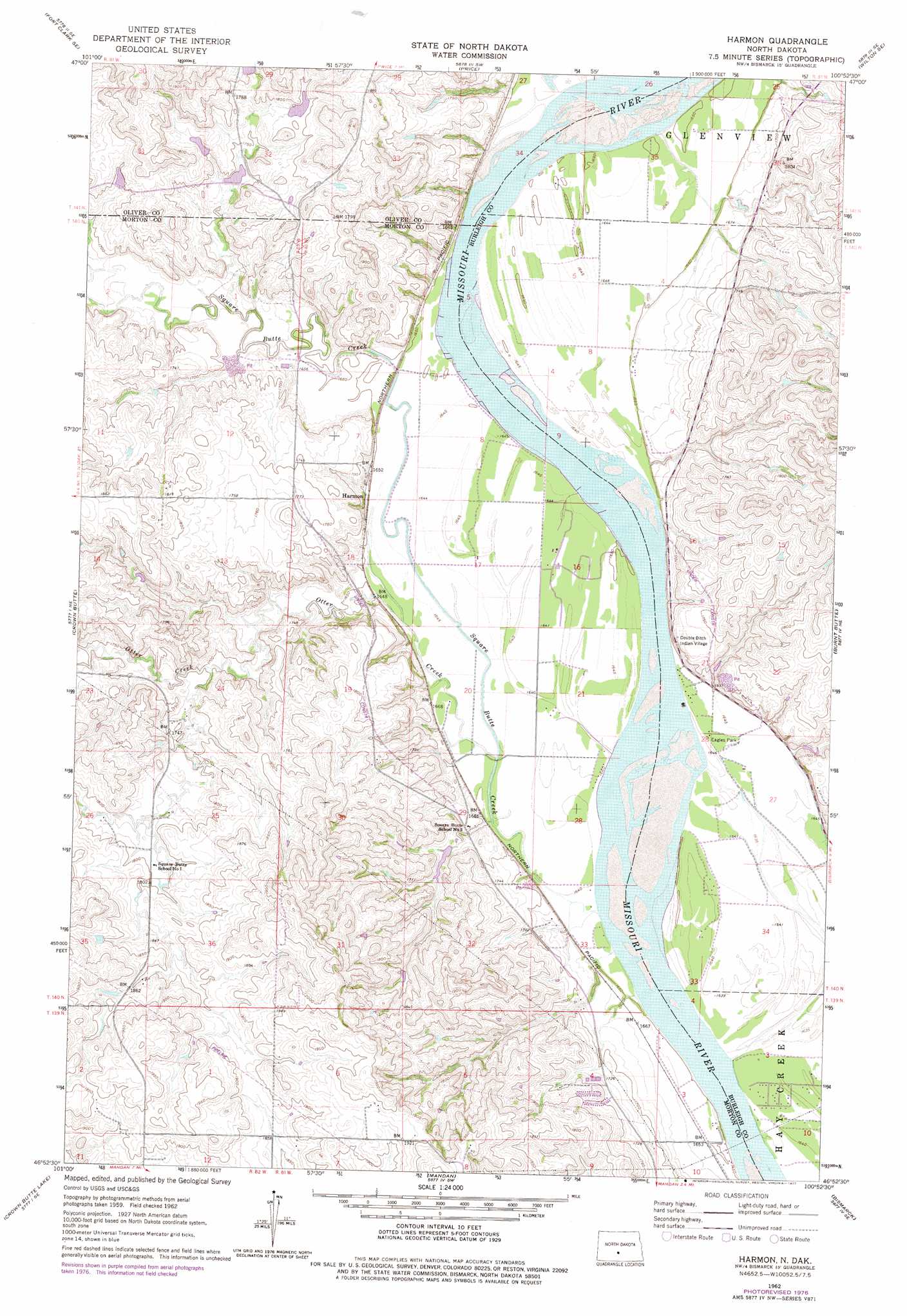
Harmon Topo Map North Dakota
To zoom in, hover over the map of Harmon
USGS Topo Quad 46100h8 - 1:24,000 scale
| Topo Map Name: | Harmon |
| USGS Topo Quad ID: | 46100h8 |
| Print Size: | ca. 21 1/4" wide x 27" high |
| Southeast Coordinates: | 46.875° N latitude / 100.875° W longitude |
| Map Center Coordinates: | 46.9375° N latitude / 100.9375° W longitude |
| U.S. State: | ND |
| Filename: | O46100H8.jpg |
| Download Map JPG Image: | Harmon topo map 1:24,000 scale |
| Map Type: | Topographic |
| Topo Series: | 7.5´ |
| Map Scale: | 1:24,000 |
| Source of Map Images: | United States Geological Survey (USGS) |
| Alternate Map Versions: |
Harmon ND 1962, updated 1964 Download PDF Buy paper map Harmon ND 1962, updated 1976 Download PDF Buy paper map Harmon ND 1976, updated 1977 Download PDF Buy paper map Harmon ND 2011 Download PDF Buy paper map Harmon ND 2014 Download PDF Buy paper map |
1:24,000 Topo Quads surrounding Harmon
Fort Clark |
Fort Clark Ne |
Sanger |
Wilton |
Grass Lake |
Nelson Lake |
Fort Clark Se |
Price |
Wilton Se |
Baldwin |
Crown Butte Nw |
Crown Butte |
Harmon |
Burnt Butte |
Keever Butte |
Sweet Briar |
Crown Butte Lake |
Mandan |
Bismarck |
Menoken Sw |
Fish Creek Lane |
Fallon Ne |
Lynwood |
Schmidt |
Sugarloaf Butte |
> Back to 46100e1 at 1:100,000 scale
> Back to 46100a1 at 1:250,000 scale
> Back to U.S. Topo Maps home
Harmon topo map: Gazetteer
Harmon: Airports
Wachter Ranch Private Landing Strip elevation 500m 1640′Harmon: Bends
Dry Point Bottom (historical) elevation 502m 1646′Mountaineer Bend (historical) elevation 499m 1637′
Norwegian Bend (historical) elevation 499m 1637′
Harmon: Dams
Danielson Dam elevation 554m 1817′Harmon: Parks
Eagles Park elevation 501m 1643′Harmon: Populated Places
Double Ditch Indian Village elevation 525m 1722′Harmon elevation 503m 1650′
Harmon: Streams
Otter Creek elevation 500m 1640′Square Butte Creek elevation 499m 1637′
Harmon digital topo map on disk
Buy this Harmon topo map showing relief, roads, GPS coordinates and other geographical features, as a high-resolution digital map file on DVD:
Eastern North Dakota & Eastern South Dakota
Buy digital topo maps: Eastern North Dakota & Eastern South Dakota