Pretty Rock Butte Topo Map North Dakota
To zoom in, hover over the map of Pretty Rock Butte
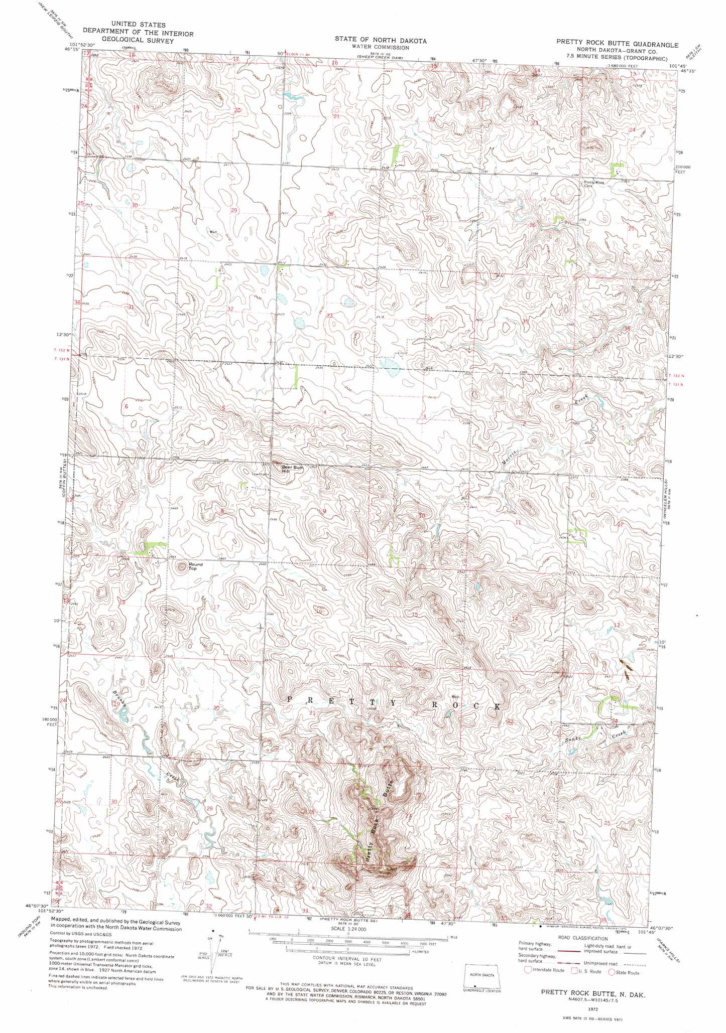
USGS Topo Quad 46101b7 - 1:24,000 scale
| Topo Map Name: | Pretty Rock Butte |
| USGS Topo Quad ID: | 46101b7 |
| Print Size: | ca. 21 1/4" wide x 27" high |
| Southeast Coordinates: | 46.125° N latitude / 101.75° W longitude |
| Map Center Coordinates: | 46.1875° N latitude / 101.8125° W longitude |
| U.S. State: | ND |
| Filename: | O46101B7.jpg |
| Download Map JPG Image: | Pretty Rock Butte topo map 1:24,000 scale |
| Map Type: | Topographic |
| Topo Series: | 7.5´ |
| Map Scale: | 1:24,000 |
| Source of Map Images: | United States Geological Survey (USGS) |
| Alternate Map Versions: |
Pretty Rock Butte ND 1972, updated 1974 Download PDF Buy paper map Pretty Rock Butte ND 2011 Download PDF Buy paper map Pretty Rock Butte ND 2014 Download PDF Buy paper map |
1:24,000 Topo Quads surrounding Pretty Rock Butte
North Star Butte |
New Leipzig North |
Elgin |
Heil |
Carson |
Bentley |
New Leipzig South |
Sheep Creek Dam |
Leith |
Carson Se |
Plum Butte Ne |
Coffin Buttes |
Pretty Rock Butte |
Wheeler Hills |
Paradise Flats |
Nason Hill |
Round Top |
Pretty Rock Butte Se |
Parks Hills |
Pitt Creek |
Lemmon Ne |
Thunder Hawk |
Keldron |
Morristown |
Watauga |
> Back to 46101a1 at 1:100,000 scale
> Back to 46100a1 at 1:250,000 scale
> Back to U.S. Topo Maps home
Pretty Rock Butte topo map: Gazetteer
Pretty Rock Butte: Summits
Beer Bum Hill elevation 800m 2624′Pretty Rock Butte elevation 838m 2749′
Round Top elevation 768m 2519′
Pretty Rock Butte digital topo map on disk
Buy this Pretty Rock Butte topo map showing relief, roads, GPS coordinates and other geographical features, as a high-resolution digital map file on DVD:
Eastern North Dakota & Eastern South Dakota
Buy digital topo maps: Eastern North Dakota & Eastern South Dakota