Burgess Topo Map North Dakota
To zoom in, hover over the map of Burgess
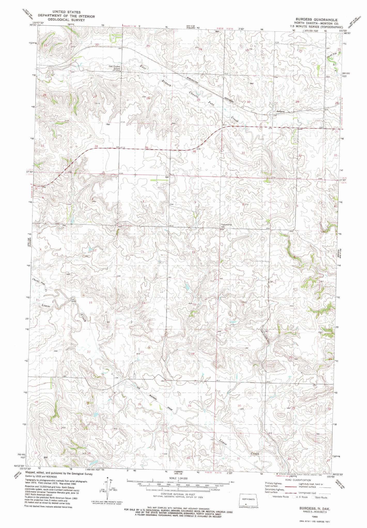
USGS Topo Quad 46101d1 - 1:24,000 scale
| Topo Map Name: | Burgess |
| USGS Topo Quad ID: | 46101d1 |
| Print Size: | ca. 21 1/4" wide x 27" high |
| Southeast Coordinates: | 46.375° N latitude / 101° W longitude |
| Map Center Coordinates: | 46.4375° N latitude / 101.0625° W longitude |
| U.S. State: | ND |
| Filename: | O46101D1.jpg |
| Download Map JPG Image: | Burgess topo map 1:24,000 scale |
| Map Type: | Topographic |
| Topo Series: | 7.5´ |
| Map Scale: | 1:24,000 |
| Source of Map Images: | United States Geological Survey (USGS) |
| Alternate Map Versions: |
Burgess ND 1980, updated 1980 Download PDF Buy paper map Burgess ND 2011 Download PDF Buy paper map Burgess ND 2014 Download PDF Buy paper map |
1:24,000 Topo Quads surrounding Burgess
Green Ridge |
Fish Creek Lane |
Fallon Ne |
Lynwood |
Schmidt |
Otter Creek East |
Nygren Dam |
Fallon |
Saint Anthony |
The Hogback |
Dogtooth Buttes |
Flasher |
Burgess |
Breien |
Solen |
Raleigh |
Freda |
Timmer |
Solen Sw |
Half Timber Butte |
Bell Coulee East |
Shields |
Porcupine |
Froelich Dam |
Barren Butte |
> Back to 46101a1 at 1:100,000 scale
> Back to 46100a1 at 1:250,000 scale
> Back to U.S. Topo Maps home
Burgess topo map: Gazetteer
Burgess: Streams
Chanta Peta Creek elevation 553m 1814′Burgess: Summits
Township Hill elevation 633m 2076′Van Duesen Hill elevation 605m 1984′
Burgess digital topo map on disk
Buy this Burgess topo map showing relief, roads, GPS coordinates and other geographical features, as a high-resolution digital map file on DVD:
Eastern North Dakota & Eastern South Dakota
Buy digital topo maps: Eastern North Dakota & Eastern South Dakota