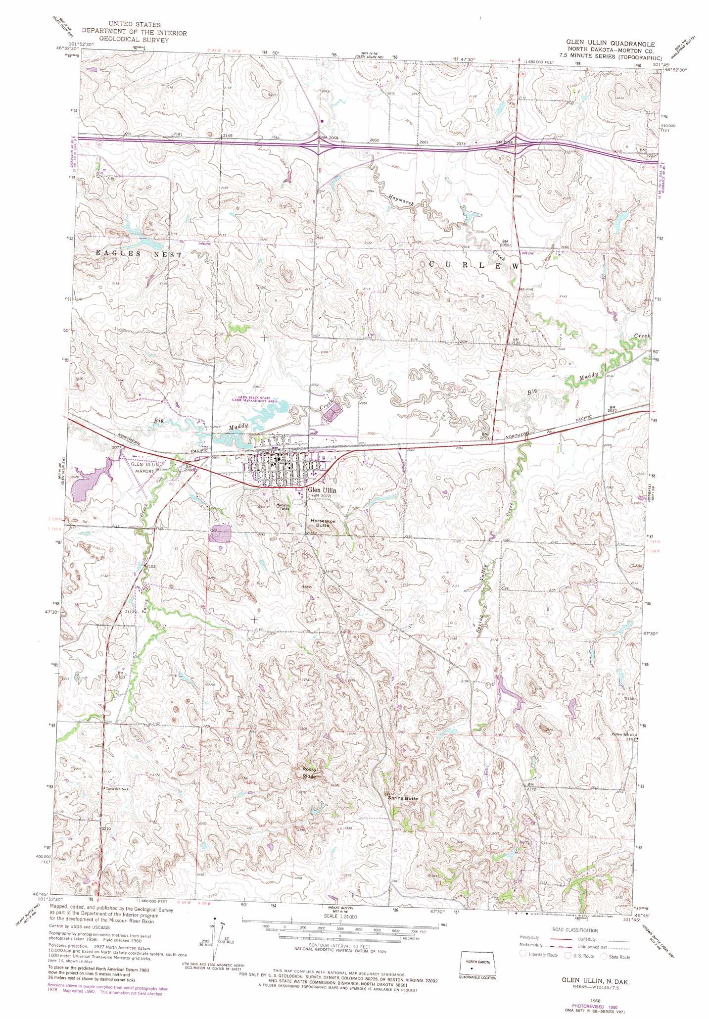
Glen Ullin Topo Map North Dakota
To zoom in, hover over the map of Glen Ullin
USGS Topo Quad 46101g7 - 1:24,000 scale
| Topo Map Name: | Glen Ullin |
| USGS Topo Quad ID: | 46101g7 |
| Print Size: | ca. 21 1/4" wide x 27" high |
| Southeast Coordinates: | 46.75° N latitude / 101.75° W longitude |
| Map Center Coordinates: | 46.8125° N latitude / 101.8125° W longitude |
| U.S. State: | ND |
| Filename: | O46101G7.jpg |
| Download Map JPG Image: | Glen Ullin topo map 1:24,000 scale |
| Map Type: | Topographic |
| Topo Series: | 7.5´ |
| Map Scale: | 1:24,000 |
| Source of Map Images: | United States Geological Survey (USGS) |
| Alternate Map Versions: |
Glen Ullin ND 1960, updated 1962 Download PDF Buy paper map Glen Ullin ND 1960, updated 1980 Download PDF Buy paper map Glen Ullin ND 2011 Download PDF Buy paper map Glen Ullin ND 2014 Download PDF Buy paper map |
1:24,000 Topo Quads surrounding Glen Ullin
Willow Creek East |
Medicine Butte Sw |
Medicine Butte Se |
Red Butte Sw |
Otter Creek |
Hebron |
Glen Ullin Nw |
Glen Ullin Ne |
Hailstone Butte |
Bluegrass |
Hebron Se |
Glen Ullin Sw |
Glen Ullin |
Dengate |
North Almont |
Clark Butte Ne |
Heart Butte Nw |
Heart Butte |
Crown Butte Creek Nw |
Almont West |
Clark Butte |
Lake Tschida West |
Lake Tschida East |
Crown Butte Creek Sw |
Crown Butte Creek Se |
> Back to 46101e1 at 1:100,000 scale
> Back to 46100a1 at 1:250,000 scale
> Back to U.S. Topo Maps home
Glen Ullin topo map: Gazetteer
Glen Ullin: Airports
Glen Ullin Municipal Airport elevation 635m 2083′Glen Ullin: Dams
Glen Ullin Railroad Dam elevation 632m 2073′Schatz Dam elevation 633m 2076′
Glen Ullin: Populated Places
Glen Ullin elevation 635m 2083′Glen Ullin: Ridges
Rocky Ridge elevation 742m 2434′Glen Ullin: Streams
Haymarsh Creek elevation 613m 2011′Spring Valley Creek elevation 618m 2027′
Tavis Creek elevation 631m 2070′
Glen Ullin: Summits
Horseshoe Butte elevation 686m 2250′Spring Butte elevation 745m 2444′
Glen Ullin digital topo map on disk
Buy this Glen Ullin topo map showing relief, roads, GPS coordinates and other geographical features, as a high-resolution digital map file on DVD:
Eastern North Dakota & Eastern South Dakota
Buy digital topo maps: Eastern North Dakota & Eastern South Dakota