Pearl Butte Topo Map North Dakota
To zoom in, hover over the map of Pearl Butte
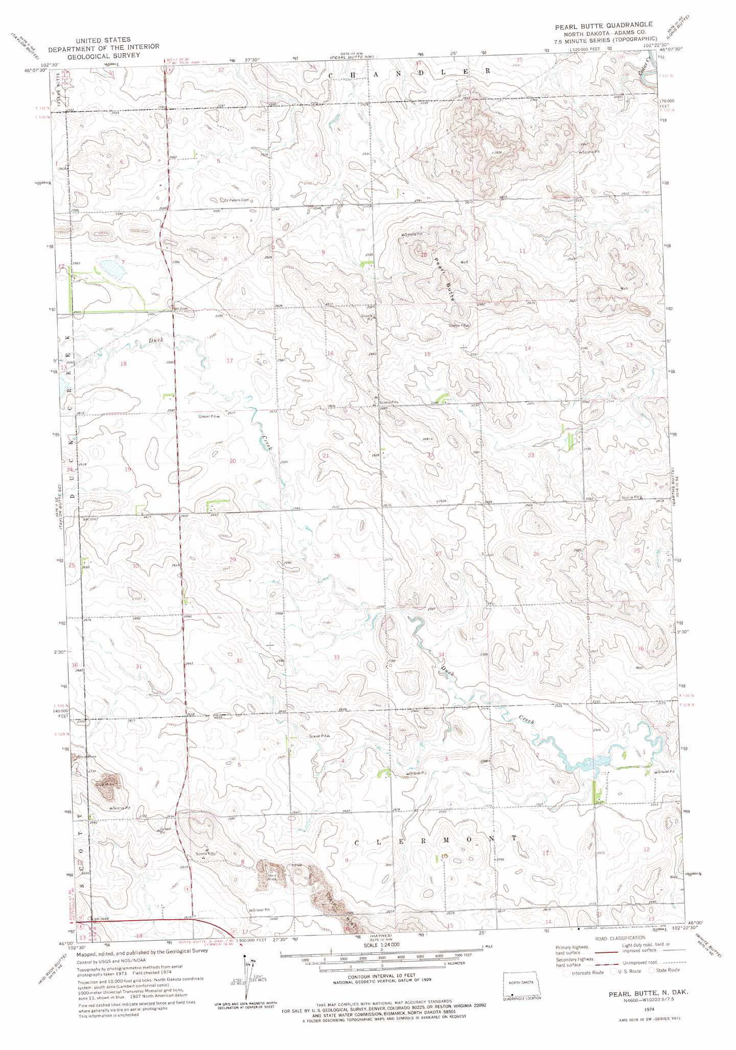
USGS Topo Quad 46102a4 - 1:24,000 scale
| Topo Map Name: | Pearl Butte |
| USGS Topo Quad ID: | 46102a4 |
| Print Size: | ca. 21 1/4" wide x 27" high |
| Southeast Coordinates: | 46° N latitude / 102.375° W longitude |
| Map Center Coordinates: | 46.0625° N latitude / 102.4375° W longitude |
| U.S. State: | ND |
| Filename: | O46102A4.jpg |
| Download Map JPG Image: | Pearl Butte topo map 1:24,000 scale |
| Map Type: | Topographic |
| Topo Series: | 7.5´ |
| Map Scale: | 1:24,000 |
| Source of Map Images: | United States Geological Survey (USGS) |
| Alternate Map Versions: |
Pearl Butte ND 2011 Download PDF Buy paper map Pearl Butte ND 2014 Download PDF Buy paper map |
1:24,000 Topo Quads surrounding Pearl Butte
Liens Dams |
Abbey Hill |
Mott Sw |
Mott South |
Burt |
Ehler Lake |
Taylor Butte |
Pearl Butte Nw |
Long Butte |
Plum Butte |
Hettinger North |
Taylor Butte Se |
Pearl Butte |
Barths Butte |
Cedar Butte |
Hettinger South |
Kid Rich Butte |
Haynes |
White Butte |
Lemmon |
Lodgepole |
Lodgepole Se |
Haynes Sw |
Haynes Se |
Sommerville |
> Back to 46102a1 at 1:100,000 scale
> Back to 46102a1 at 1:250,000 scale
> Back to U.S. Topo Maps home
Pearl Butte topo map: Gazetteer
Pearl Butte: Dams
Duck Creek Dam elevation 770m 2526′Pearl Butte: Summits
Pearl Butte elevation 850m 2788′Pearl Butte digital topo map on disk
Buy this Pearl Butte topo map showing relief, roads, GPS coordinates and other geographical features, as a high-resolution digital map file on DVD:
Eastern Montana & Western North Dakota
Buy digital topo maps: Eastern Montana & Western North Dakota