Mott North Topo Map North Dakota
To zoom in, hover over the map of Mott North
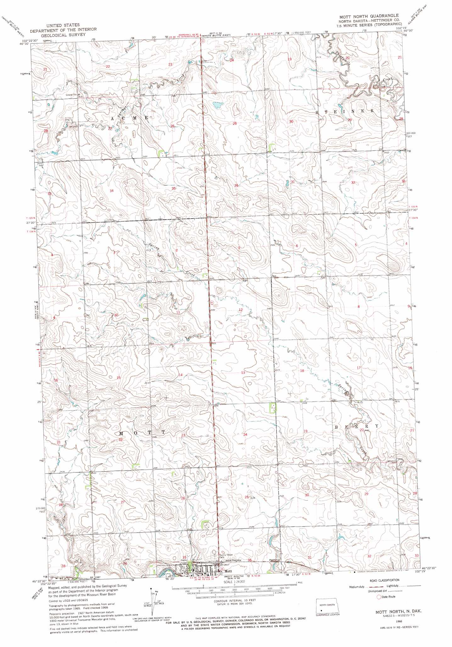
USGS Topo Quad 46102d3 - 1:24,000 scale
| Topo Map Name: | Mott North |
| USGS Topo Quad ID: | 46102d3 |
| Print Size: | ca. 21 1/4" wide x 27" high |
| Southeast Coordinates: | 46.375° N latitude / 102.25° W longitude |
| Map Center Coordinates: | 46.4375° N latitude / 102.3125° W longitude |
| U.S. State: | ND |
| Filename: | O46102D3.jpg |
| Download Map JPG Image: | Mott North topo map 1:24,000 scale |
| Map Type: | Topographic |
| Topo Series: | 7.5´ |
| Map Scale: | 1:24,000 |
| Source of Map Images: | United States Geological Survey (USGS) |
| Alternate Map Versions: |
Mott North ND 1966, updated 1967 Download PDF Buy paper map Mott North ND 2011 Download PDF Buy paper map Mott North ND 2014 Download PDF Buy paper map |
1:24,000 Topo Quads surrounding Mott North
Lefor |
White Butte Nw |
White Butte Ne |
Clark Butte Nw |
Clark Butte Ne |
Stony Butte |
White Butte West |
White Butte East |
Clark Butte Sw |
Clark Butte |
Regent |
Mott Nw |
Mott North |
Burt Nw |
North Star Butte |
Abbey Hill |
Mott Sw |
Mott South |
Burt |
Bentley |
Taylor Butte |
Pearl Butte Nw |
Long Butte |
Plum Butte |
Plum Butte Ne |
> Back to 46102a1 at 1:100,000 scale
> Back to 46102a1 at 1:250,000 scale
> Back to U.S. Topo Maps home
No gazetteer data is available for the Mott North topo map sheet.
Mott North digital topo map on disk
Buy this Mott North topo map showing relief, roads, GPS coordinates and other geographical features, as a high-resolution digital map file on DVD:
Eastern Montana & Western North Dakota
Buy digital topo maps: Eastern Montana & Western North Dakota