Regent Topo Map North Dakota
To zoom in, hover over the map of Regent
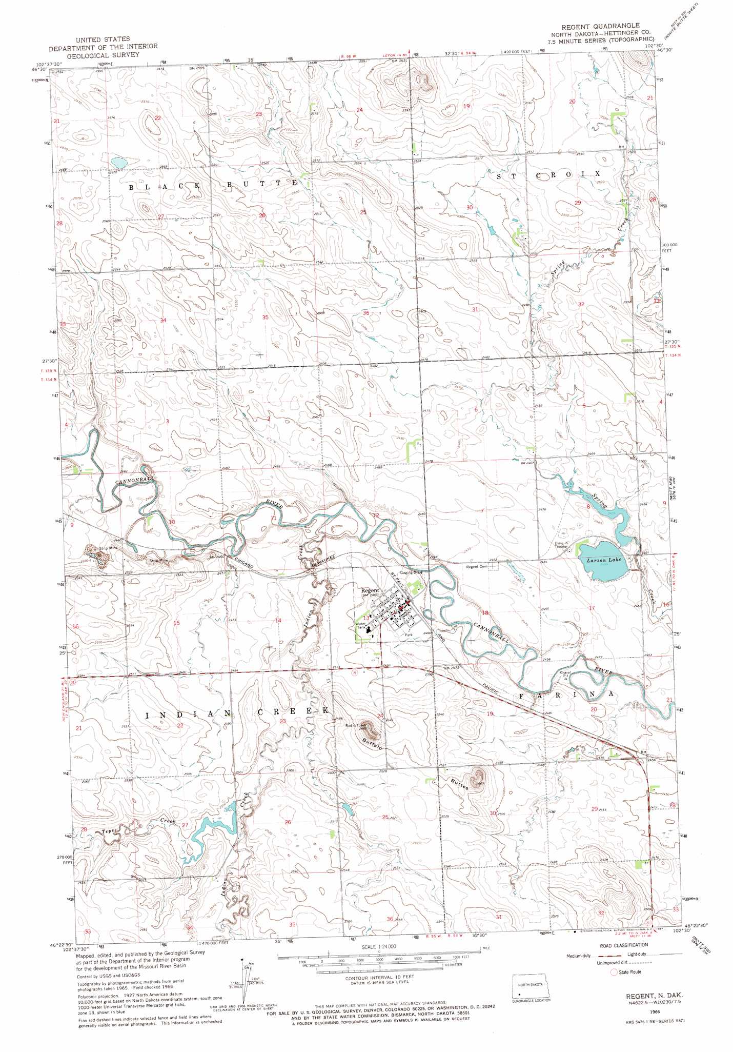
USGS Topo Quad 46102d5 - 1:24,000 scale
| Topo Map Name: | Regent |
| USGS Topo Quad ID: | 46102d5 |
| Print Size: | ca. 21 1/4" wide x 27" high |
| Southeast Coordinates: | 46.375° N latitude / 102.5° W longitude |
| Map Center Coordinates: | 46.4375° N latitude / 102.5625° W longitude |
| U.S. State: | ND |
| Filename: | O46102D5.jpg |
| Download Map JPG Image: | Regent topo map 1:24,000 scale |
| Map Type: | Topographic |
| Topo Series: | 7.5´ |
| Map Scale: | 1:24,000 |
| Source of Map Images: | United States Geological Survey (USGS) |
| Alternate Map Versions: |
Regent ND 1966, updated 1967 Download PDF Buy paper map Regent ND 2011 Download PDF Buy paper map Regent ND 2014 Download PDF Buy paper map |
1:24,000 Topo Quads surrounding Regent
Schefield |
Lefor Nw |
Lefor |
White Butte Nw |
White Butte Ne |
New England |
Lefor Sw |
Stony Butte |
White Butte West |
White Butte East |
Jung Lake |
Havelock |
Regent |
Mott Nw |
Mott North |
Enterprise School |
Liens Dams |
Abbey Hill |
Mott Sw |
Mott South |
Wolf Butte |
Ehler Lake |
Taylor Butte |
Pearl Butte Nw |
Long Butte |
> Back to 46102a1 at 1:100,000 scale
> Back to 46102a1 at 1:250,000 scale
> Back to U.S. Topo Maps home
Regent topo map: Gazetteer
Regent: Airports
Regent Municipal Landing Field elevation 751m 2463′Regent: Dams
Regent Dam elevation 750m 2460′Squaw Creek Dam elevation 773m 2536′
Regent: Lakes
Larson Lake elevation 750m 2460′Regent: Populated Places
Regent elevation 750m 2460′Regent: Ranges
Buffalo Buttes elevation 782m 2565′Regent: Reservoirs
Larson Lake elevation 750m 2460′Regent: Streams
Indian Creek elevation 745m 2444′Tepee Creek elevation 756m 2480′
Regent digital topo map on disk
Buy this Regent topo map showing relief, roads, GPS coordinates and other geographical features, as a high-resolution digital map file on DVD:
Eastern Montana & Western North Dakota
Buy digital topo maps: Eastern Montana & Western North Dakota