Black Butte Topo Map North Dakota
To zoom in, hover over the map of Black Butte
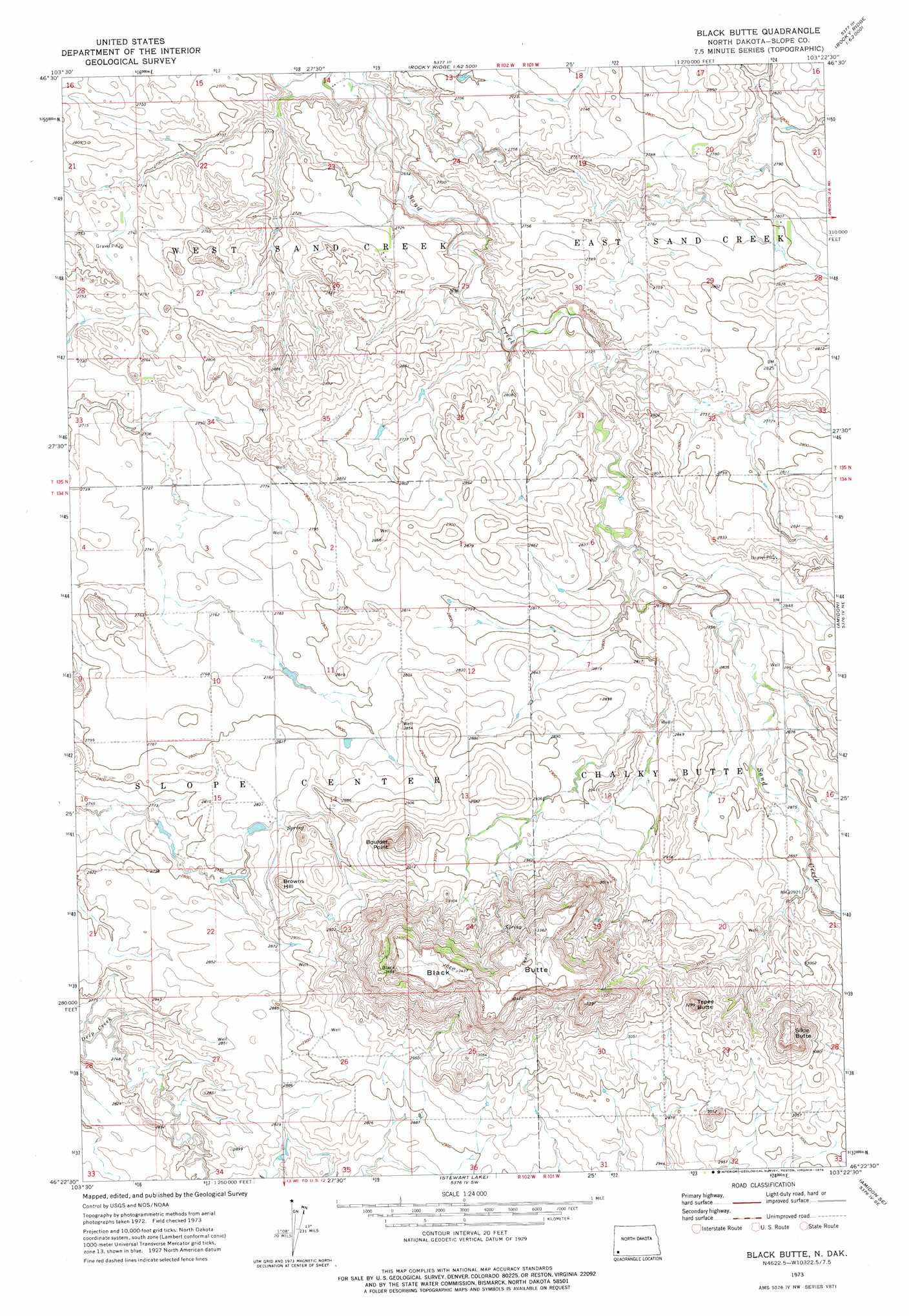
USGS Topo Quad 46103d4 - 1:24,000 scale
| Topo Map Name: | Black Butte |
| USGS Topo Quad ID: | 46103d4 |
| Print Size: | ca. 21 1/4" wide x 27" high |
| Southeast Coordinates: | 46.375° N latitude / 103.375° W longitude |
| Map Center Coordinates: | 46.4375° N latitude / 103.4375° W longitude |
| U.S. State: | ND |
| Filename: | O46103D4.jpg |
| Download Map JPG Image: | Black Butte topo map 1:24,000 scale |
| Map Type: | Topographic |
| Topo Series: | 7.5´ |
| Map Scale: | 1:24,000 |
| Source of Map Images: | United States Geological Survey (USGS) |
| Alternate Map Versions: |
Black Butte ND 1973, updated 1976 Download PDF Buy paper map Black Butte ND 1997, updated 2001 Download PDF Buy paper map Black Butte ND 2011 Download PDF Buy paper map Black Butte ND 2014 Download PDF Buy paper map |
| FStopo: | US Forest Service topo Black Butte is available: Download FStopo PDF Download FStopo TIF |
1:24,000 Topo Quads surrounding Black Butte
Dry Bullion Creek |
Bullion Butte |
Cliffs Plateau |
Rocky Ridge North |
Daglum Nw |
Spring Creek |
Deep Creek North |
Juniper Spur |
Rocky Ridge South |
Daglum Sw |
Boyce Creek East |
Deep Creek South |
Black Butte |
Amidon |
White Lake |
Ives |
West Fork Deep Creek |
Stewart Lake |
Amidon Se |
Mineral Springs |
Rhame |
Griffin |
Bowman |
Talbot Butte |
Scranton |
> Back to 46103a1 at 1:100,000 scale
> Back to 46102a1 at 1:250,000 scale
> Back to U.S. Topo Maps home
Black Butte topo map: Gazetteer
Black Butte: Summits
Black Butte elevation 1056m 3464′Boulder Point elevation 974m 3195′
Browns Hill elevation 903m 2962′
Slide Butte elevation 1019m 3343′
Tepee Butte elevation 997m 3270′
Black Butte digital topo map on disk
Buy this Black Butte topo map showing relief, roads, GPS coordinates and other geographical features, as a high-resolution digital map file on DVD:
Eastern Montana & Western North Dakota
Buy digital topo maps: Eastern Montana & Western North Dakota