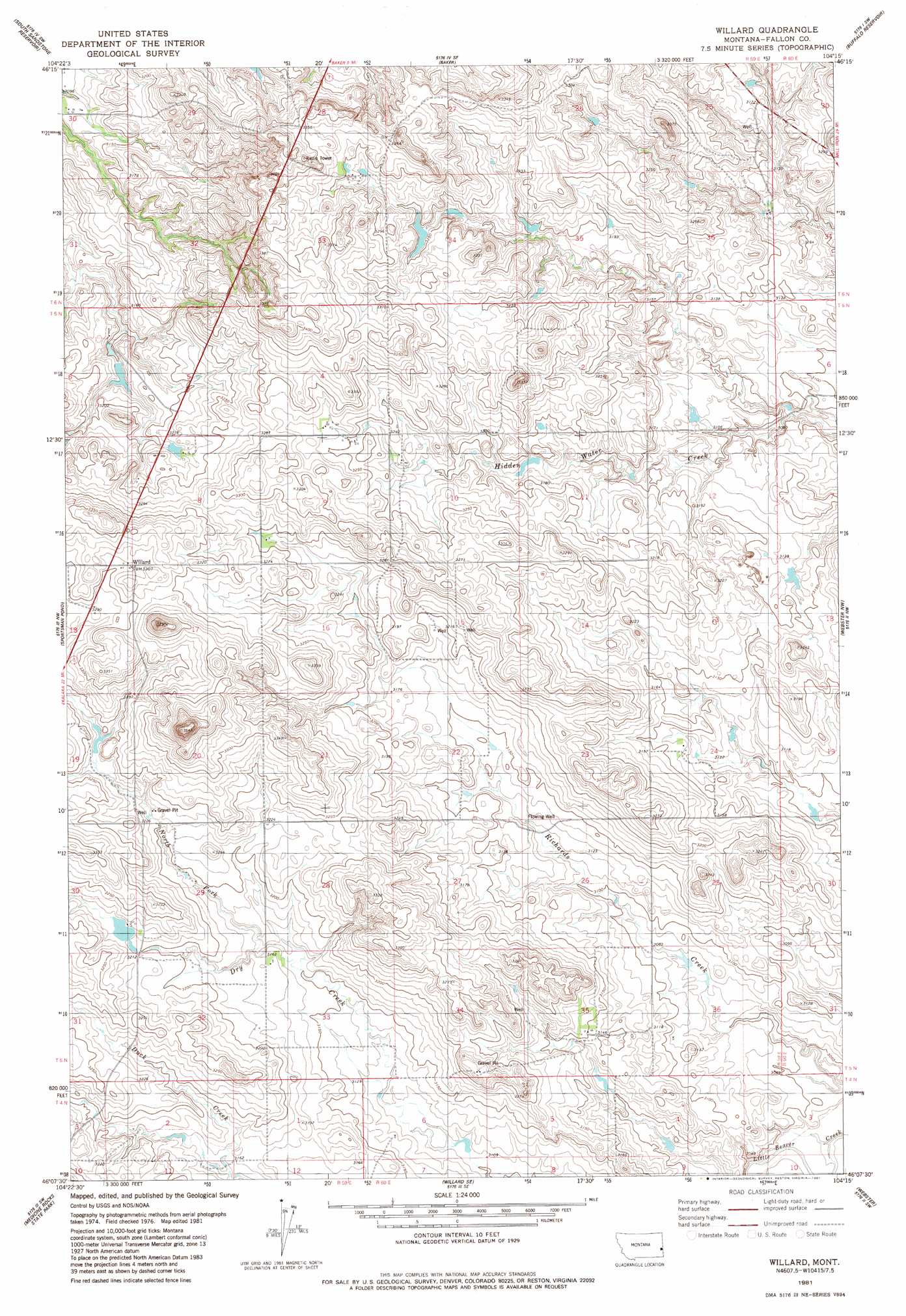
Willard Topo Map Montana
To zoom in, hover over the map of Willard
USGS Topo Quad 46104b3 - 1:24,000 scale
| Topo Map Name: | Willard |
| USGS Topo Quad ID: | 46104b3 |
| Print Size: | ca. 21 1/4" wide x 27" high |
| Southeast Coordinates: | 46.125° N latitude / 104.25° W longitude |
| Map Center Coordinates: | 46.1875° N latitude / 104.3125° W longitude |
| U.S. State: | MT |
| Filename: | o46104b3.jpg |
| Download Map JPG Image: | Willard topo map 1:24,000 scale |
| Map Type: | Topographic |
| Topo Series: | 7.5´ |
| Map Scale: | 1:24,000 |
| Source of Map Images: | United States Geological Survey (USGS) |
| Alternate Map Versions: |
Willard MT 1981, updated 1981 Download PDF Buy paper map Willard MT 2011 Download PDF Buy paper map Willard MT 2014 Download PDF Buy paper map |
1:24,000 Topo Quads surrounding Willard
Plevna |
Baker Nw |
Baker Ne |
Morris Butte |
Badland Draw |
Little Pine Creek |
South Sandstone Reservoir |
Baker |
Buffalo Reservoir |
Waterhole Creek |
Seven-Up Butte |
Sportsman Pond |
Willard |
Webster Nw |
Webster Ne |
Piney Butte |
Medicine Rocks State Park |
Willard Se |
Webster |
Scole School |
Ekalaka |
Terrell Creek |
Dutchman Hill |
Flasted Hill |
Snider Hill |
> Back to 46104a1 at 1:100,000 scale
> Back to 46104a1 at 1:250,000 scale
> Back to U.S. Topo Maps home
Willard topo map: Gazetteer
Willard: Dams
Lindstrom Dam elevation 980m 3215′R Myhre Number 1 Dam elevation 946m 3103′
Willard: Populated Places
Willard elevation 1017m 3336′Willard: Post Offices
Willard Post Office (historical) elevation 1015m 3330′Willard: Streams
North Fork of Dry Creek elevation 965m 3166′Willard: Wells
05N59E06AA__01 Well elevation 971m 3185′05N59E08BA__01 Well elevation 990m 3248′
05N59E08BC__01 Well elevation 982m 3221′
05N59E09AB__01 Well elevation 998m 3274′
05N59E09AB__02 Well elevation 998m 3274′
05N59E18AAAB01 Well elevation 1018m 3339′
05N59E24CD__01 Well elevation 980m 3215′
05N59E30AAA_01 Well elevation 998m 3274′
06N59E30AB__01 Well elevation 966m 3169′
06N59E30AC__01 Well elevation 960m 3149′
06N59E30AC__02 Well elevation 950m 3116′
06N60E30BC__01 Well elevation 973m 3192′
Willard digital topo map on disk
Buy this Willard topo map showing relief, roads, GPS coordinates and other geographical features, as a high-resolution digital map file on DVD:
Eastern Montana & Western North Dakota
Buy digital topo maps: Eastern Montana & Western North Dakota