Bracket Butte Se Topo Map Montana
To zoom in, hover over the map of Bracket Butte Se
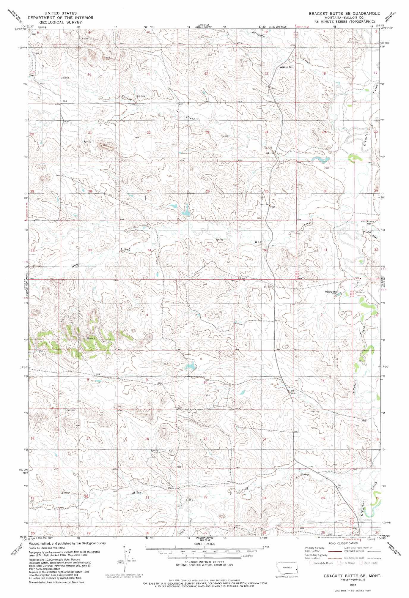
USGS Topo Quad 46104c7 - 1:24,000 scale
| Topo Map Name: | Bracket Butte Se |
| USGS Topo Quad ID: | 46104c7 |
| Print Size: | ca. 21 1/4" wide x 27" high |
| Southeast Coordinates: | 46.25° N latitude / 104.75° W longitude |
| Map Center Coordinates: | 46.3125° N latitude / 104.8125° W longitude |
| U.S. State: | MT |
| Filename: | o46104c7.jpg |
| Download Map JPG Image: | Bracket Butte Se topo map 1:24,000 scale |
| Map Type: | Topographic |
| Topo Series: | 7.5´ |
| Map Scale: | 1:24,000 |
| Source of Map Images: | United States Geological Survey (USGS) |
| Alternate Map Versions: |
Bracket Butte SE MT 1981, updated 1981 Download PDF Buy paper map Bracket Butte SE MT 2011 Download PDF Buy paper map Bracket Butte SE MT 2014 Download PDF Buy paper map |
1:24,000 Topo Quads surrounding Bracket Butte Se
Little Whitney Creek |
Loony Hollow |
Ismay North |
Ayer Spring |
Lawrence Creek West |
Montague Butte |
Bracket Butte |
Ismay South |
Westmore |
Plevna |
Knowlton |
Foundation Spring |
Bracket Butte Se |
T G Creek |
Little Pine Creek |
Tepee Butte Ne |
Hooky Dam |
Nelson Butte |
Harmon Butte |
Seven-Up Butte |
Tepee Butte |
North Fork Alkali Creek |
Skunk Creek |
Piney Butte Sw |
Piney Butte |
> Back to 46104a1 at 1:100,000 scale
> Back to 46104a1 at 1:250,000 scale
> Back to U.S. Topo Maps home
Bracket Butte Se topo map: Gazetteer
Bracket Butte Se: Dams
Savage Dam elevation 863m 2831′Bracket Butte Se: Streams
Back Creek elevation 859m 2818′Hay Creek elevation 818m 2683′
Miles City Creek elevation 833m 2732′
Scroggin Creek elevation 812m 2664′
Spring Creek elevation 814m 2670′
Timber Creek elevation 817m 2680′
Bracket Butte Se: Wells
06N55E14A___01 Well elevation 830m 2723′06N55E23ABDA01 Well elevation 849m 2785′
06N55E23BA__01 Well elevation 855m 2805′
06N55E24BB__01 Well elevation 847m 2778′
06N56E19CA__01 Well elevation 838m 2749′
06N56E30BB__01 Well elevation 853m 2798′
07N55E16CC__01 Well elevation 874m 2867′
07N55E22AA__01 Well elevation 846m 2775′
07N55E22AADA01 Well elevation 847m 2778′
07N55E28BB__01 Well elevation 892m 2926′
07N56E08CC__01 Well elevation 844m 2769′
07N56E20CC__01 Well elevation 823m 2700′
Bracket Butte Se digital topo map on disk
Buy this Bracket Butte Se topo map showing relief, roads, GPS coordinates and other geographical features, as a high-resolution digital map file on DVD:
Eastern Montana & Western North Dakota
Buy digital topo maps: Eastern Montana & Western North Dakota