Foundation Spring Topo Map Montana
To zoom in, hover over the map of Foundation Spring
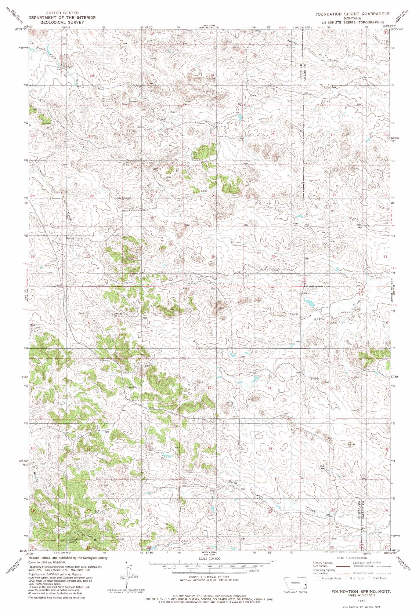
USGS Topo Quad 46104c8 - 1:24,000 scale
| Topo Map Name: | Foundation Spring |
| USGS Topo Quad ID: | 46104c8 |
| Print Size: | ca. 21 1/4" wide x 27" high |
| Southeast Coordinates: | 46.25° N latitude / 104.875° W longitude |
| Map Center Coordinates: | 46.3125° N latitude / 104.9375° W longitude |
| U.S. State: | MT |
| Filename: | o46104c8.jpg |
| Download Map JPG Image: | Foundation Spring topo map 1:24,000 scale |
| Map Type: | Topographic |
| Topo Series: | 7.5´ |
| Map Scale: | 1:24,000 |
| Source of Map Images: | United States Geological Survey (USGS) |
| Alternate Map Versions: |
Foundation Spring MT 1981 Download PDF Buy paper map Foundation Spring MT 2011 Download PDF Buy paper map Foundation Spring MT 2014 Download PDF Buy paper map |
1:24,000 Topo Quads surrounding Foundation Spring
Flat Top Butte Sw |
Little Whitney Creek |
Loony Hollow |
Ismay North |
Ayer Spring |
Hogan Creek |
Montague Butte |
Bracket Butte |
Ismay South |
Westmore |
Red Knob |
Knowlton |
Foundation Spring |
Bracket Butte Se |
T G Creek |
Pennock Creek |
Tepee Butte Ne |
Hooky Dam |
Nelson Butte |
Harmon Butte |
Bear Jaw Creek |
Tepee Butte |
North Fork Alkali Creek |
Skunk Creek |
Piney Butte Sw |
> Back to 46104a1 at 1:100,000 scale
> Back to 46104a1 at 1:250,000 scale
> Back to U.S. Topo Maps home
Foundation Spring topo map: Gazetteer
Foundation Spring: Populated Places
Foundation (historical) elevation 971m 3185′Foundation Spring: Post Offices
Dragseth Post Office (historical) elevation 973m 3192′Foundation Post Office (historical) elevation 971m 3185′
Foundation Spring: Springs
Foundation Spring elevation 939m 3080′Foundation Spring: Wells
06N54E11BB__01 Well elevation 903m 2962′06N54E13CDAB01 Well elevation 920m 3018′
06N54E14CB__01 Well elevation 943m 3093′
06N54E20CD__01 Well elevation 958m 3143′
06N54E22ABC_01 Well elevation 948m 3110′
06N54E24AB__01 Well elevation 918m 3011′
06N54E24AC__01 Well elevation 901m 2956′
06N54E24AD__01 Well elevation 905m 2969′
06N54E24DB__01 Well elevation 903m 2962′
07N54E25DD__01 Well elevation 909m 2982′
07N54E26DA__01 Well elevation 934m 3064′
07N55E08CD__01 Well elevation 879m 2883′
07N55E17BD__01 Well elevation 877m 2877′
Foundation Spring digital topo map on disk
Buy this Foundation Spring topo map showing relief, roads, GPS coordinates and other geographical features, as a high-resolution digital map file on DVD:
Eastern Montana & Western North Dakota
Buy digital topo maps: Eastern Montana & Western North Dakota